MyTopo
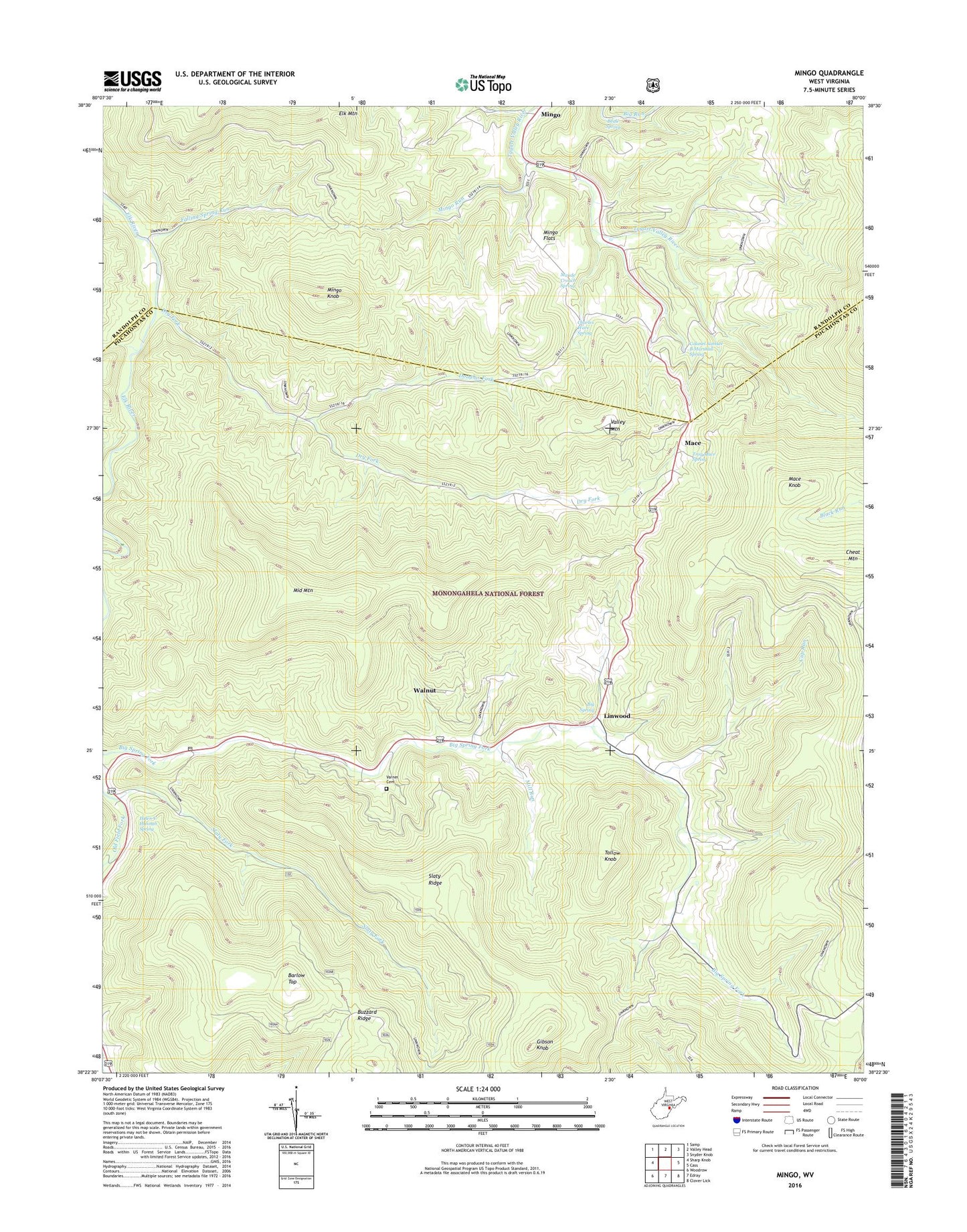
Mingo West Virginia US Topo Map
Couldn't load pickup availability
Also explore the Mingo Forest Service Topo of this same quad for updated USFS data
2023 topographic map quadrangle Mingo in the state of West Virginia. Scale: 1:24000. Based on the newly updated USGS 7.5' US Topo map series, this map is in the following counties: Pocahontas, Randolph. The map contains contour data, water features, and other items you are used to seeing on USGS maps, but also has updated roads and other features. This is the next generation of topographic maps. Printed on high-quality waterproof paper with UV fade-resistant inks.
Quads adjacent to this one:
West: Sharp Knob
Northwest: Samp
North: Valley Head
Northeast: Snyder Knob
East: Cass
Southeast: Clover Lick
South: Edray
Southwest: Woodrow
This map covers the same area as the classic USGS quad with code o38080d1.
Contains the following named places: Barlow Top, Beale Spring, Big Spring, Big Springs Linwood Presbyterian Church, Blackhole Run, Brady School, Buzzard Ridge, Charles Ware Spring, Cheat Mountain, Colonel Samuel B Marshall Spring, Cup Run, Douglas Fork, Dry Fork, Fairview School, Falling Spring Run, Gibson Knob, Hannah School, Helen V Hannah Spring, Linwood, Linwood Community Library, Linwood School, Mace, Mace Knob, Mace School, Mace United Methodist Church, Maude Crouch Spring, Middle Mountain, Mill Run, Mingo, Mingo Flats, Mingo Knob, Mingo Run, Raven Golf Club at Snowshoe Mountain, Slaty Fork, Slaty Ridge, Slatyfork Methodist Church, Slatyfork Post Office, Tallow Knob, Troy Mace Spring, Upper Mingo, Valley Mountain, Varner Cemetery, Walnut, Yewglade School