MyTopo
Kiahsville West Virginia US Topo Map
Couldn't load pickup availability
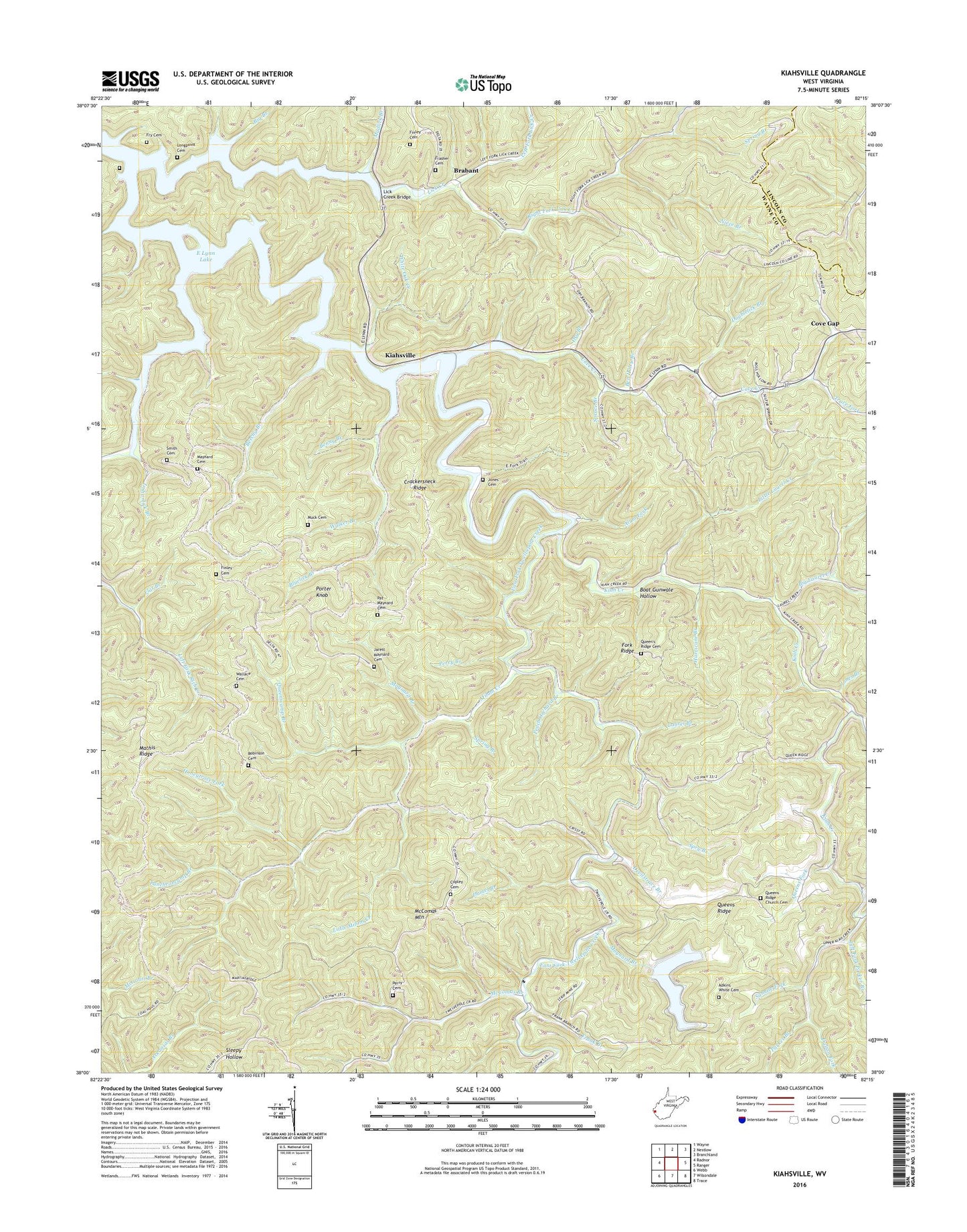
2023 topographic map quadrangle Kiahsville in the state of West Virginia. Scale: 1:24000. Based on the newly updated USGS 7.5' US Topo map series, this map is in the following counties: Wayne, Lincoln. The map contains contour data, water features, and other items you are used to seeing on USGS maps, but also has updated roads and other features. This is the next generation of topographic maps. Printed on high-quality waterproof paper with UV fade-resistant inks.
Quads adjacent to this one:
West: Radnor
Northwest: Wayne
North: Nestlow
Northeast: Branchland
East: Ranger
Southeast: Trace
South: Wilsondale
Southwest: Webb
This map covers the same area as the classic USGS quad with code o38082a3.
Contains the following named places: Adkins Cemetery, Adkins White Cemetery, Alum Fork, Beech Grove Church, Beechy Branch, Ben Haley Branch, Benny Branch, Big Branch, Big Laurel Creek, Black Oak Gap, Bluelick Branch, Boat Gunwale Hollow, Brabant, Cinthia Branch, Copley Cemetery, Cove Chapel, Cove Creek, Cove Gap, Crackersneck Ridge, Dalton Fork, Damel Branch, Devilstrace Branch, Doublelick Branch, Dry Branch, East Lynn Lake, East Lynn Lake Wildlife Management Area, Finley Cemetery, Flat Branch, Fork Ridge, Frank Branch, Frasher Cemetery, Fry Cemetery, Greasy Ridge Church, Honeytrace Fork, Hurricane Branch, Indianlick Branch, Jarett Maynard Cemetery, Jones Branch, Jones Cemetery, Kiah Creek, Kiah Creek School, Kiahsville, Kiahsville Post Office, Laurel Branch, Left Fork Lick Creek, Left Fork Parker Branch, Lick Creek, Lick Creek Bridge, Little Laurel Creek, Little Milam Creek, Longpoint Cemetery, Mary Magdalene Church, Mathis Ridge, Maynard Branch, Maynard Cemetery, McComas Branch, McComas Mountain, McComas School, Milam Creek, Milam School, Muck Cemetery, Mudlick Branch, Niece Branch, Parker Branch, Parker School, Pat Maynard Cemetery, Peach Orchard Branch, Perry Branch, Perry Cemetery, Porter Knob, Puncheoncamp Branch, Queens Fork, Queens Ridge, Queen's Ridge Cemetery, Queens Ridge Church, Queens Ridge Church Cemetery, Queenscamp Branch, Rich Creek, Right Fork Lick Creek, Robinson Cemetery, Smith Cemetery, Spring Branch, Spruce Branch, Spry Branch, Stonewall District, Sumate Fork, Trace Fork, Trough Fork, Walker Branch, Wallace Cemetery, White Oak Creek, ZIP Codes: 25511, 25534