MyTopo
Medley West Virginia US Topo Map
Couldn't load pickup availability
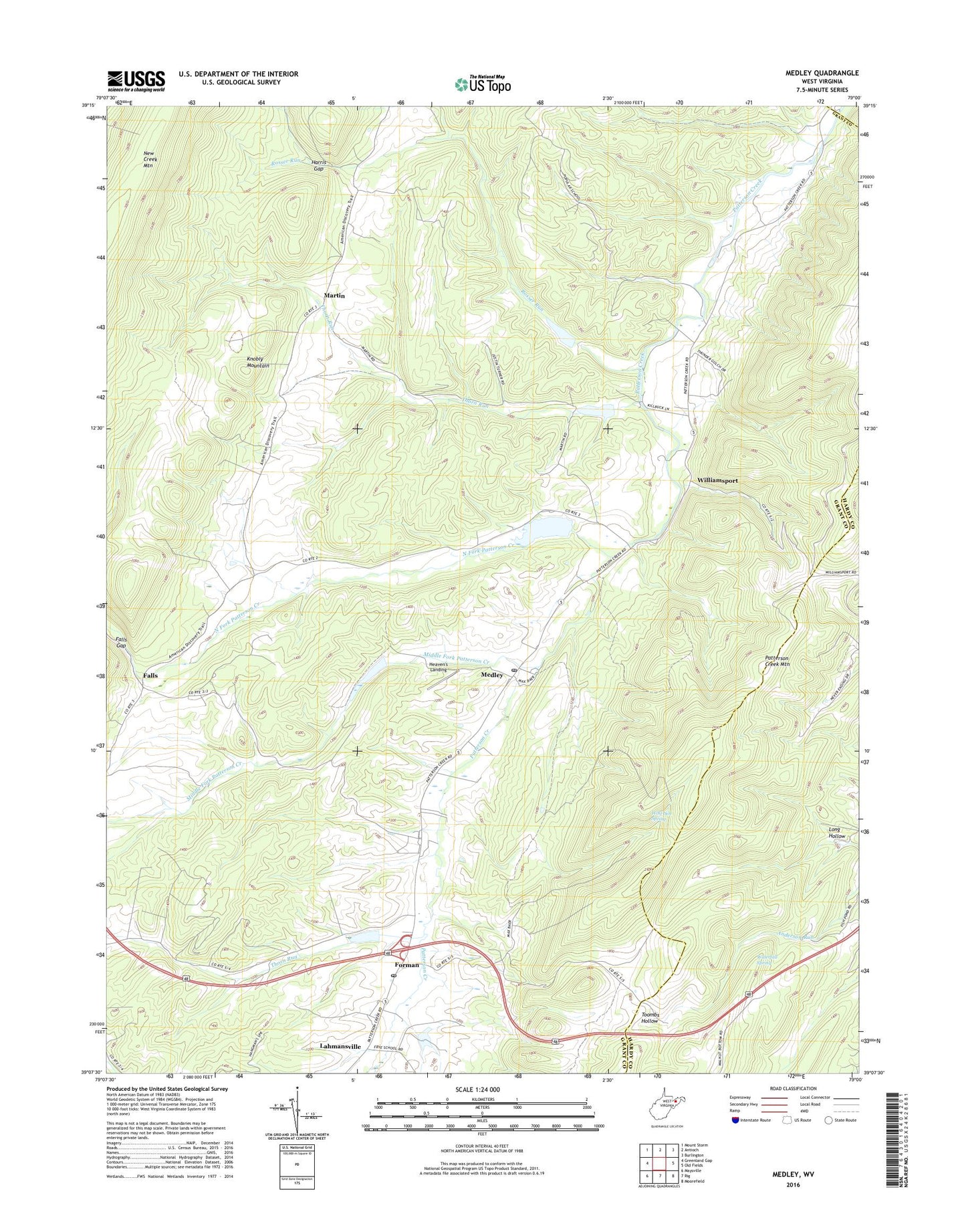
2019 topographic map quadrangle Medley in the state of West Virginia. Scale: 1:24000. Based on the newly updated USGS 7.5' US Topo map series, this map is in the following counties: Grant, Hardy, Mineral. The map contains contour data, water features, and other items you are used to seeing on USGS maps, but also has updated roads and other features. This is the next generation of topographic maps. Printed on high-quality waterproof paper with UV fade-resistant inks.
Quads adjacent to this one:
West: Greenland Gap
Northwest: Mount Storm
North: Antioch
Northeast: Burlington
East: Old Fields
Southeast: Moorefield
South: Rig
Southwest: Maysville
Contains the following named places: Baker School, Falls, Falls Gap, Falls School, Forman, Grant District, Harris Gap, Heaven's Landing Airstrip, Lahmansville, Lahmansville Post Office, Long Hollow, Martin, Medley, Medley Post Office, Middle Fork Patterson Creek, North Fork Patterson Creek, Patterson Creek Structure 12 Dam, Patterson Creek Structure 13 Dam, Patterson Creek Structure 41 Dam, Patterson Creek Structure 49 Dam, Patterson Creek Structure Four Dam, Patterson Creek Structure Three Dam, Patterson Creek Structure Two Dam, Poplar School, Powders School, Rosser Run, Saint Pauls Church, The Ridge Brethren Church, Thorn Run, Thorn Run School, Waterfall Spring, Williamsport, Wolf Den Spring, ZIP Code: 26731