MyTopo
Paddy Knob West Virginia US Topo Map
Couldn't load pickup availability
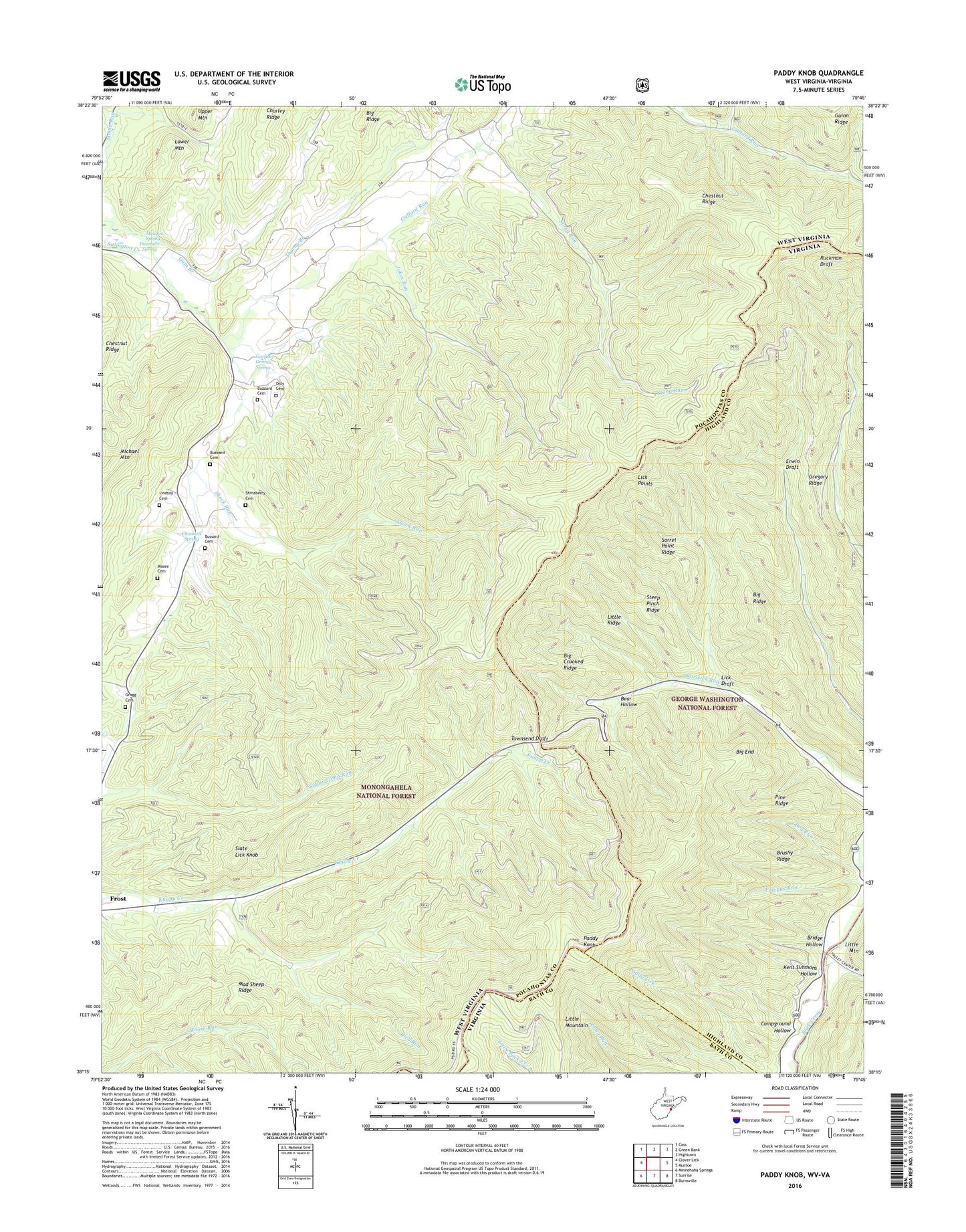
2019 topographic map quadrangle Paddy Knob in the states of West Virginia, Virginia. Scale: 1:24000. Based on the newly updated USGS 7.5' US Topo map series, this map is in the following counties: Pocahontas, Highland, Bath. The map contains contour data, water features, and other items you are used to seeing on USGS maps, but also has updated roads and other features. This is the next generation of topographic maps. Printed on high-quality waterproof paper with UV fade-resistant inks.
Quads adjacent to this one:
West: Clover Lick
Northwest: Cass
North: Green Bank
Northeast: Hightown
East: Mustoe
Southeast: Burnsville
South: Sunrise
Southwest: Minnehaha Springs
Contains the following named places: Bear Hollow, Big Crooked Ridge, Big End, Big Ridge, Bird Run, Bird Run Campground, Bridge Hollow, Brushy Ridge, Bussard Cemetery, Buzzard Cemetery, Camp Copperhead, Campground Hollow, Charley Ridge, Chestnut Ridge, Chocklett Spring, Dilley Cemetery, Dunmore Spring, Galford Run, Garfield Grimes Spring, Gragg Cemetery, Gregory Ridge, Gum Branch, Gum Spring School, Hillside School, Jakes Run, Kent Simmons Hollow, Left Prong Galford Run, Lick Draft, Lick Points, Lindsay Cemetery, Little Ridge, Lower Gap, Lower Mountain, Mad Sheep Ridge, Meadow Spring, Moore Cemetery, Moses Spur, Mount Pleasant School, New Hope Church, Paddy Knob, Paddy Knob Lookout Tower, Paddy Knob Trail, Pine Ridge, Shinaberry Cemetery, Shock Run, Slate Lick Knob, Sorrel Point Ridge, Steep Pinch Ridge, Stony Run, Thorny Branch, Wesley Chapel, Wesley Chapel School