MyTopo
Armstrong Creek Wisconsin US Topo Map
Couldn't load pickup availability
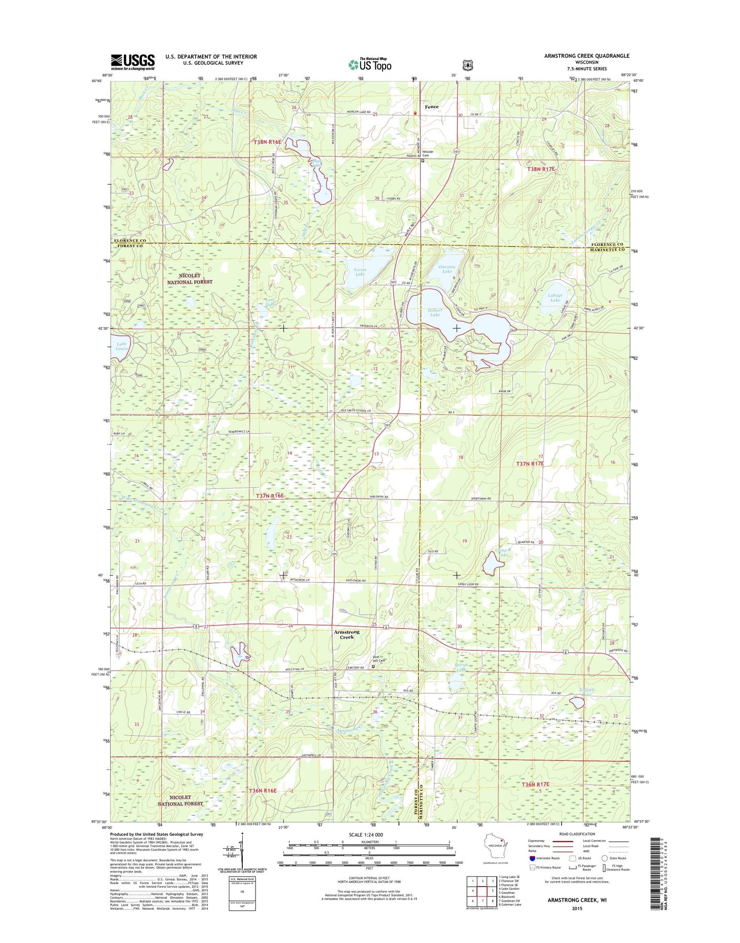
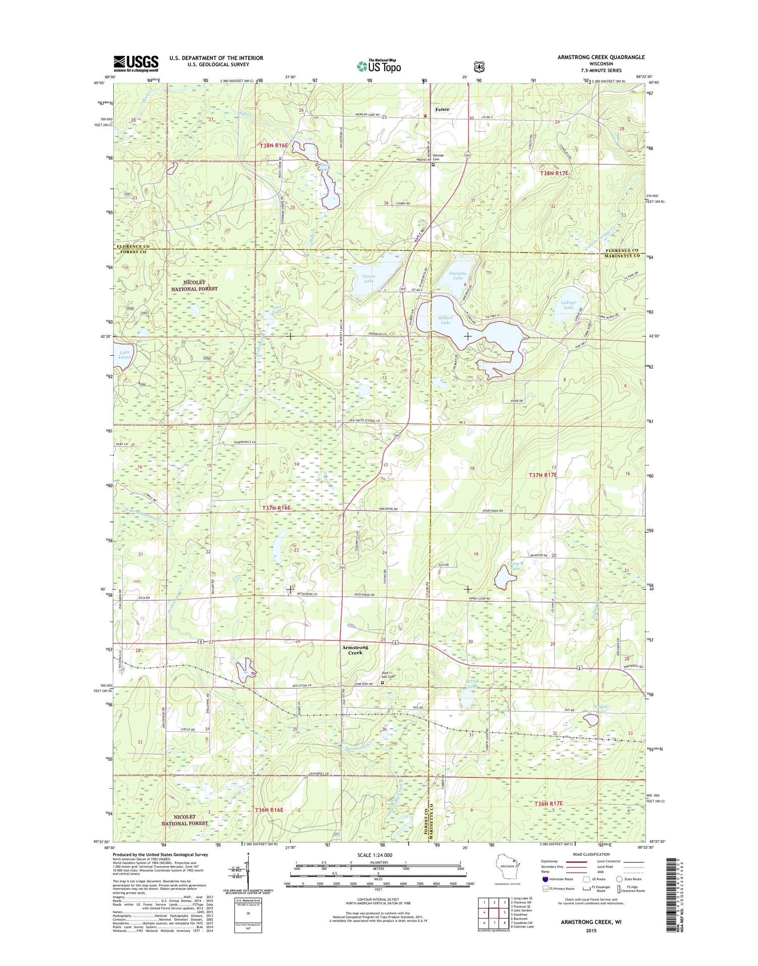
2018 topographic map quadrangle Armstrong Creek in the state of Wisconsin. Scale: 1:24000. Based on the newly updated USGS 7.5' US Topo map series, this map is in the following counties: Forest, Marinette, Florence. The map contains contour data, water features, and other items you are used to seeing on USGS maps, but also has updated roads and other features. This is the next generation of topographic maps. Printed on high-quality waterproof paper with UV fade-resistant inks.
Quads adjacent to this one:
West: Lake Gordon
Northwest: Long Lake SE
North: Florence SW
Northeast: Florence SE
East: Goodman
Southeast: Coleman Lake
South: Goodman SW
Southwest: Blackwell
Contains the following named places: Armstrong Creek, Armstrong Creek Post Office, Camp B Lake, Engleking School, Fence, Fence Post Office, Fence Volunteer Fire Department, Forest Lake, Goodman Park, Hilbert Lake, Hillside Cemetery, Kingdom Hall, LaFave Lake, Lost Lake, Mud Creek, Mud Creek D7777 Dam, Mud Lake, Nadjak Lake, Oneonta Lake, Petryk Lake, Pine Hill Cemetery, Rock Creek, West Branch Armstrong Creek