MyTopo
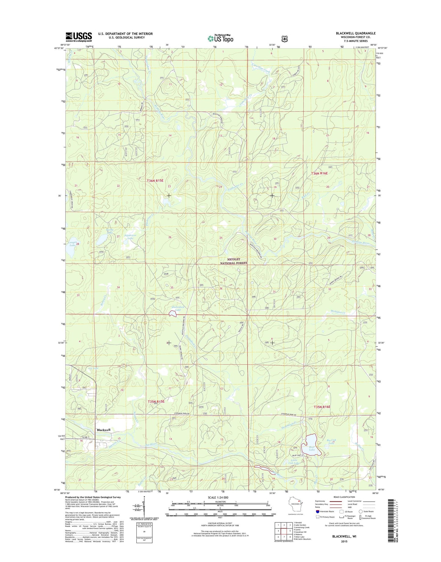
Blackwell Wisconsin US Topo Map
Couldn't load pickup availability
Also explore the Blackwell Forest Service Topo of this same quad for updated USFS data
2022 topographic map quadrangle Blackwell in the state of Wisconsin. Scale: 1:24000. Based on the newly updated USGS 7.5' US Topo map series, this map is in the following counties: Forest. The map contains contour data, water features, and other items you are used to seeing on USGS maps, but also has updated roads and other features. This is the next generation of topographic maps. Printed on high-quality waterproof paper with UV fade-resistant inks.
Quads adjacent to this one:
West: Laona
Northwest: Newald
North: Lake Gordon
Northeast: Armstrong Creek
East: Goodman SW
Southeast: McCaslin Mountain
South: Otter Lake
Southwest: Wabeno
This map covers the same area as the classic USGS quad with code o45088e5.
Contains the following named places: Bear Lake, Bear Lake Campground, Big Cub Lake, Blackwell, Blackwell Job Corps Center, Catwillow Creek, CCC Pond, Coldwater Creek, Dendro Eco Trail, Haymeadow Creek, Langer Lake, Little Cub Lake, Piledriver Creek, Piledriver Lake, Purdy Lake, Shabodock Creek, Shabodock Lake, Spencer Creek, Stoney Creek, Town of Blackwell, ZIP Code: 54541