MyTopo
Doering Wisconsin US Topo Map
Couldn't load pickup availability
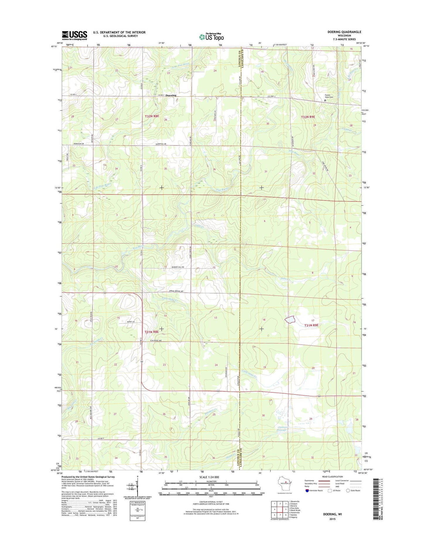
2022 topographic map quadrangle Doering in the state of Wisconsin. Scale: 1:24000. Based on the newly updated USGS 7.5' US Topo map series, this map is in the following counties: Lincoln, Langlade. The map contains contour data, water features, and other items you are used to seeing on USGS maps, but also has updated roads and other features. This is the next generation of topographic maps. Printed on high-quality waterproof paper with UV fade-resistant inks.
Quads adjacent to this one:
West: Pine Dells
Northwest: Bloomville
North: Gleason
Northeast: Bavaria
East: Black Brook
Southeast: Hogarty
South: Kalinke
Southwest: Nutterville
This map covers the same area as the classic USGS quad with code o45089b4.
Contains the following named places: Ackley Lookout Tower, Ackley State Wildlife Areas, Doering, Doering School, East Branch Pratt Creek, Forest View Cemetery, Forest View Church, Forest View School, Gleason Flowage 2, Little Oxbo Creek, Lloyd Creek, McCloud Creek, Oxbo Creek, Pratt Creek, Prospect School, Saint Matthews Church, Skunk Creek D12.185 Dam, Spring Brook School, Wildwood Church