MyTopo
Chittamo NE Wisconsin US Topo Map
Couldn't load pickup availability
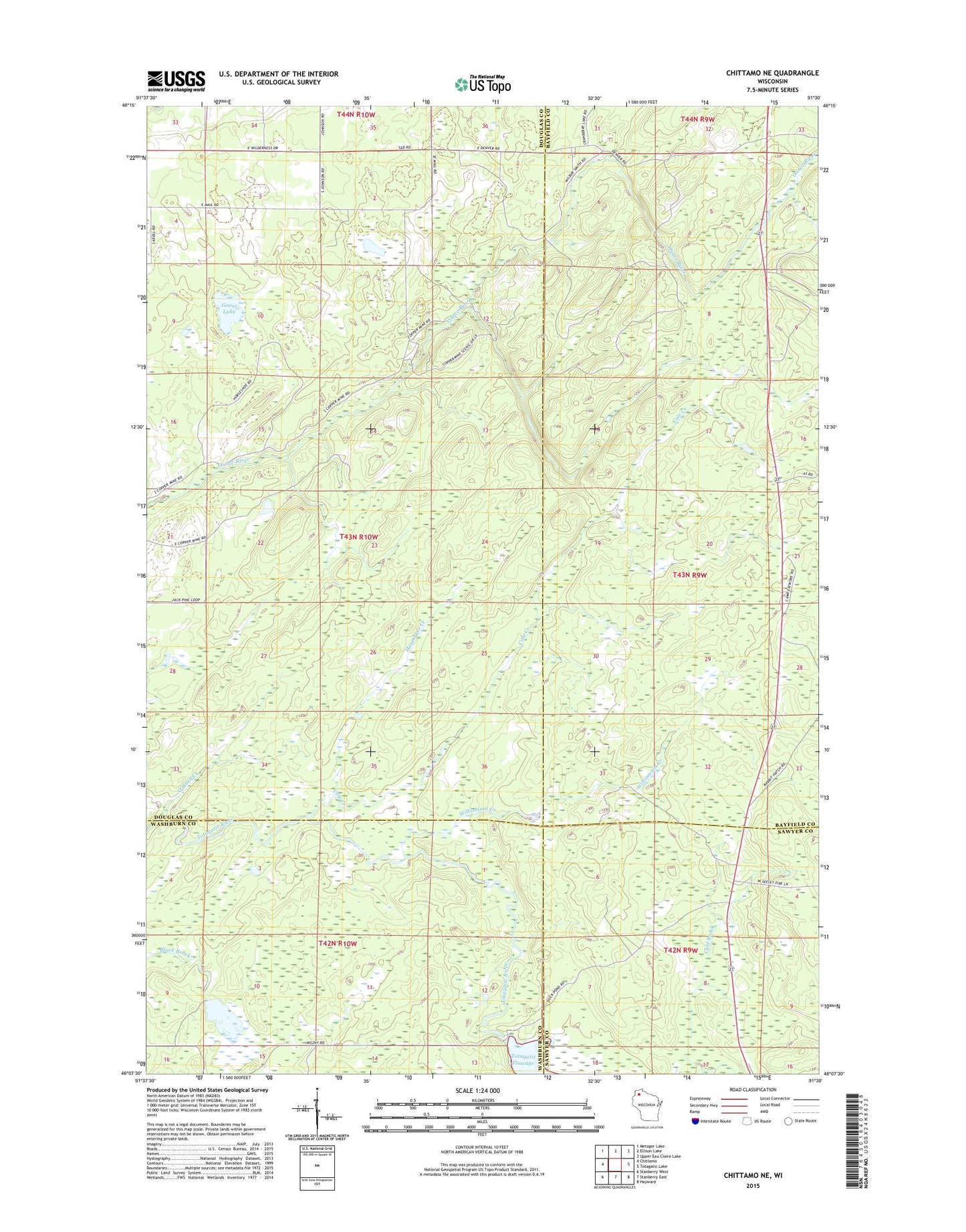
2022 topographic map quadrangle Chittamo NE in the state of Wisconsin. Scale: 1:24000. Based on the newly updated USGS 7.5' US Topo map series, this map is in the following counties: Douglas, Bayfield, Washburn, Sawyer. The map contains contour data, water features, and other items you are used to seeing on USGS maps, but also has updated roads and other features. This is the next generation of topographic maps. Printed on high-quality waterproof paper with UV fade-resistant inks.
Quads adjacent to this one:
West: Chittamo
Northwest: Metzger Lake
North: Ellison Lake
Northeast: Upper Eau Claire Lake
East: Totagatic Lake
Southeast: Hayward
South: Stanberry East
Southwest: Stanberry West
This map covers the same area as the classic USGS quad with code o46091b5.
Contains the following named places: Cole Creek, Goose Lake, Haymaker Creek, O'Hara Creek, Totagatic River State Wildlife Managemnet Area, Totagatic Wildlife 2WP804 Dam, Williamson Creek