MyTopo
Ellison Lake Wisconsin US Topo Map
Couldn't load pickup availability
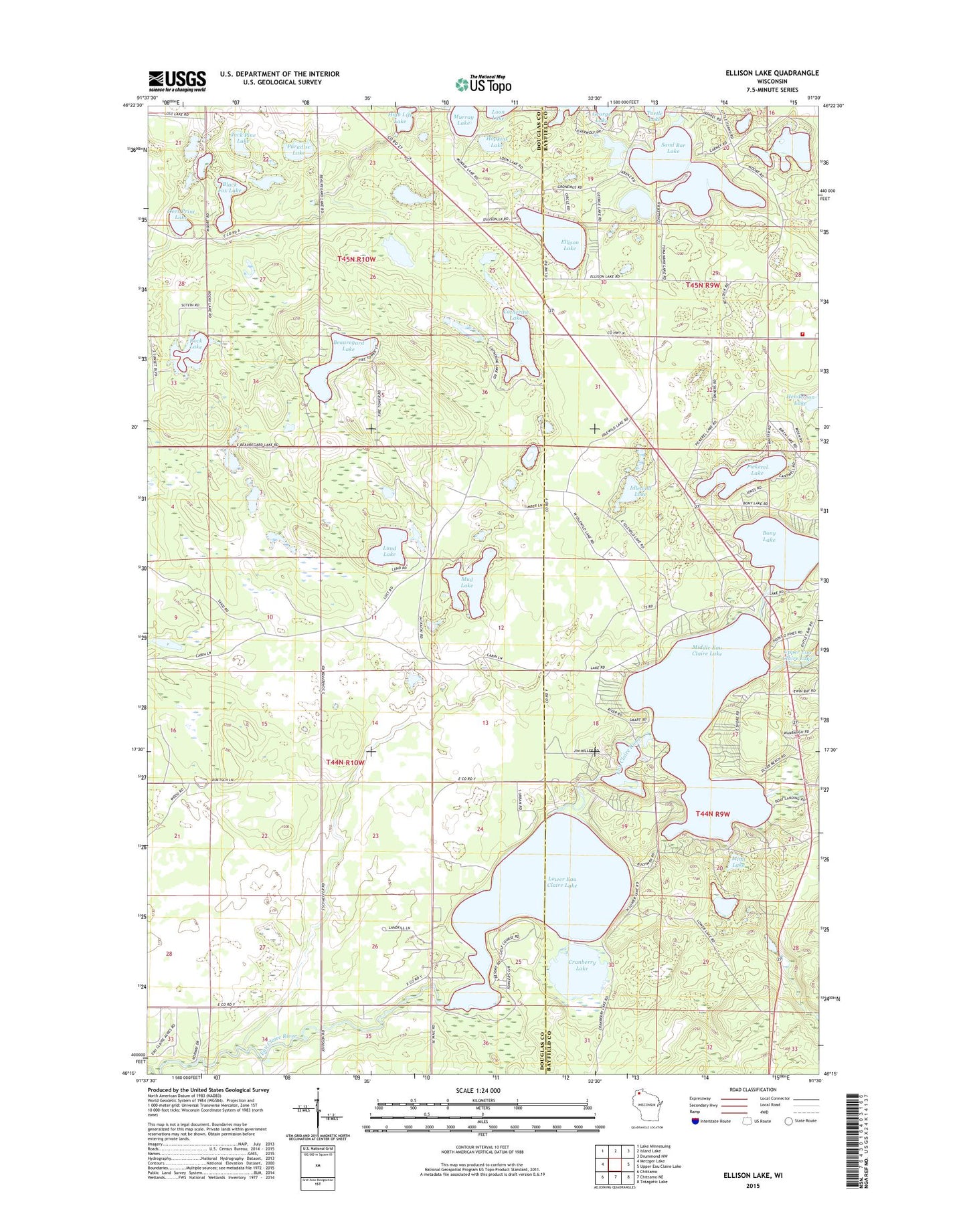
2022 topographic map quadrangle Ellison Lake in the state of Wisconsin. Scale: 1:24000. Based on the newly updated USGS 7.5' US Topo map series, this map is in the following counties: Douglas, Bayfield. The map contains contour data, water features, and other items you are used to seeing on USGS maps, but also has updated roads and other features. This is the next generation of topographic maps. Printed on high-quality waterproof paper with UV fade-resistant inks.
Quads adjacent to this one:
West: Metzger Lake
Northwest: Lake Minnesuing
North: Island Lake
Northeast: Drummond NW
East: Upper Eau Claire Lake
Southeast: Totagatic Lake
South: Chittamo NE
Southwest: Chittamo
This map covers the same area as the classic USGS quad with code o46091c5.
Contains the following named places: Barnes Ambulance Service, Barnes Fire Department, Barnes Memorial Cemetery, Barnes Townhall, Beauregard Lake, Black Fox Lake, Bony Lake, Catherine Lake, Cranberry Lake, Deer Print Lake, Ellison Lake, High Life Lake, Highland Lookout Tower, Hopkins Lake, Idlewild Lake, Jack Pine Lake, Little Island Lake, Lower Eau Claire Lake, Lower Eau Claire Lake 55, Lower Eau Claire Lake Dam, Lund Lake, Middle Eau Claire Lake, Middle Eau Claire Lake 2WP366 Dam, Middle Eau Claire Lake 57, Mimi Lake, Mirror Lake, Mooney Dam County Park, Mud Lake, Murray Lake, Paradise Lake, Pickerel Lake, Rock Lake, Sand Bar Lake, Tomahawk Lake


