MyTopo
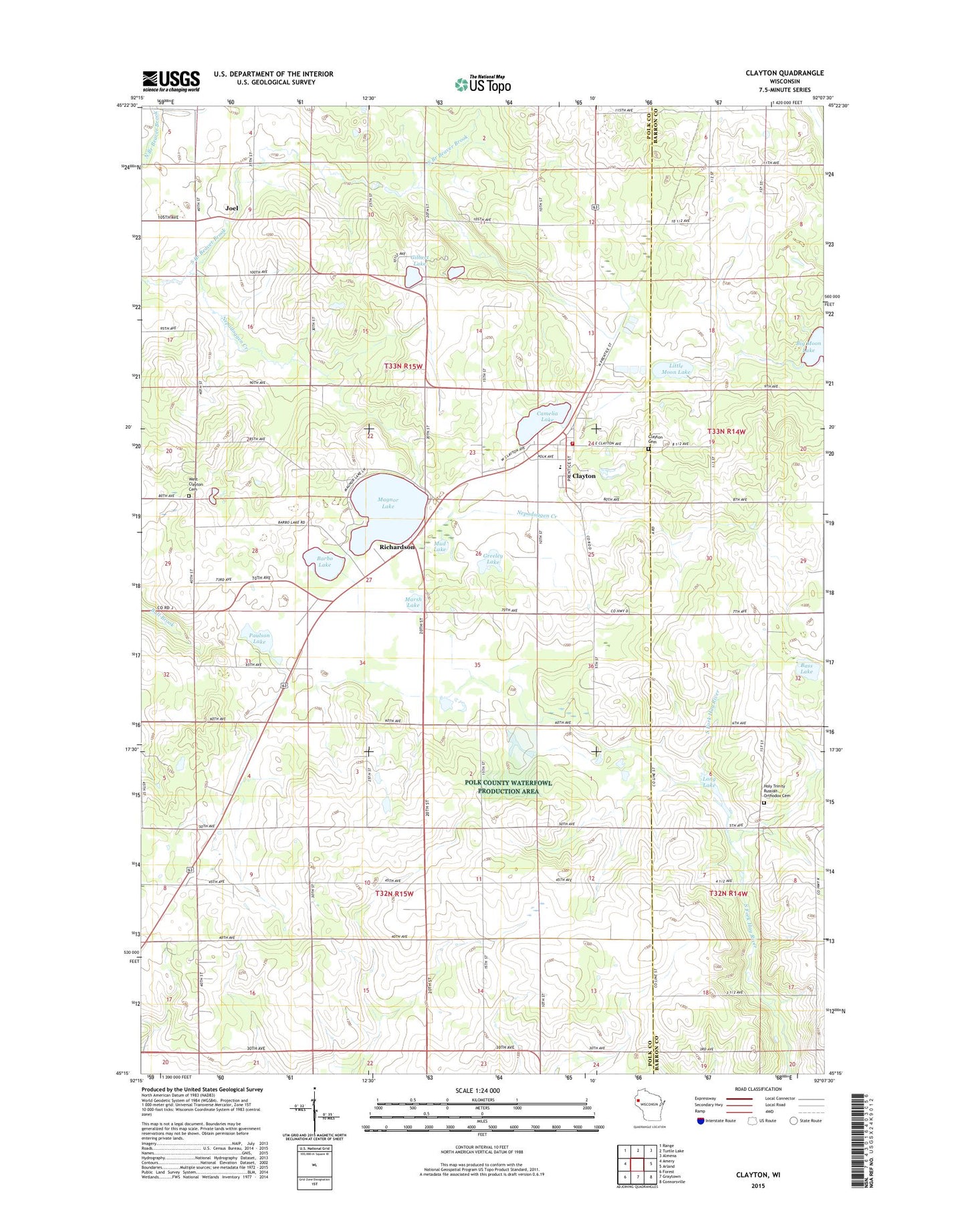
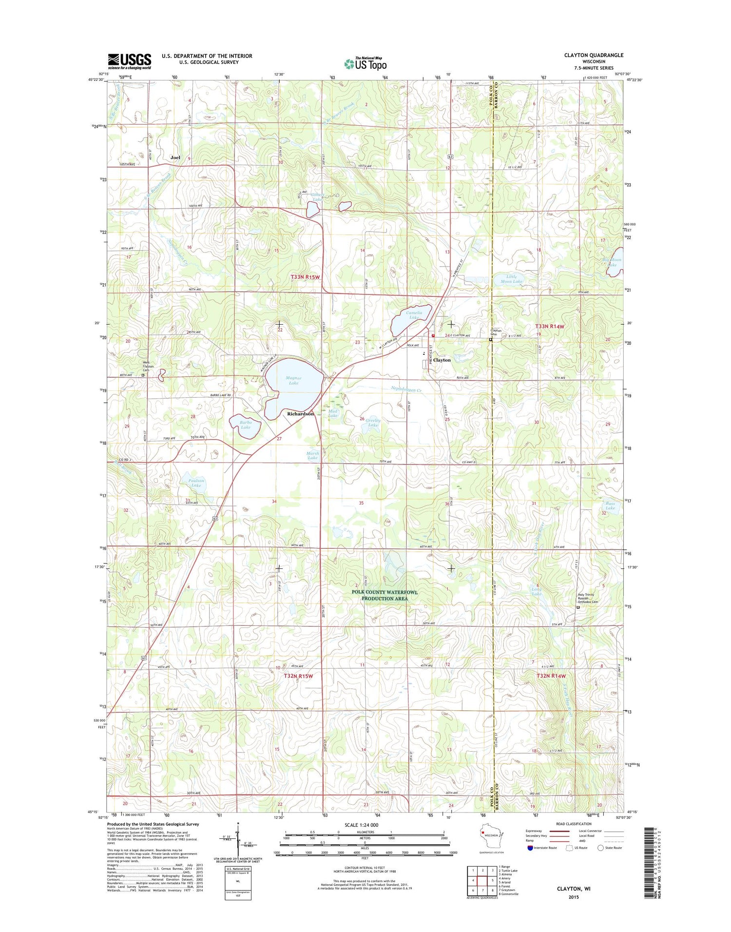
Clayton Wisconsin US Topo Map
Couldn't load pickup availability
2018 topographic map quadrangle Clayton in the state of Wisconsin. Scale: 1:24000. Based on the newly updated USGS 7.5' US Topo map series, this map is in the following counties: Polk, Barron. The map contains contour data, water features, and other items you are used to seeing on USGS maps, but also has updated roads and other features. This is the next generation of topographic maps. Printed on high-quality waterproof paper with UV fade-resistant inks.
Quads adjacent to this one:
West: Amery
Northwest: Range
North: Turtle Lake
Northeast: Almena
East: Arland
Southeast: Connorsville
South: Graytown
Southwest: Forest
Contains the following named places: Barbo Lake, Bass Lake, Bethany Church, Camelia Lake, Clayton, Clayton Cemetery, Clayton Elementary School, Clayton Fire Department, Clayton High School, Clayton Middle School, Clayton Police Department, Clayton Post Office, Edgewood School, Emmanuel Church, Faith Lutheran Church, Gilbert Lake, Greeley Lake, Holy Trinity Orthodox Church, Holy Trinity Russian Orthodox Cemetery, Immanuel Evangelical Lutheran Church, Joel, Little Moon Lake, Long Lake, Magnor Lake, Marsh Lake, Meadowbrook School, Moe Lutheran Church, Mud Lake, Nepadoggen Creek, Paulson Lake, Richardson, South Clayton School, Sunny Brook School, Sunny Slope School, Town of Clayton, Town of Clear Lake, Village of Clayton, West Clayton Cemetery, ZIP Code: 54004