MyTopo
Clintonville North Wisconsin US Topo Map
Couldn't load pickup availability
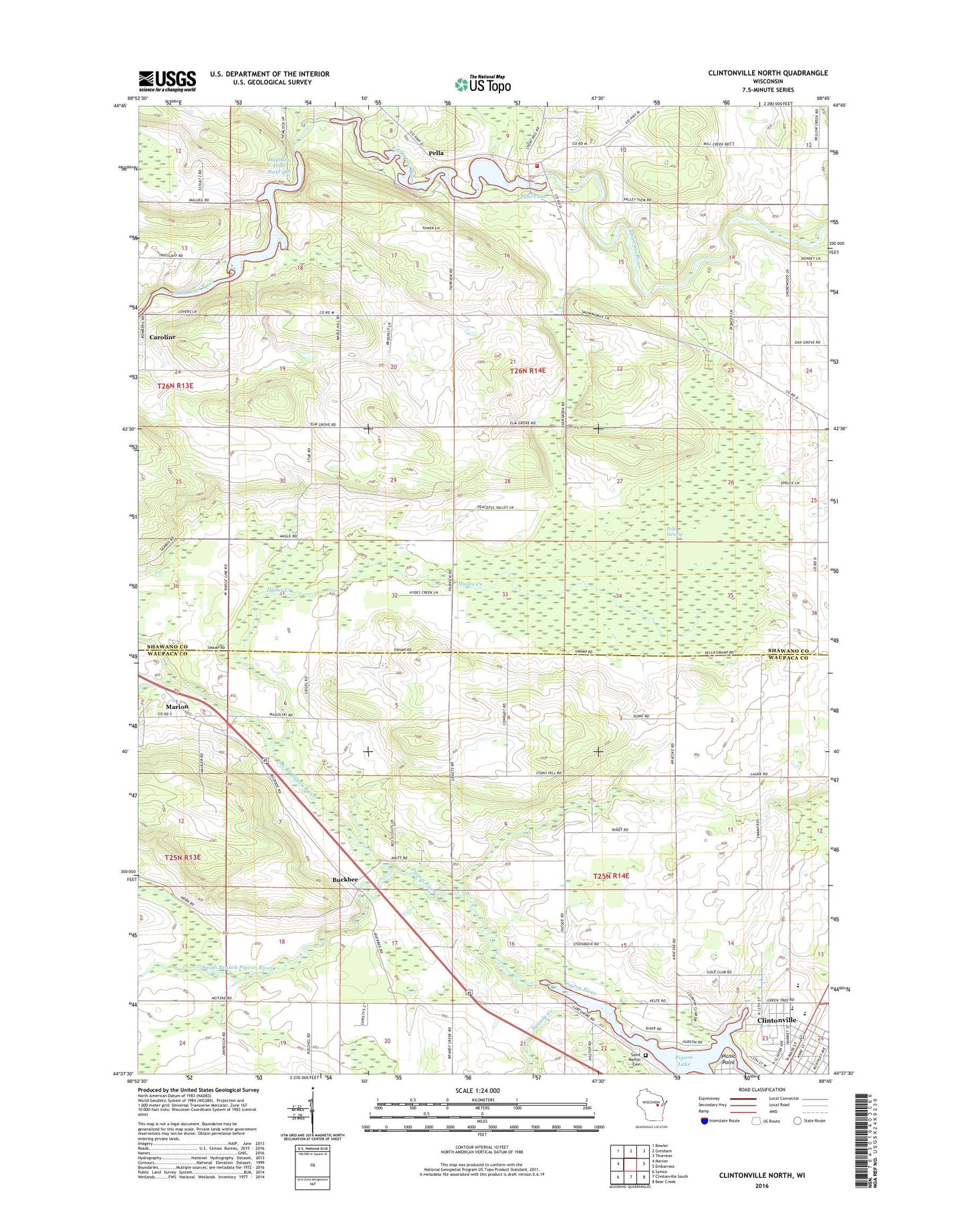
2018 topographic map quadrangle Clintonville North in the state of Wisconsin. Scale: 1:24000. Based on the newly updated USGS 7.5' US Topo map series, this map is in the following counties: Shawano, Waupaca. The map contains contour data, water features, and other items you are used to seeing on USGS maps, but also has updated roads and other features. This is the next generation of topographic maps. Printed on high-quality waterproof paper with UV fade-resistant inks.
Quads adjacent to this one:
West: Marion
Northwest: Bowler
North: Gresham
Northeast: Thornton
East: Embarrass
Southeast: Bear Creek
South: Clintonville South
Southwest: Symco
Contains the following named places: Bethlehem Lutheran Church, Brandy Creek, Buckbee, Clintonville High School, Clintonville Middle School, Dellwood Early Learning Center School, Excelsior School, Fairview School, Hayman Falls County Park, Hayman Falls Pond 260, Hayman Falls WP 94-18 Dam, Hydes Creek, Immanuel Lutheran Church, Morning Star School, North Branch Embarrass River, North Branch Pigeon River, Pella, Pella 1882c38 Dam, Pella Census Designated Place, Pella Pond, Pella Swamp, Pella Township Fire Department, Picnic Point, Pigeon Lake, Riverside Golf Club, Saint Martin Cemetery, Sandy Hollow School, South Branch Pigeon River, Town of Larrabee, Town of Pella, ZIP Code: 54928