MyTopo
Nashville Wisconsin US Topo Map
Couldn't load pickup availability
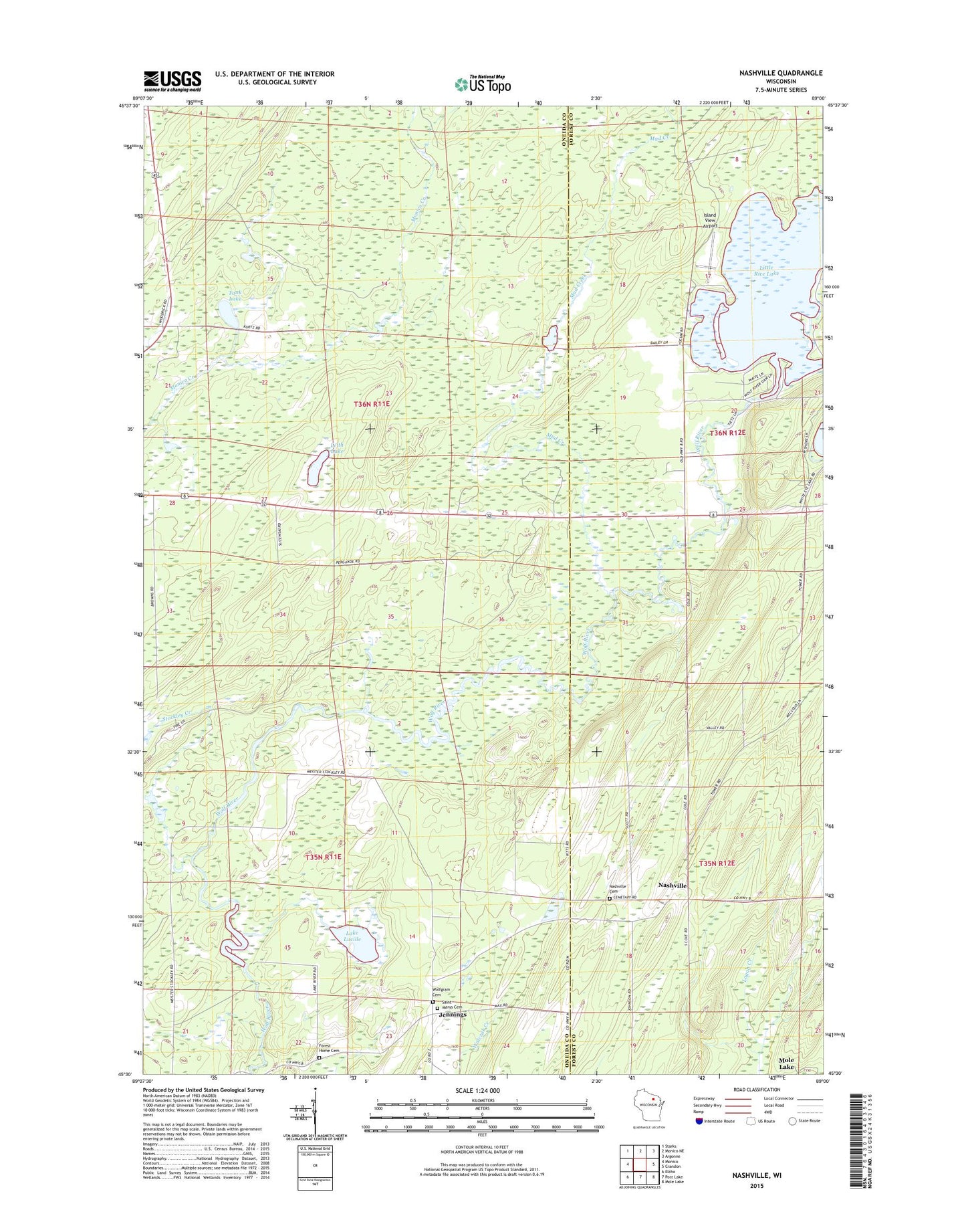
2022 topographic map quadrangle Nashville in the state of Wisconsin. Scale: 1:24000. Based on the newly updated USGS 7.5' US Topo map series, this map is in the following counties: Oneida, Forest. The map contains contour data, water features, and other items you are used to seeing on USGS maps, but also has updated roads and other features. This is the next generation of topographic maps. Printed on high-quality waterproof paper with UV fade-resistant inks.
Quads adjacent to this one:
West: Monico
Northwest: Starks
North: Monico NE
Northeast: Argonne
East: Crandon
Southeast: Mole Lake
South: Post Lake
Southwest: Elcho
This map covers the same area as the classic USGS quad with code o45089e1.
Contains the following named places: Forest Home Cemetery, Island View Airport, Jennings, Lake Lucille, Leith Lake, Lennox, Little Rice Lake, Little Rice Lake 2WP209 Dam, Little Rice Lake 45, Maple Ridge School, Mud Creek, Nashville, Nashville Cemetery, Saint Marys Cemetery, Stockley Creek, Tank Lake, Wolf River Lookout Tower, Wolf River School, Wolfgram Cemetery