MyTopo
Curtiss Wisconsin US Topo Map
Couldn't load pickup availability
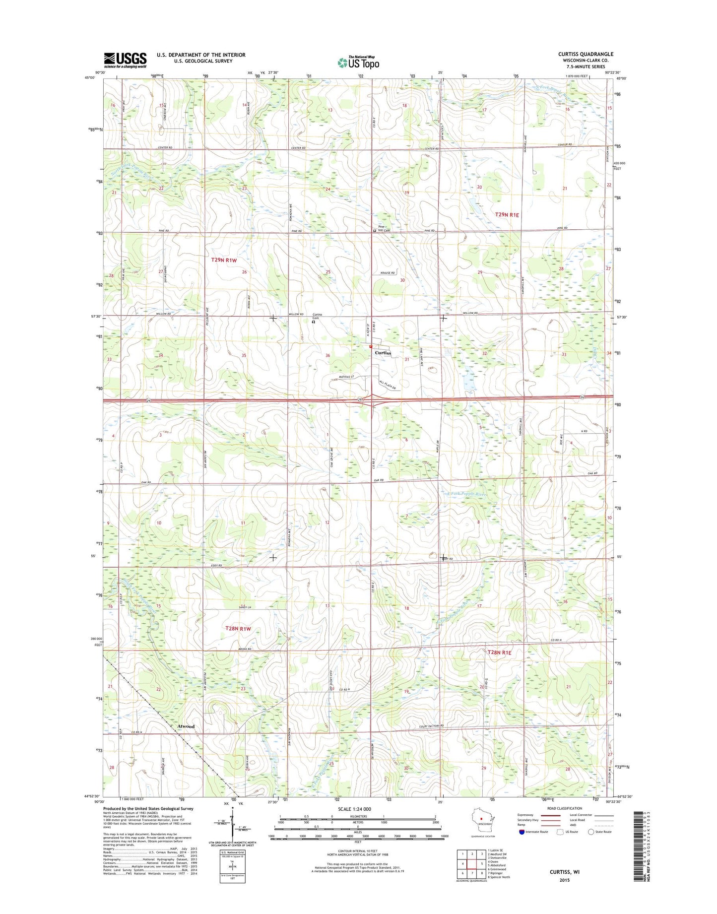
2022 topographic map quadrangle Curtiss in the state of Wisconsin. Scale: 1:24000. Based on the newly updated USGS 7.5' US Topo map series, this map is in the following counties: Clark. The map contains contour data, water features, and other items you are used to seeing on USGS maps, but also has updated roads and other features. This is the next generation of topographic maps. Printed on high-quality waterproof paper with UV fade-resistant inks.
Quads adjacent to this one:
West: Owen
Northwest: Lublin SE
North: Medford SW
Northeast: Stetsonville
East: Abbotsford
Southeast: Spencer North
South: Riplinger
Southwest: Greenwood
This map covers the same area as the classic USGS quad with code o44090h4.
Contains the following named places: Atwood, Atwood School, Bee Hive School, Clover Nook School, Curtiss, Curtiss Post Office, Curtiss Volunteer Fire Department, Midway School, Norwegian Church, Pine Hill Cemetery, Saint Paul Church, Saint Paul Lutheran Cemetery, Sand Hill School, Town of Colby, Town of Green Grove, Town of Hoard, Town of Mayville, Village of Curtiss, Woodland School, ZIP Code: 54422