MyTopo
De Soto Wisconsin US Topo Map
Couldn't load pickup availability
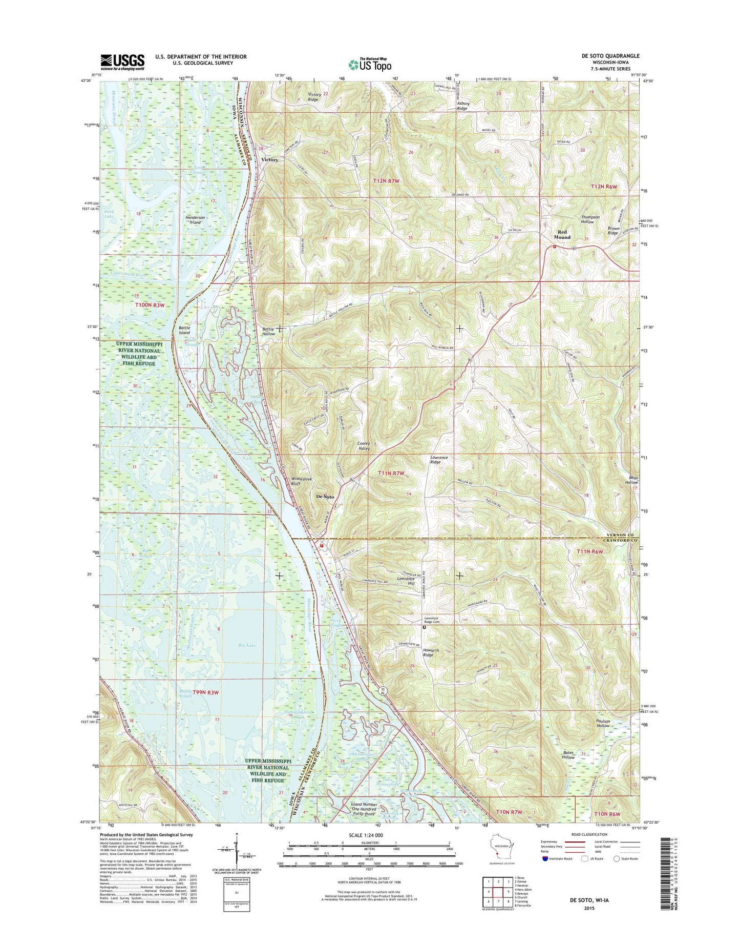
2018 topographic map quadrangle De Soto in the states of Wisconsin, Iowa. Scale: 1:24000. Based on the newly updated USGS 7.5' US Topo map series, this map is in the following counties: Vernon, Allamakee, Crawford. The map contains contour data, water features, and other items you are used to seeing on USGS maps, but also has updated roads and other features. This is the next generation of topographic maps. Printed on high-quality waterproof paper with UV fade-resistant inks.
Quads adjacent to this one:
West: New Albin
Northwest: Reno
North: Genoa
Northeast: Newton
East: Retreat
Southeast: Ferryville
South: Lansing
Southwest: Church
Contains the following named places: Asbury Ridge, Asbury School, Bates Hollow, Battle Bluff Prairie State Natural Area, Battle Creek, Battle Hollow, Battle Hollow School, Battle Island, Battle Slough, Bean Hollow, Big Lake, Big Slough, Conway Lake, Cooley Valley School, De Soto, De Soto Fire and Rescue Department, De Soto High School, De Soto Middle School, De Soto Post Office, DeSoto Bay, Elm Park School, Ferry Slough, Fish Lake, Green Lake, Henderson Island, Henderson Slough, Howarth Ridge, Howarth School, Hummingbird Slough, Lansing Big Lake Public Hunting Area, Launsom Lake, Lawrence Hill, Lawrence Ridge, Lawrence Ridge Cemetery, Lost Channel, McDonald Slough, Middle Slough, Minnesota Slough, Partridge School, Paulson Hollow, Peck Lake, Phillipi Lake, Pigpen Slough, Red Mound, Rush Creek State Natural Area, Sunnyside School, Town of Wheatland, Upper Iowa River, Victory, Victory Census Designated Place, Village of De Soto, Wheatland Volunteer Fire Department, Winneshiek Bluff, ZIP Code: 54624