
MyTopo
Drummond Wisconsin US Topo Map
Couldn't load pickup availability
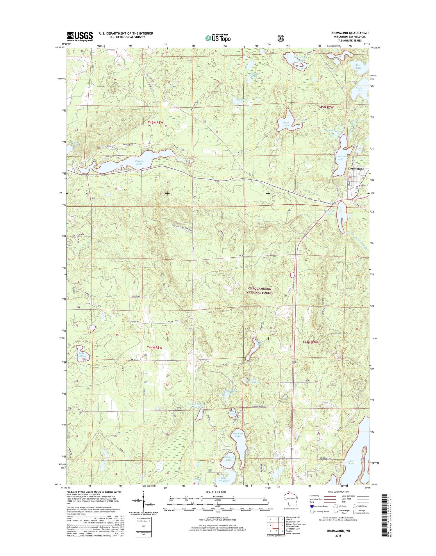
2018 topographic map quadrangle Drummond in the state of Wisconsin. Scale: 1:24000. Based on the newly updated USGS 7.5' US Topo map series, this map is in the following counties: Bayfield. The map contains contour data, water features, and other items you are used to seeing on USGS maps, but also has updated roads and other features. This is the next generation of topographic maps. Printed on high-quality waterproof paper with UV fade-resistant inks.
Quads adjacent to this one:
West: Upper Eau Claire Lake
Northwest: Drummond NW
North: Delta
Northeast: Grandview NW
East: Diamond Lake
Southeast: Lake Tahkodah
South: Cable
Southwest: Totagatic Lake
Contains the following named places: Armstrong Lake, Ascend Academy, Balsam Pond, Bullhead Lake, Cisco Lake, Cisco Lake 0.41, Cisco Lake Dam, Cisco Lake Summer Homes, Drummond, Drummond Dam, Drummond Elementary School, Drummond Fire and Rescue, Drummond High School, Drummond Junior High School, Drummond Lake, Drummond Lake 2WP1339 Dam, Drummond Lake 50, Drummond Post Office, Egg Lake, Esox Lake, Flynn Lake, Hammil Lake, Jorgenson Lake, Lake Dinner Camp, Lake Half Moon, Lake Holly, Lake Horseshoe, Lake Owen, Lake Sixteen, Lake Wilipyro, Maple Grove School, Mill Pond Lake, Mill Pond Lake 45, Mirror Lake, Mountain Lake, Old Chippewa Camp Ground, Pigeon Lake, Pigeon Lake Trail, Rana Lake, Samoset Lake, Stewart Lake, Town of Drummond, University of Wisconsin Field Station, ZIP Code: 54832


