MyTopo
Rock Falls Wisconsin US Topo Map
Couldn't load pickup availability
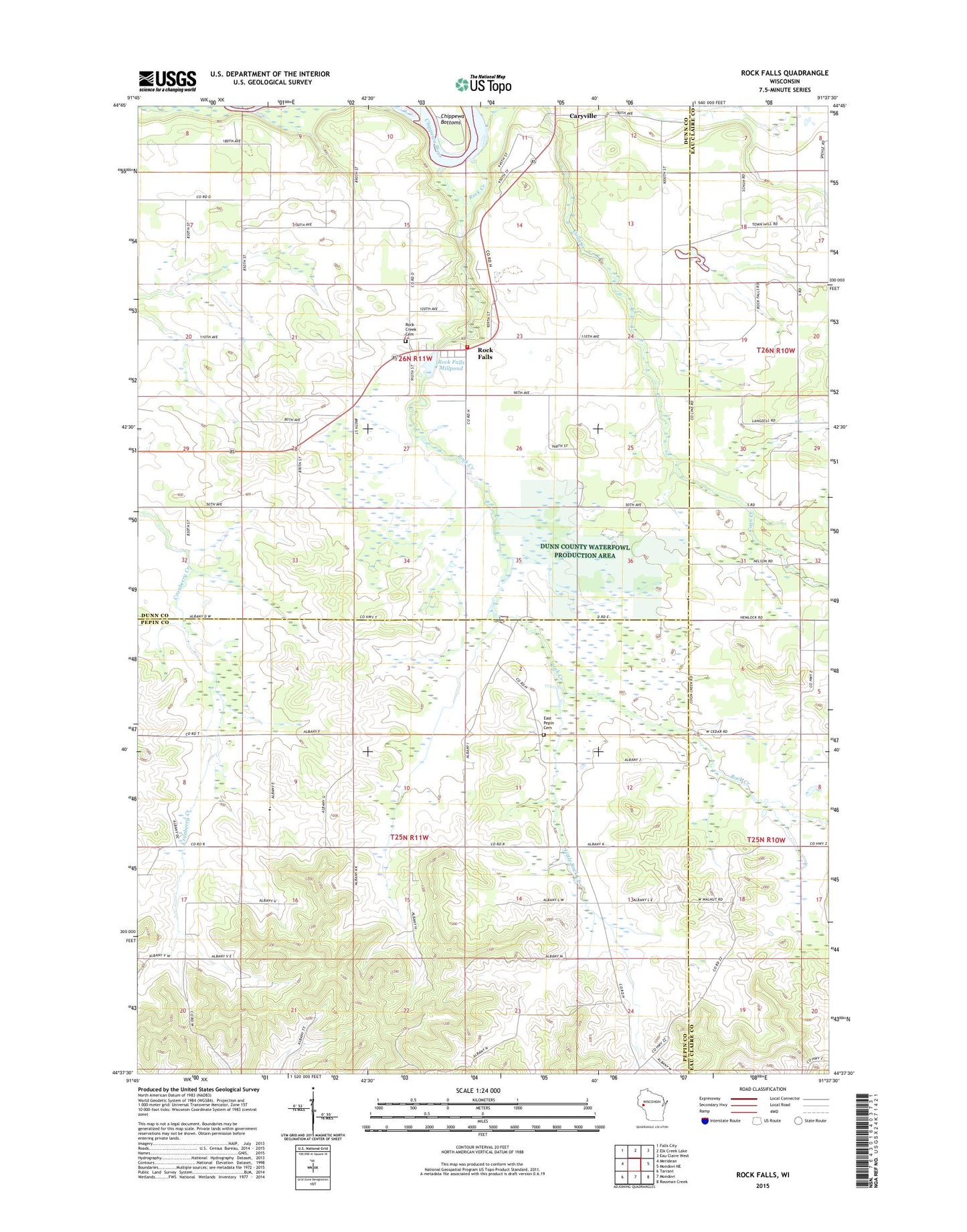
2022 topographic map quadrangle Rock Falls in the state of Wisconsin. Scale: 1:24000. Based on the newly updated USGS 7.5' US Topo map series, this map is in the following counties: Dunn, Pepin, Eau Claire. The map contains contour data, water features, and other items you are used to seeing on USGS maps, but also has updated roads and other features. This is the next generation of topographic maps. Printed on high-quality waterproof paper with UV fade-resistant inks.
Quads adjacent to this one:
West: Meridean
Northwest: Falls City
North: Elk Creek Lake
Northeast: Eau Claire West
East: Mondovi NE
Southeast: Rossman Creek
South: Mondovi
Southwest: Tarrant
This map covers the same area as the classic USGS quad with code o44091f6.
Contains the following named places: Albany Hill's Amish School, Chippewa Valley Church, Coon Creek, Coon Creek School, Cranberry School, Dunn County Waterfowl Production Area, East Pepin Cemetery, East Pepin School, Fairoaks School, Hayden E-7286 Dam, Little Red School, Little Rock Creek, Peru Amish School, Pleasant Hill School, Rock Creek, Rock Creek Cemetery, Rock Creek Township Fire Department, Rock Creek Township Volunteer Fire Department, Rock Falls, Rock Falls Census Designated Place, Rock Falls Dam, Rock Falls Millpond, Thomas School, Town of Albany, Town of Rock Creek, White Block School