MyTopo
Ettrick Wisconsin US Topo Map
Couldn't load pickup availability
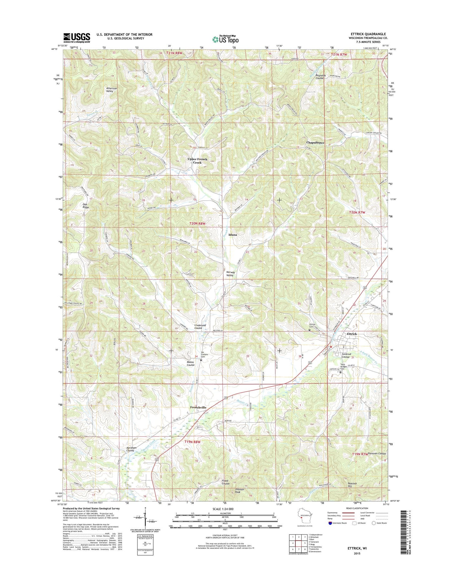
2022 topographic map quadrangle Ettrick in the state of Wisconsin. Scale: 1:24000. Based on the newly updated USGS 7.5' US Topo map series, this map is in the following counties: Trempealeau. The map contains contour data, water features, and other items you are used to seeing on USGS maps, but also has updated roads and other features. This is the next generation of topographic maps. Printed on high-quality waterproof paper with UV fade-resistant inks.
Quads adjacent to this one:
West: Tamarack
Northwest: Independence
North: Whitehall
Northeast: Blair
East: Hegg
Southeast: Stevenstown
South: Galesville
Southwest: Trempealeau
This map covers the same area as the classic USGS quad with code o44091b3.
Contains the following named places: Abraham Coulee, Berean Christian School, Bidwell Creek, Chapultepec School, Chapultepee, Ettrick, Ettrick Cemetery, Ettrick Elementary School, Ettrick Post Office, Ettrick Volunteer Fire Department, French Creek, French Creek Church, Frenchville, Frenchville School, Iduna, Johnson Peak, Linderund Coulee, Mais Creek, Mason Coulee, North Fork Beaver Creek, Oak Ridge School, Saint Bridget Cemetery, Smikrud Coulee, Smith Creek, Smith School, South Fork Beaver Creek, Upper French Creek, Upper French Creek School, Village of Ettrick, Vor Frelsers Cemetery, Wayside School