MyTopo
Galesville Wisconsin US Topo Map
Couldn't load pickup availability
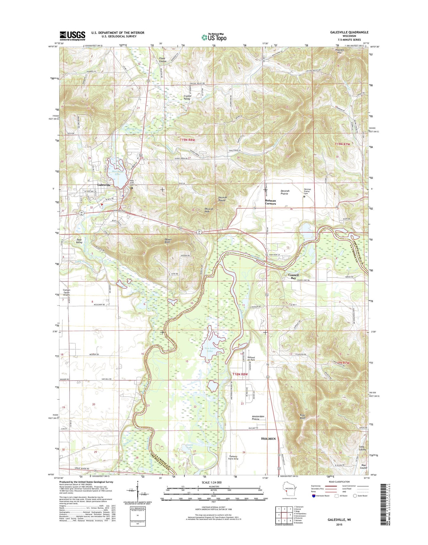
2022 topographic map quadrangle Galesville in the state of Wisconsin. Scale: 1:24000. Based on the newly updated USGS 7.5' US Topo map series, this map is in the following counties: Trempealeau, La Crosse. The map contains contour data, water features, and other items you are used to seeing on USGS maps, but also has updated roads and other features. This is the next generation of topographic maps. Printed on high-quality waterproof paper with UV fade-resistant inks.
Quads adjacent to this one:
West: Trempealeau
Northwest: Tamarack
North: Ettrick
Northeast: Hegg
East: Stevenstown
Southeast: Onalaska
South: Holmen
Southwest: Pickwick
This map covers the same area as the classic USGS quad with code o44091a3.
Contains the following named places: 0.65 Reservoir, 54630, Amsterdam Prairie School, Beaver Creek, Berean Church, Bigelow School, Brick School, Butman Corners, Caledonia School, Carhart Farms Airport, Castle Mound Country Club, City of Galesville, Council Bay, Council Bay School, Crystal Valley, Crystal Valley School, Dale Valley, Decorah Mound, Decorah Peak, Decorah Prairie, Decorah Prairie Cemetery, Decorah Prairie School, Dutch Creek, Flood Coulee, French and Sacia G-6693 Dam, Gale - Ettrick - Trempealeau High School, Galesville, Galesville Area Volunteer Fire Department, Galesville Elementary School, Galesville Mill Dam, Galesville Police Department, Galesville Post Office, Golf Course Pond, Goose Lake, Grant Creek, Grant School, Holland Air Park, King Bluff, Little Tamarack Creek, Marinuka Lake, Parkway Farm Strip, Peacock Hill, Pine Cliff Cemetery, Pow Wow Campground, Queen Bluff, Silver Creek, Silver Creek School, Town of Caledonia, Town of Gale, Town of Holland, Van Loon Lake, Van Loon Wildlife Area, WKBT-TV (La Crosse)