MyTopo
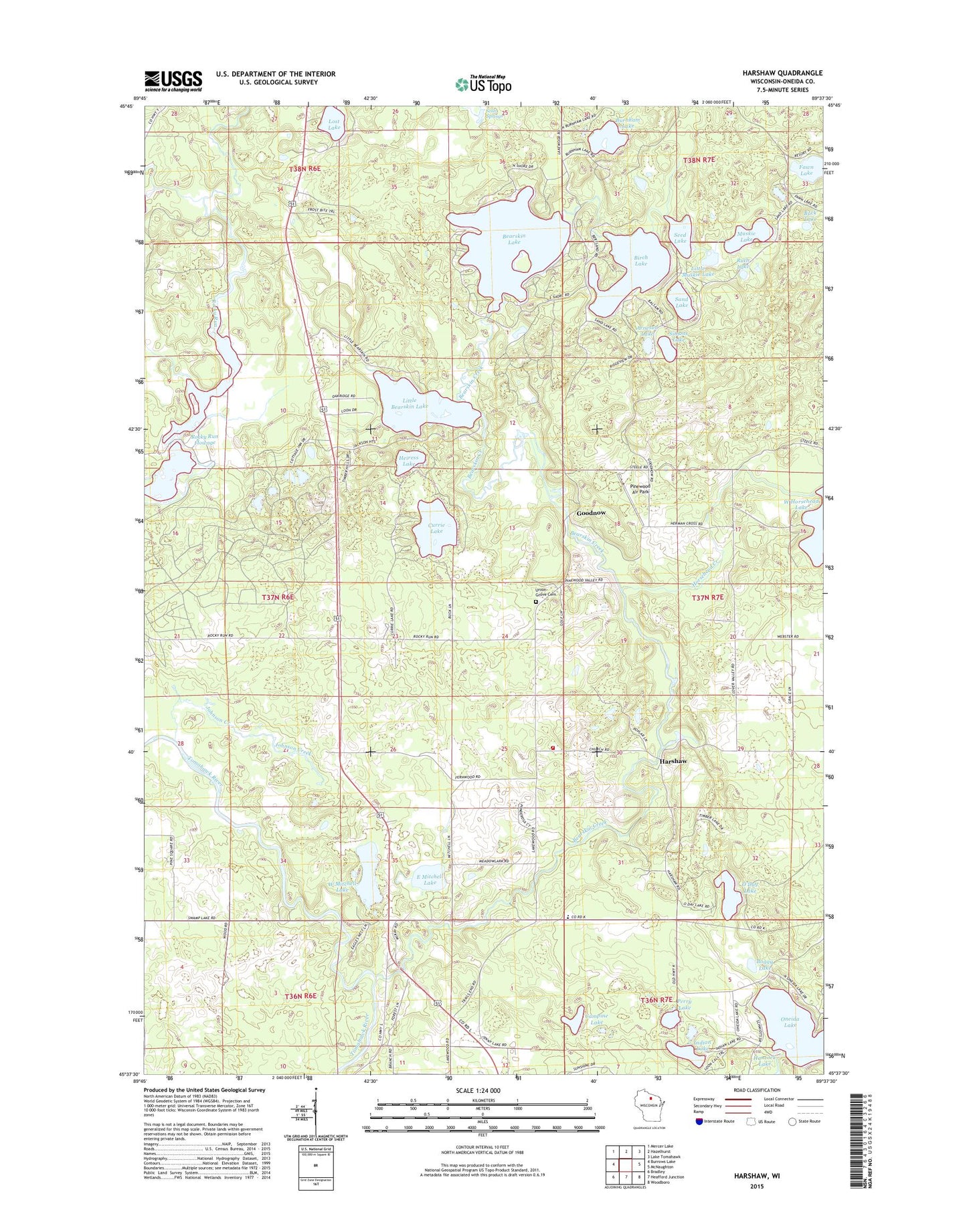
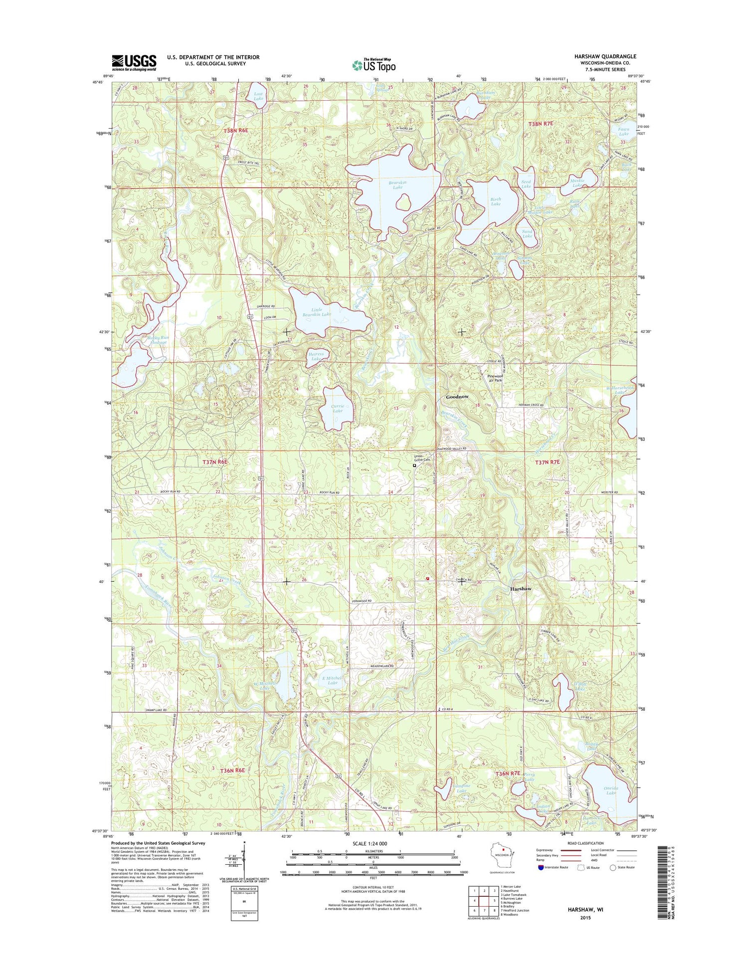
Harshaw Wisconsin US Topo Map
Couldn't load pickup availability
2018 topographic map quadrangle Harshaw in the state of Wisconsin. Scale: 1:24000. Based on the newly updated USGS 7.5' US Topo map series, this map is in the following counties: Oneida. The map contains contour data, water features, and other items you are used to seeing on USGS maps, but also has updated roads and other features. This is the next generation of topographic maps. Printed on high-quality waterproof paper with UV fade-resistant inks.
Quads adjacent to this one:
West: Burrows Lake
Northwest: Mercer Lake
North: Hazelhurst
Northeast: Lake Tomahawk
East: McNaughton
Southeast: Woodboro
South: Heafford Junction
Southwest: Bradley
Contains the following named places: Arneson Lake, Bearskin Creek, Bearskin Lake, Bearskin State Park Trail, Birch Lake, Boggy Lake, Buck Lake, Burnham Lake, Campine Lake, Cassian Townhall, Cassian Volunteer Fire Department, Currie Lake, East Mitchell Lake, Faith Church, Fawn Lake, Fernwood School, Goodnow, Goodnow School, Harshaw, Harshaw Post Office, Heiress Lake, Horsehead Creek, Indian Lake, Johnson Creek, Little Bearskin Lake, Little Muskie Lake, Lost Lake, McKays Spur, Muskie Lake, Northwoods Community Elementary School, O'Day Lake, Oneida Lake, Perry Lake, Pinewood Air Park, Pinewood Country Club, Rocky Run Flowage, Ruth Lake, Sand Lake, Seed Lake, Simons Lake, Stewart School, Town of Cassian, Union Grove Cemetery, West Mitchell Lake, Woodboro Townhall, ZIP Code: 54529