MyTopo
Iola Wisconsin US Topo Map
Couldn't load pickup availability
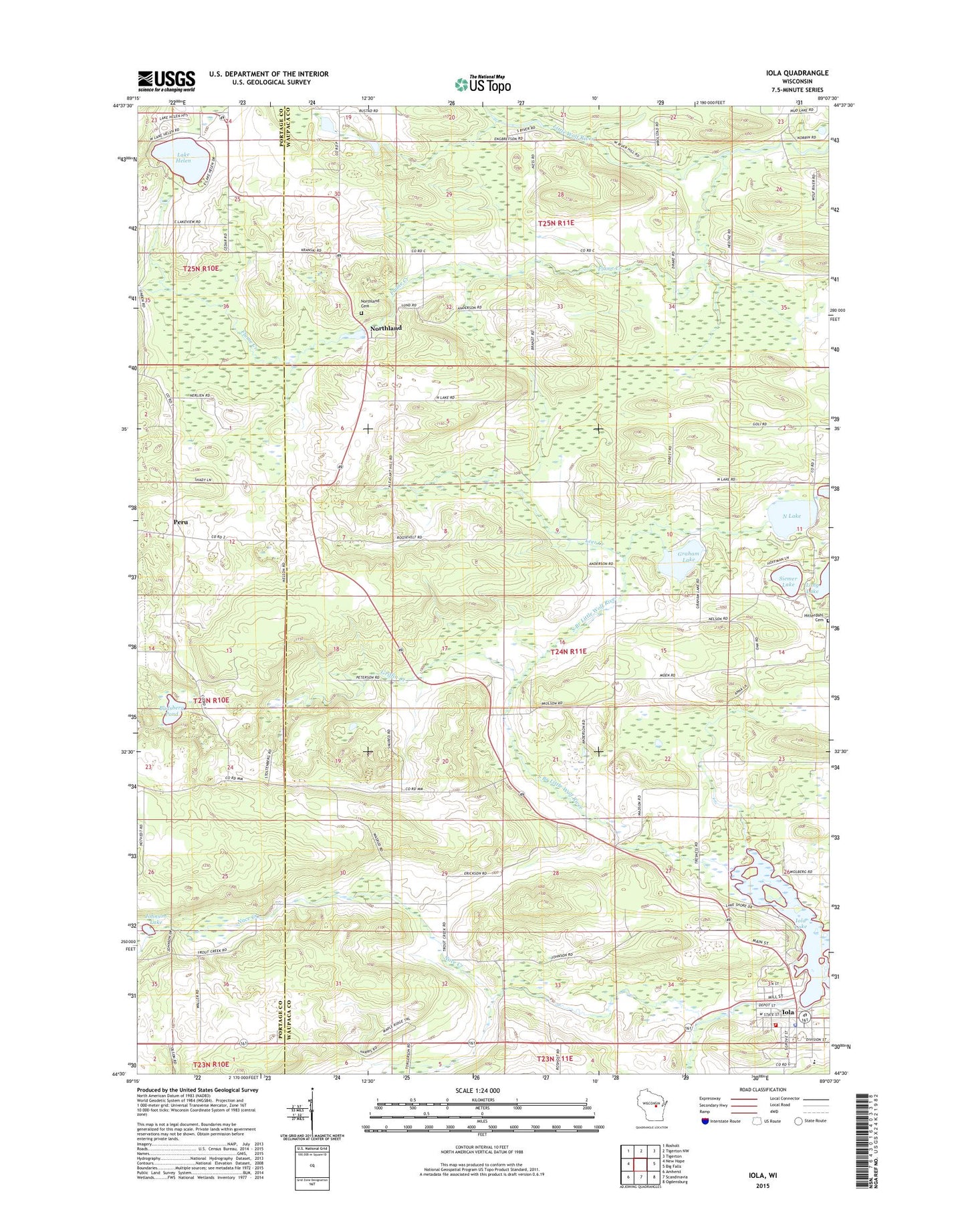
2022 topographic map quadrangle Iola in the state of Wisconsin. Scale: 1:24000. Based on the newly updated USGS 7.5' US Topo map series, this map is in the following counties: Waupaca, Portage. The map contains contour data, water features, and other items you are used to seeing on USGS maps, but also has updated roads and other features. This is the next generation of topographic maps. Printed on high-quality waterproof paper with UV fade-resistant inks.
Quads adjacent to this one:
West: New Hope
Northwest: Rosholt
North: Tigerton NW
Northeast: Tigerton
East: Big Falls
Southeast: Ogdensburg
South: Scandinavia
Southwest: Amherst
This map covers the same area as the classic USGS quad with code o44089e2.
Contains the following named places: Anderson School, Budsberg Pond, Flume Creek, Graham Lake, Griffin Creek, Honkens Hilltop Farm, Iola, Iola - Scandinavia High School, Iola 1870C480 Dam, Iola and Rural Fire Department and Ambulance Service, Iola Emergency Heliport, Iola Lake, Iola Lake 100, Iola Police Department, Iola Post Office, Johnson Lake, Lake Helen, Langdock School, Leer Creek, Nace Creek, North Lake, Northland, Northland Lutheran Cemetery, Northland School, Our Saviors Lutheran Church, Peru, Petersville, Pleasant Hill School, Siemer Lake, Town of Iola, ZIP Code: 54945