MyTopo
Tigerton NW Wisconsin US Topo Map
Couldn't load pickup availability
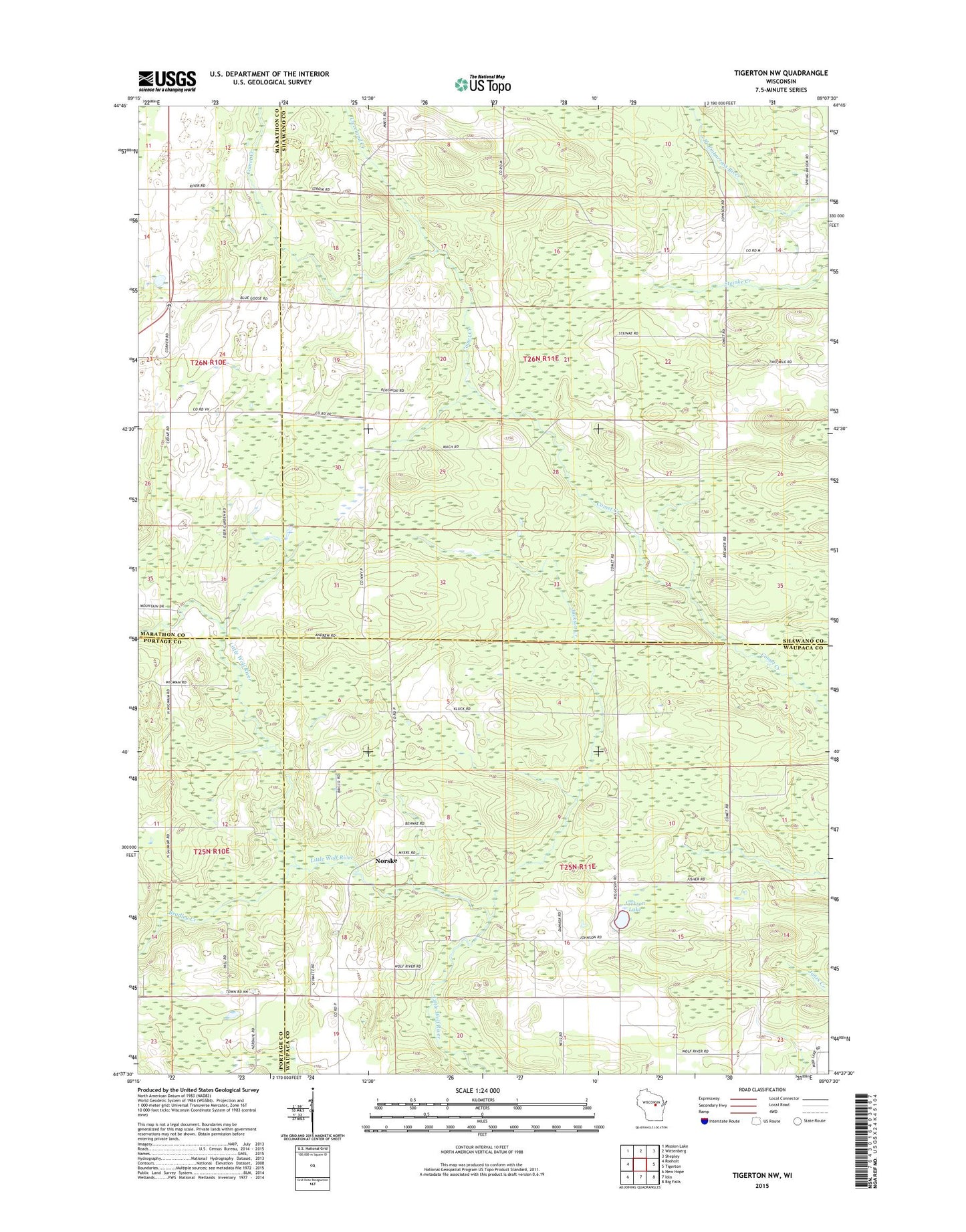
2022 topographic map quadrangle Tigerton NW in the state of Wisconsin. Scale: 1:24000. Based on the newly updated USGS 7.5' US Topo map series, this map is in the following counties: Shawano, Waupaca, Marathon, Portage. The map contains contour data, water features, and other items you are used to seeing on USGS maps, but also has updated roads and other features. This is the next generation of topographic maps. Printed on high-quality waterproof paper with UV fade-resistant inks.
Quads adjacent to this one:
West: Rosholt
Northwest: Mission Lake
North: Wittenberg
Northeast: Shepley
East: Tigerton
Southeast: Big Falls
South: Iola
Southwest: New Hope
This map covers the same area as the classic USGS quad with code o44089f2.
Contains the following named places: Alban Chapel, Bradley Creek, Cleveland Creek, Fairview School, Grove Terrace Farm, Harrison Center School, Jackson Creek, Jackson Lake, Little Wolf River State Natural Area, Norske, Town of Germania, Town of Harrison