MyTopo
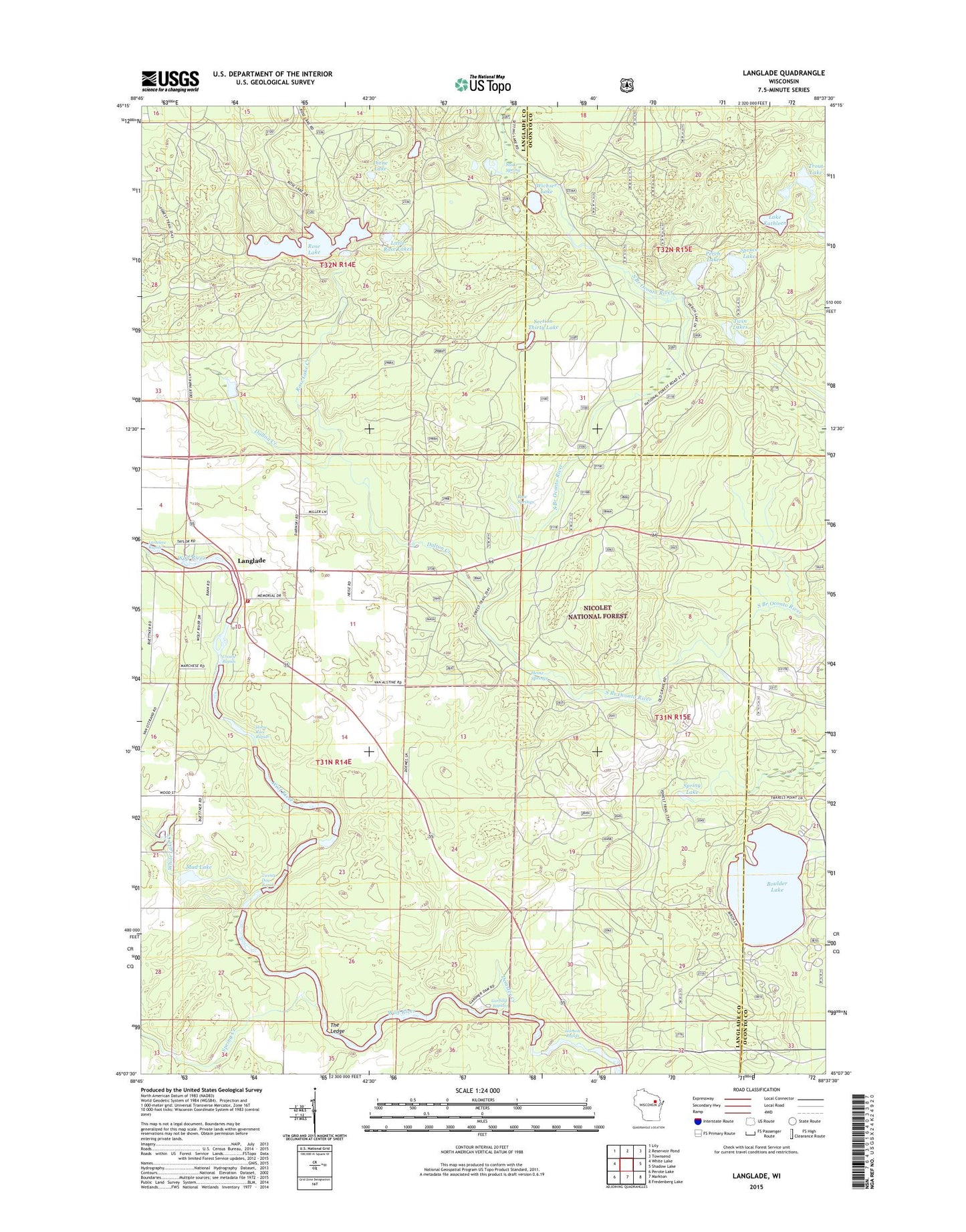
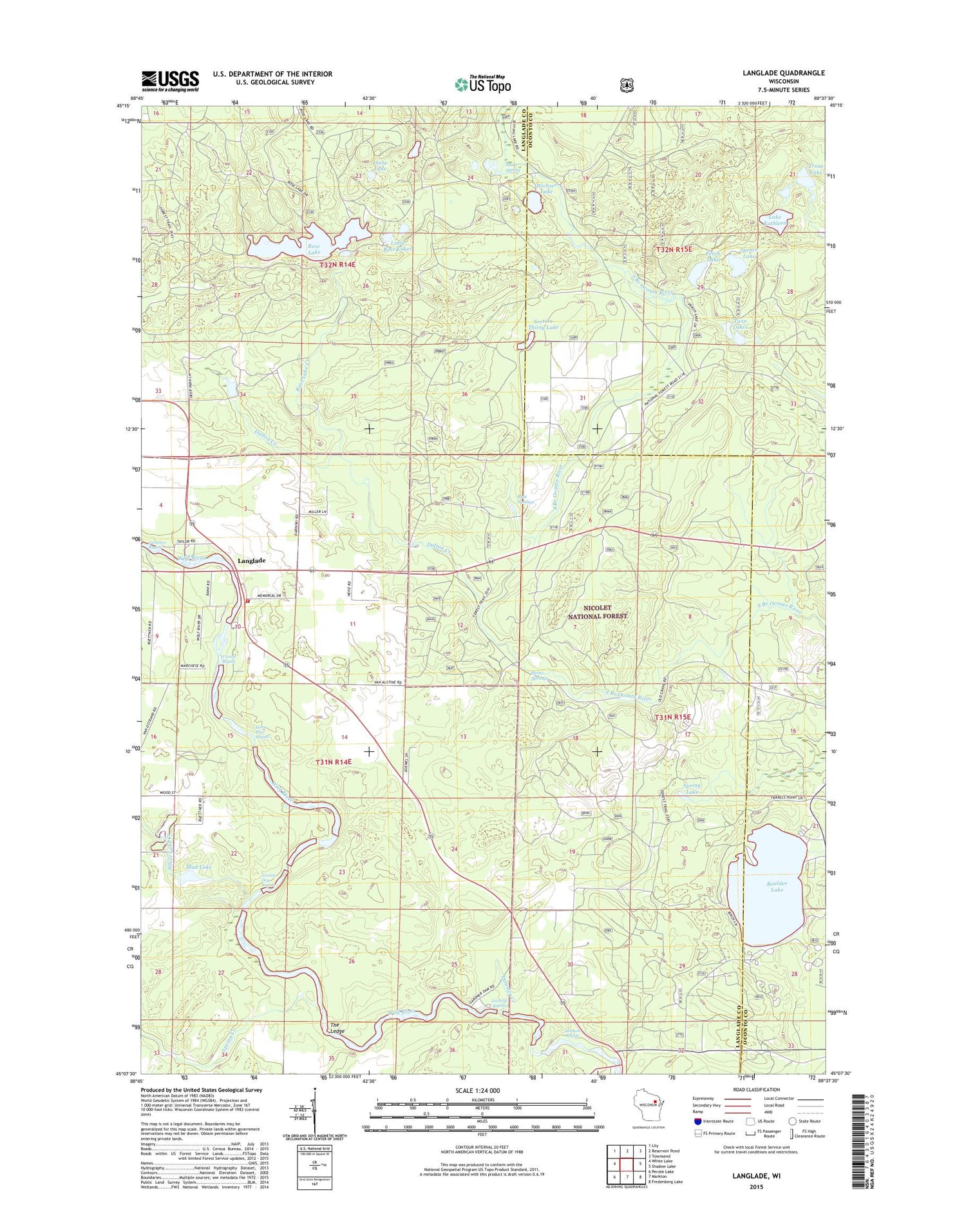
Langlade Wisconsin US Topo Map
Couldn't load pickup availability
2018 topographic map quadrangle Langlade in the state of Wisconsin. Scale: 1:24000. Based on the newly updated USGS 7.5' US Topo map series, this map is in the following counties: Langlade, Oconto. The map contains contour data, water features, and other items you are used to seeing on USGS maps, but also has updated roads and other features. This is the next generation of topographic maps. Printed on high-quality waterproof paper with UV fade-resistant inks.
Quads adjacent to this one:
West: White Lake
Northwest: Lily
North: Reservoir Pond
Northeast: Townsend
East: Shadow Lake
Southeast: Fredenberg Lake
South: Markton
Southwest: Perote Lake
Contains the following named places: Boulder Lake, Boulder Lake Campground, Boulder Lake Lookout Tower, Crowle Rapids, Dalton Creek, Demster Creek, Diene Lake, Gardner Dam Camp, Garfield Rapids, Hanson Rapids, Heinz Springs, Horse Race Rapids, Lake Kathleen, Langlade, Little Rose Lakes, Marktown Post Office, Mud Lake, Oconto Seed Orchards, Perch Lake, Popple Ridge Snowmobile Trail, Roix Springs, Rose Lake, Rose Lake Creek, Saint Stanislaus Church, Saul Spring, Section Thirty Lake, Spring Creek, Spring Lake, Spruce Lake, The Ledge, Town of Wolf River, Trout Lake, Twenty Day Rapids, Twin Lakes, White Lake Creek, Wichser Lake, Wolf River Volunteer Fire Department