
MyTopo
McKinley Wisconsin US Topo Map
Couldn't load pickup availability
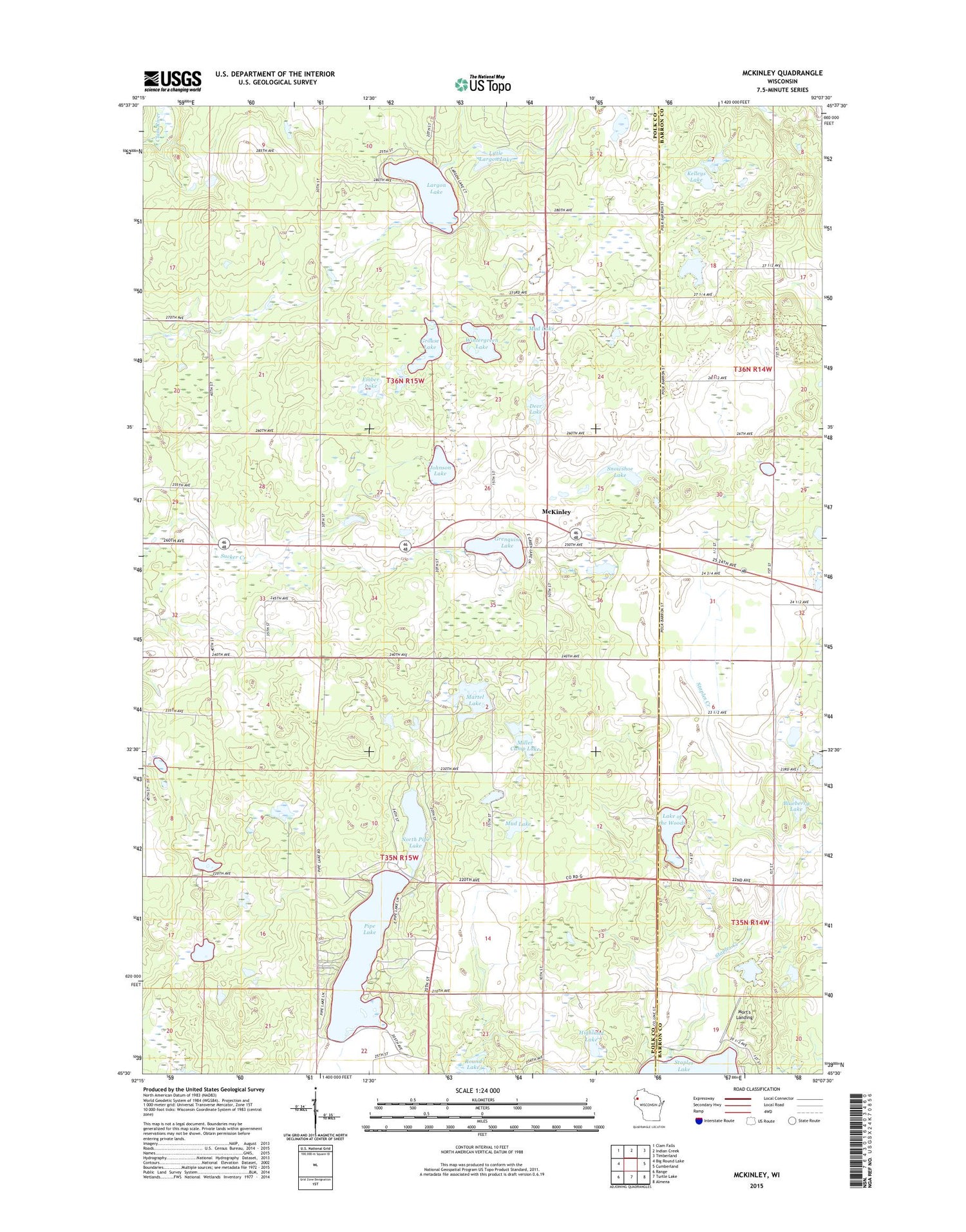
2018 topographic map quadrangle McKinley in the state of Wisconsin. Scale: 1:24000. Based on the newly updated USGS 7.5' US Topo map series, this map is in the following counties: Polk, Barron. The map contains contour data, water features, and other items you are used to seeing on USGS maps, but also has updated roads and other features. This is the next generation of topographic maps. Printed on high-quality waterproof paper with UV fade-resistant inks.
Quads adjacent to this one:
West: Big Round Lake
Northwest: Clam Falls
North: Indian Creek
Northeast: Timberland
East: Cumberland
Southeast: Almena
South: Turtle Lake
Southwest: Range
Contains the following named places: Bergman School, Black Bear Lake, Blueberry Lake, Deer Lake, Ember Lake, Emerson School, Grenquist Lake, Grenquist Park, Grouse Lake, Highland Lake, Johnson Lake, Kelleys Lake, Lake of the Woods, Largon Lake, Largon School, Little Largon Lake, Martel Lake, McKinley, McKinley School, McKinley Townhall, Miller Camp Lake, Mort's Landing, Mud Lake, North Pipe Lake, Pipe Lake, Pipe Lake School, Round Lake, Snowshoe Lake, Staples Creek, Town of Johnstown, Town of McKinley, Wintergreen Lake, Woodside School


