MyTopo
Mondovi Wisconsin US Topo Map
Couldn't load pickup availability
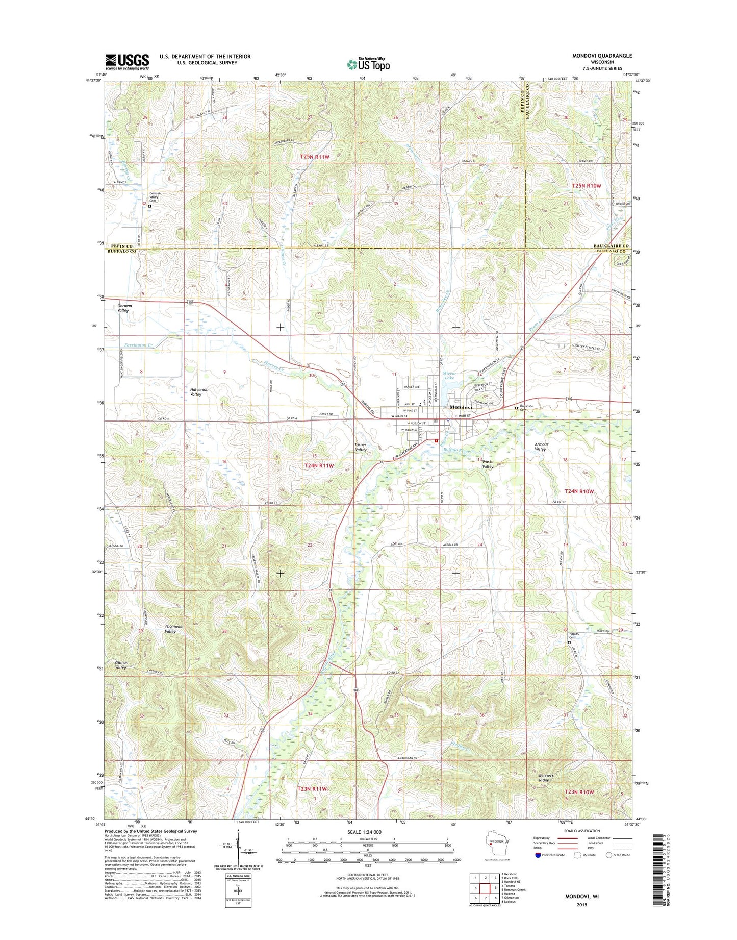
2022 topographic map quadrangle Mondovi in the state of Wisconsin. Scale: 1:24000. Based on the newly updated USGS 7.5' US Topo map series, this map is in the following counties: Buffalo, Pepin, Eau Claire. The map contains contour data, water features, and other items you are used to seeing on USGS maps, but also has updated roads and other features. This is the next generation of topographic maps. Printed on high-quality waterproof paper with UV fade-resistant inks.
Quads adjacent to this one:
West: Tarrant
Northwest: Meridean
North: Rock Falls
Northeast: Mondovi NE
East: Rossman Creek
Southeast: Lookout
South: Gilmanton
Southwest: Modena
This map covers the same area as the classic USGS quad with code o44091e6.
Contains the following named places: Armour Valley, Armour Valley School, Brownlee Creek, Brownlee G12 6 Dam, Buffalo County Fair Grounds, Castleholm Farm, Central Lutheran Church, City of Mondovi, Devaney School, Dillon Creek, Evangelical Lutheran Zions Church, Farrington Creek, German Valley, German Valley Cemetery, German Valley School, Halverson Valley, Harvey Creek, Harvey School, Heike Farms, Holmes Creek, Lincoln Public School, Memorial Park, Mirror Lake, Mondovi, Mondovi Ambulance Service, Mondovi City Hall, Mondovi City Library, Mondovi Clinic Hospital, Mondovi Elementary School, Mondovi Fire Department, Mondovi Greenhouses, Mondovi High School, Mondovi Hospital, Mondovi Middle School, Mondovi Police Department, Mondovi Post Office, Mondovi Wastewater Treatment Plant, Mondovi Water Works, Naples Cemetery, Olson Farms, Our Saviors United Methodist Church, Paradise Valley School, Peeso Creek, Peeso School, Pettingill Creek, Riverside Lutheran Cemetery, Sacred Heart Grade School, Sacred Heart Roman Catholic Church, Thompson Valley Church, Thompson Valley School, Town of Mondovi, Valley Golf Course, Waste Valley, Waste Valley School, Whelan Public School, Zion Lutheran Church, ZIP Code: 54755


