MyTopo
Lookout Wisconsin US Topo Map
Couldn't load pickup availability
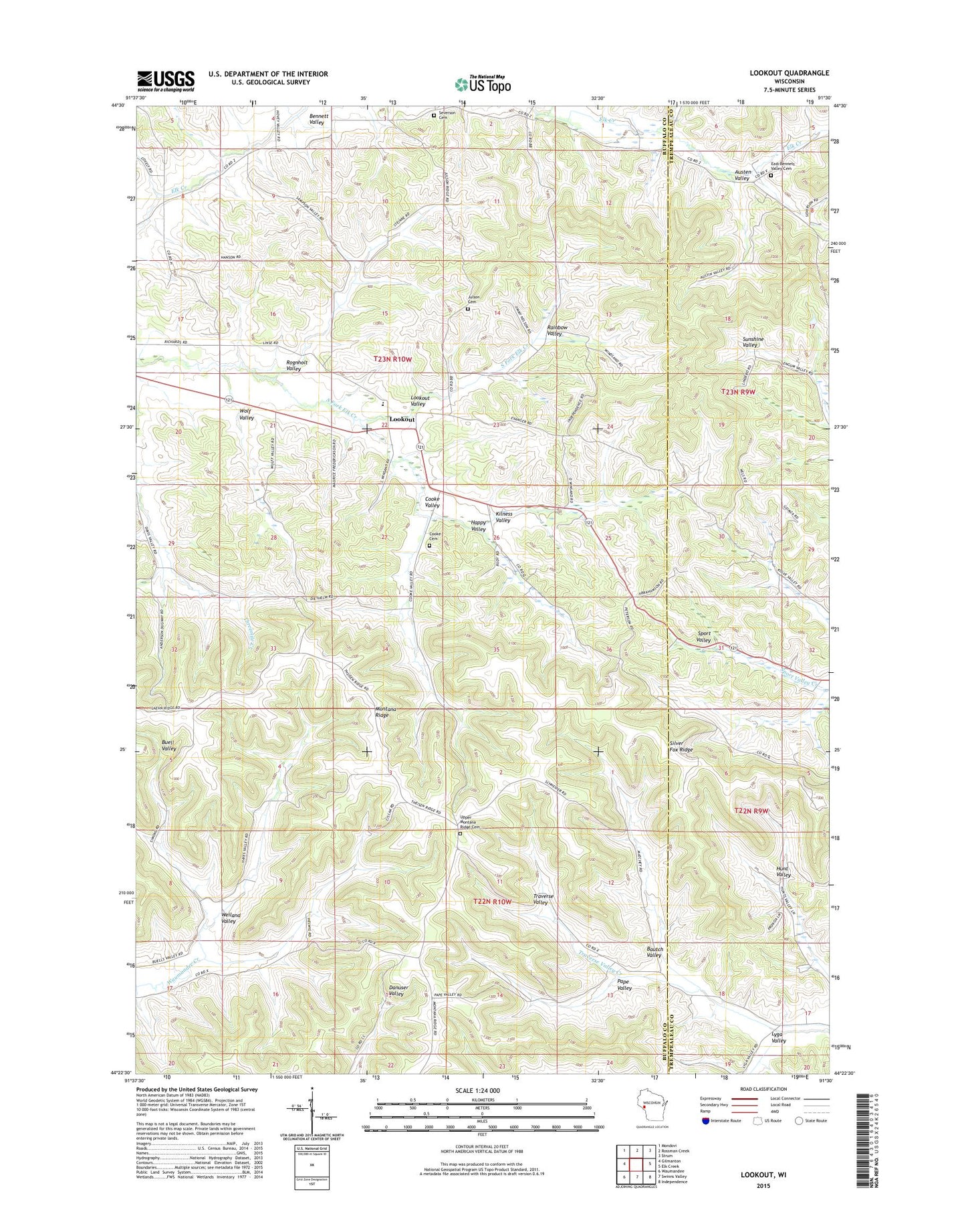
2022 topographic map quadrangle Lookout in the state of Wisconsin. Scale: 1:24000. Based on the newly updated USGS 7.5' US Topo map series, this map is in the following counties: Buffalo, Trempealeau. The map contains contour data, water features, and other items you are used to seeing on USGS maps, but also has updated roads and other features. This is the next generation of topographic maps. Printed on high-quality waterproof paper with UV fade-resistant inks.
Quads adjacent to this one:
West: Gilmanton
Northwest: Mondovi
North: Rossman Creek
Northeast: Strum
East: Elk Creek
Southeast: Independence
South: Swinns Valley
Southwest: Waumandee
This map covers the same area as the classic USGS quad with code o44091d5.
Contains the following named places: Austen Valley, Bautch Valley, Bennett Valley Norwegian Lutheran Church, Bennett Valley School, Borst Valley State Public Hunting Area, Buell Valley School, Cooke Cemetery, Cooke Valley, Davis Valley School, Dover Elementary School, East Bennett Valley Cemetery, Evanger Lutheran Church, Good Shepherd Lutheran Church, Happy Valley, Jackson Hollow Farm, Julson Cemetery, Kilness Valley, Lookout, Lookout Lutheran Church, Lookout School, Lookout Valley, Lower Bennett Valley School, Lyga Valley, Meadowbrook School, Pape Valley, Rainbow Valley, Rindahl School, Rognholt Valley, Severson Cemetery, Silver Fox Ridge, The Farm Airport, Town of Dover, Town of Montana, Upper Montana Ridge Cemetery, Upper Montana Ridge School, Weiland Valley, Wolf Valley, ZIP Code: 54747