MyTopo
Rossman Creek Wisconsin US Topo Map
Couldn't load pickup availability
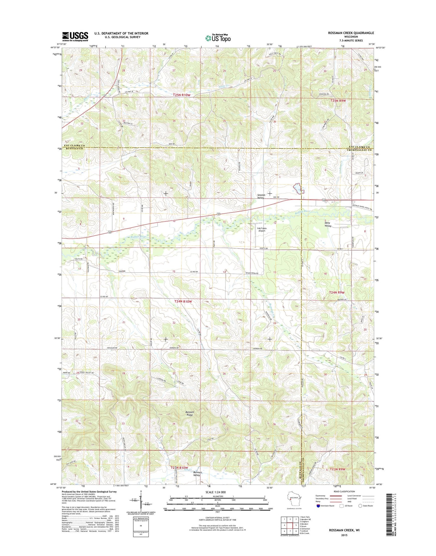
2022 topographic map quadrangle Rossman Creek in the state of Wisconsin. Scale: 1:24000. Based on the newly updated USGS 7.5' US Topo map series, this map is in the following counties: Buffalo, Eau Claire, Trempealeau. The map contains contour data, water features, and other items you are used to seeing on USGS maps, but also has updated roads and other features. This is the next generation of topographic maps. Printed on high-quality waterproof paper with UV fade-resistant inks.
Quads adjacent to this one:
West: Mondovi
Northwest: Rock Falls
North: Mondovi NE
Northeast: Cleghorn
East: Strum
Southeast: Elk Creek
South: Lookout
Southwest: Gilmanton
This map covers the same area as the classic USGS quad with code o44091e5.
Contains the following named places: Adams Creek, Bennett Ridge, Davy Valley, Gibson School, Hemlock School, Hilliard School, Lindsay Creek, Log Cabin Airport, Mondovi Airfield, Naples School, Norden School, Norden Trinity Church, Pace School, Plainview School, Rossman Creek, Sands School, Session Valley, Seyforth School, Silver Creek, Town of Naples