MyTopo
Brodhead West Wisconsin US Topo Map
Couldn't load pickup availability
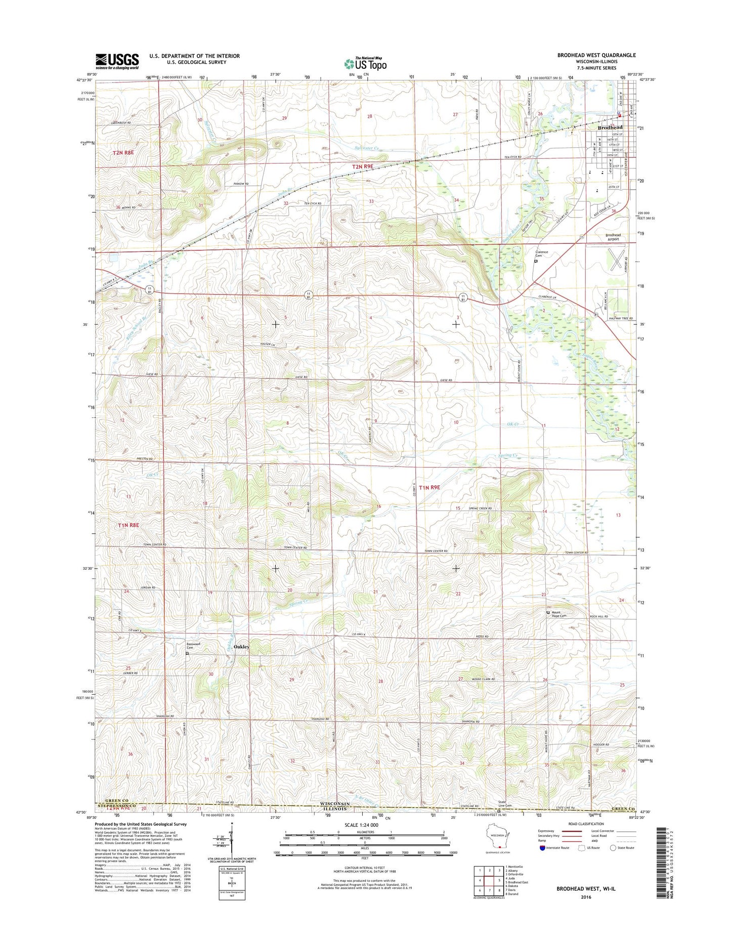
2022 topographic map quadrangle Brodhead West in the states of Wisconsin, Illinois. Scale: 1:24000. Based on the newly updated USGS 7.5' US Topo map series, this map is in the following counties: Green, Stephenson, Winnebago. The map contains contour data, water features, and other items you are used to seeing on USGS maps, but also has updated roads and other features. This is the next generation of topographic maps. Printed on high-quality waterproof paper with UV fade-resistant inks.
Quads adjacent to this one:
West: Juda
Northwest: Monticello
North: Albany
Northeast: Orfordville
East: Brodhead East
Southeast: Durand
South: Davis
Southwest: Dakota
This map covers the same area as the classic USGS quad with code o42089e4.
Contains the following named places: Basswood Cemetery, Boeke Farm, Brodhead, Brodhead Airport, Brodhead Area Emergency Medical Services, Brodhead Fire District, Brodhead High School, Brodhead Middle School, Brodhead Police Department, Brodhead Post Office, Brodhead Wastewater Treatment Facility, Cardinal Crest, Church of the Nazarene, City of Brodhead, Clarence, Clarence Cemetery, Davis School, Figi Valley Farms, Happy Hollow, Juda Branch, Mount Hope Cemetery, Oakley, Oakley Branch, Oakley School, OK Creek, Poplar Grove School, Riley School Branch, Ronald Albrecht Elementary School, Saint Rose of Lima Catholic Church, Spring Creek, State Line Cemetery, State Line Church, Sylvester Creek, Town of Spring Grove, Union Church, Weir White Oaks State Natural Area, ZIP Code: 53550