MyTopo
Albany Wisconsin US Topo Map
Couldn't load pickup availability
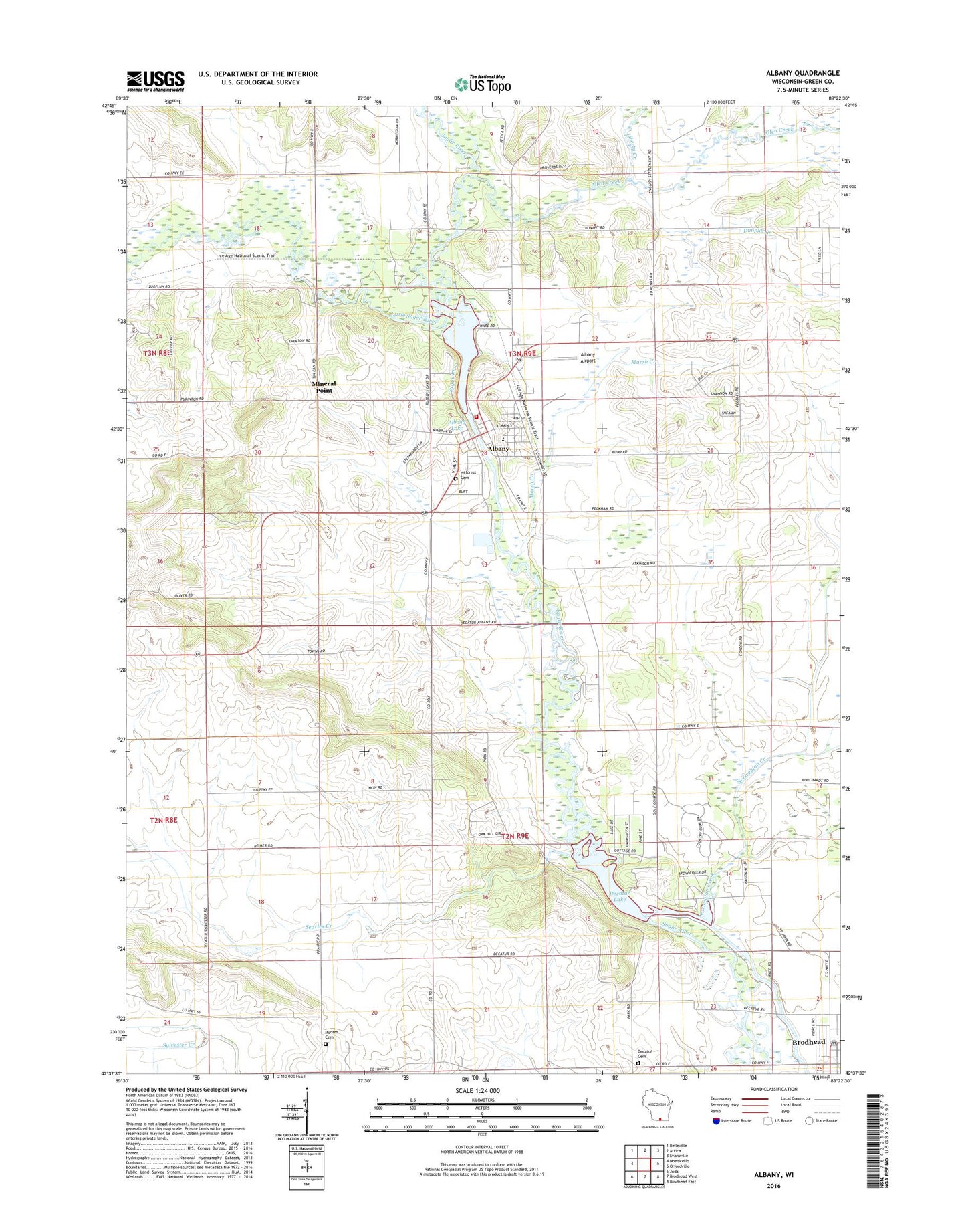
2022 topographic map quadrangle Albany in the state of Wisconsin. Scale: 1:24000. Based on the newly updated USGS 7.5' US Topo map series, this map is in the following counties: Green. The map contains contour data, water features, and other items you are used to seeing on USGS maps, but also has updated roads and other features. This is the next generation of topographic maps. Printed on high-quality waterproof paper with UV fade-resistant inks.
Quads adjacent to this one:
West: Monticello
Northwest: Belleville
North: Attica
Northeast: Evansville
East: Orfordville
Southeast: Brodhead East
South: Brodhead West
Southwest: Juda
This map covers the same area as the classic USGS quad with code o42089f4.
Contains the following named places: Abrahams Woods State Natural Area, Albany, Albany Airport, Albany Community Middle School, Albany Dam, Albany Elementary School, Albany Emergency Medical Services, Albany Fire Department, Albany High School, Albany Lake, Albany Police Department, Albany Post Office, Allen Creek, Brodhead Dam, County of Green Landfill, Decatur, Decatur Cemetery, Decatur Lake, Decatur School, Dunphy Branch, Gap Church, Hillcrest Cemetery, Liberty Creek, Little Sugar River, Marsh Creek, Mineral Point, Moores Cemetery, Muralt Bluff Prairie State Natural Area, Norwegian Creek, Oliver Prairie State Natural Area, Oliver Quarry, Peebles School, Searles Creek, Smiley School, Town of Albany, Town of Decatur, Village of Albany, Ward Swartz Decatur Woods State Natural Area, ZIP Code: 53502