MyTopo
Observatory Hill Wisconsin US Topo Map
Couldn't load pickup availability
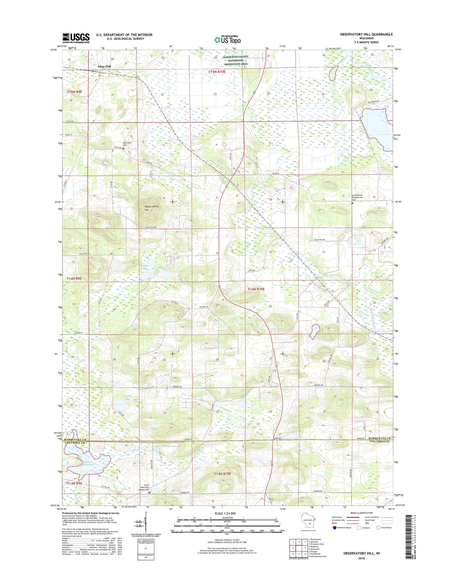
2018 topographic map quadrangle Observatory Hill in the state of Wisconsin. Scale: 1:24000. Based on the newly updated USGS 7.5' US Topo map series, this map is in the following counties: Marquette, Columbia. The map contains contour data, water features, and other items you are used to seeing on USGS maps, but also has updated roads and other features. This is the next generation of topographic maps. Printed on high-quality waterproof paper with UV fade-resistant inks.
Quads adjacent to this one:
West: Endeavor
Northwest: Packwaukee
North: Montello
Northeast: Princeton West
East: Marquette
Southeast: Sand Spring Creek
South: Pardeeville
Southwest: Portage
Contains the following named places: Belle Fountain Creek, Buffalo Church, Dates Mill Dam, Dates Millpond, Dates Millpond 14, French Creek State Wildlife Area, Glen Oak, Grand River, Grand River Marsh 3WR220 Dam, Grand River State Wildlife Area, Greenwood Church, Greenwood Presbyterian Cemetery, Log Cabin School, Madden Lakes, Mulhern Lake, North Marcellon Cemetery, North Marcellon Church, Oak Lawn Cemetery, Observatory Hill, Observatory Hill State Natural Area, Saint Andrews Church, Town of Buffalo, Wee White Kirk Church