
MyTopo
Oconto Falls North Wisconsin US Topo Map
Couldn't load pickup availability
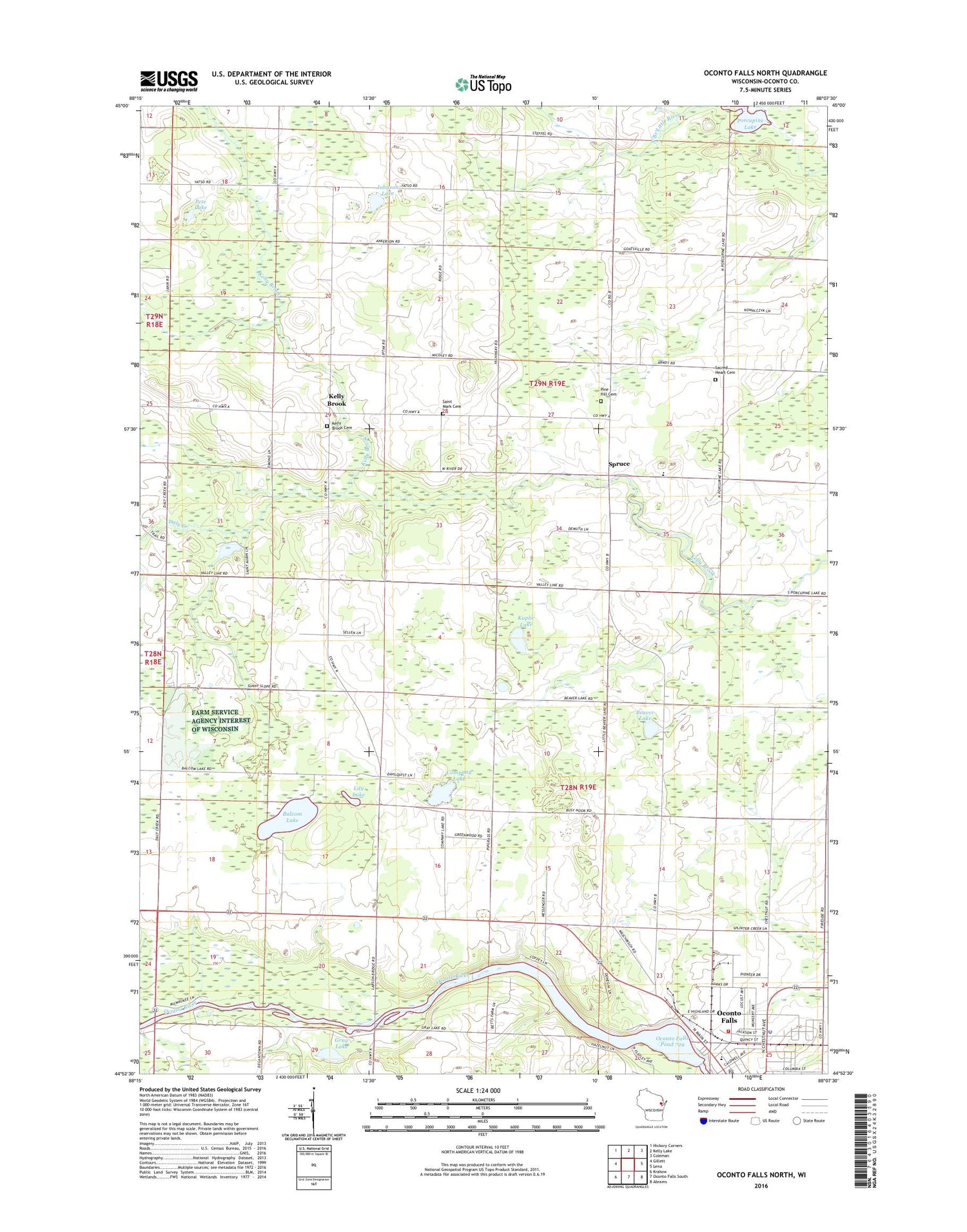
2018 topographic map quadrangle Oconto Falls North in the state of Wisconsin. Scale: 1:24000. Based on the newly updated USGS 7.5' US Topo map series, this map is in the following counties: Oconto. The map contains contour data, water features, and other items you are used to seeing on USGS maps, but also has updated roads and other features. This is the next generation of topographic maps. Printed on high-quality waterproof paper with UV fade-resistant inks.
Quads adjacent to this one:
West: Gillett
Northwest: Hickory Corners
North: Kelly Lake
Northeast: Coleman
East: Lena
Southeast: Abrams
South: Oconto Falls South
Southwest: Krakow
Contains the following named places: Balcom Lake, Beaver Lake, Beaver Lake School, Company Lake, Daly Creek, Gray Lake, Johnson Lake, Kelly Brook, Kelly Brook Cemetery, Kelly Brook School, Kuplic Lake, Lily Lake, North Branch School, Oak School, Oconto County, Oconto Falls Community Library, Oconto Falls Fire Department, Oconto Falls Police Department, Oconto Falls Pond 729, Oconto Falls Post Office, Pete Lake, Pine Hill Cemetery, Porcupine Lake, Sacred Heart Cemetery, Sacred Heart Church, Saint Anthony School, Saint Anthonys Roman Catholic Church, Saint John Church, Saint Mark Cemetery, Saint Mark Church, Spruce, Spruce Elementary School, Sunny Slope School, Town of Oconto Falls, Town of Spruce, Upper Oconto Falls WP98 Dam


