MyTopo
Roberts Lake Wisconsin US Topo Map
Couldn't load pickup availability
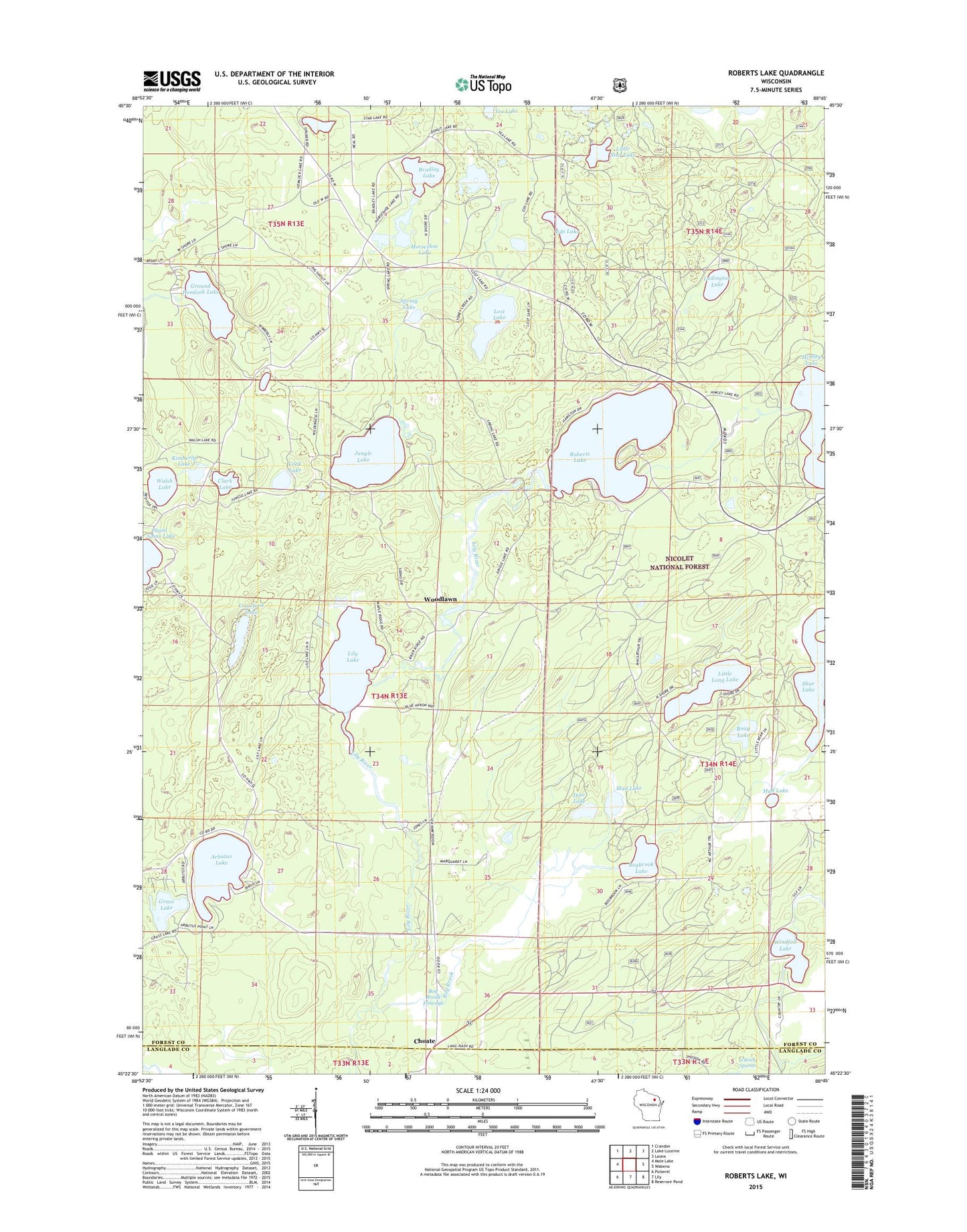
2018 topographic map quadrangle Roberts Lake in the state of Wisconsin. Scale: 1:24000. Based on the newly updated USGS 7.5' US Topo map series, this map is in the following counties: Forest, Langlade. The map contains contour data, water features, and other items you are used to seeing on USGS maps, but also has updated roads and other features. This is the next generation of topographic maps. Printed on high-quality waterproof paper with UV fade-resistant inks.
Quads adjacent to this one:
West: Mole Lake
Northwest: Crandon
North: Lake Lucerne
Northeast: Laona
East: Wabeno
Southeast: Reservoir Pond
South: Lily
Southwest: Pickerel
Contains the following named places: Arbutus Lake, Bog Brook, Bog Brook 2WP1571 Dam, Bog Brook Flowage, Bog Brook State Wildlife Area, Bogbrook Impoundment, Bogbrook Lake, Bradley Lake, Choate, Clark Lake, Cook Lake, Crawford Lake, Deer Lake, Donut Lake, Eds Lake, Eds Lake Trail System, Grass Lake, Ground Hemlock Lake, Himley Lake, Horseshoe Lake, Jungle Lake, Kimberly Lake, Lily Lake, Little Long Lake, Little Star Lake, Lost Lake, Ludington Lake, Mud Lake, Pig Snout Siding, Roberts Lake, Roxy Lake, Shoe Lake, Spring Lake, Walsh Lake, Windfall Lake, Woodlawn