MyTopo
Sand Spring Creek Wisconsin US Topo Map
Couldn't load pickup availability
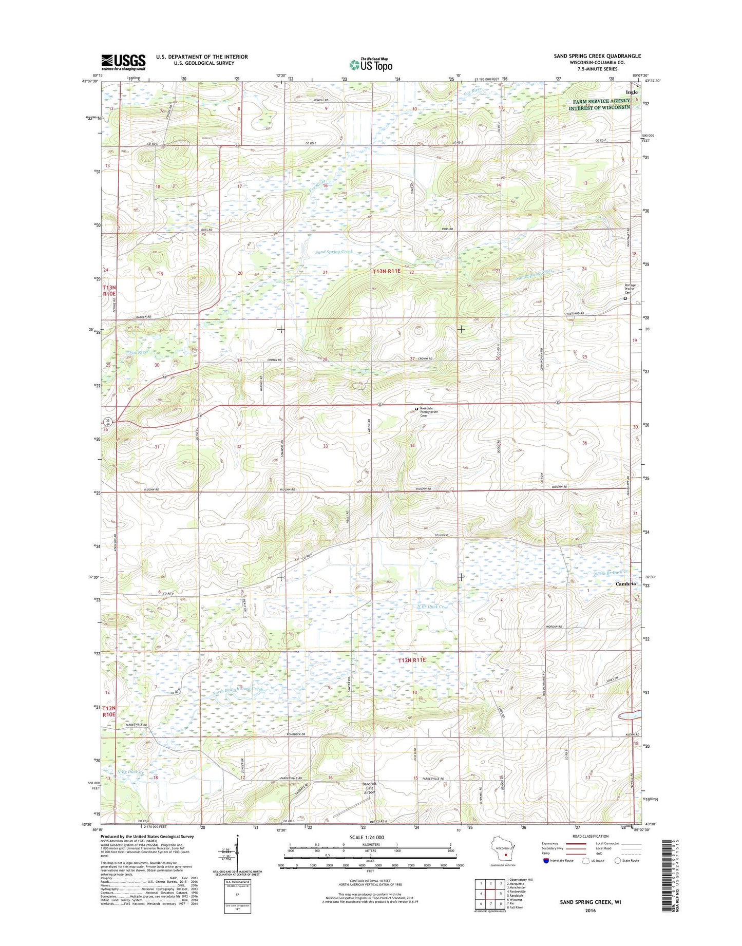
2018 topographic map quadrangle Sand Spring Creek in the state of Wisconsin. Scale: 1:24000. Based on the newly updated USGS 7.5' US Topo map series, this map is in the following counties: Columbia. The map contains contour data, water features, and other items you are used to seeing on USGS maps, but also has updated roads and other features. This is the next generation of topographic maps. Printed on high-quality waterproof paper with UV fade-resistant inks.
Quads adjacent to this one:
West: Pardeeville
Northwest: Observatory Hill
North: Marquette
Northeast: Manchester
East: Randolph
Southeast: Fall River
South: Rio
Southwest: Wyocena
Contains the following named places: Bancroft East Airport, Gaastra Quarry, Healy School, Ingle, Meadow View Amish School, North Scott Church, Portage Prairie Cemetery, Prairie School, Rosedale Presbyterian Cemetery, Rosedale Presbyterian Church, Rosedale School, Sand Spring Creek, Scott School, Slab School, Springville State Wildlife Area, Town of Scott, Town of Springvale, Welsh Prairie School, Woodside School, ZIP Code: 53923