MyTopo
Seeley Wisconsin US Topo Map
Couldn't load pickup availability
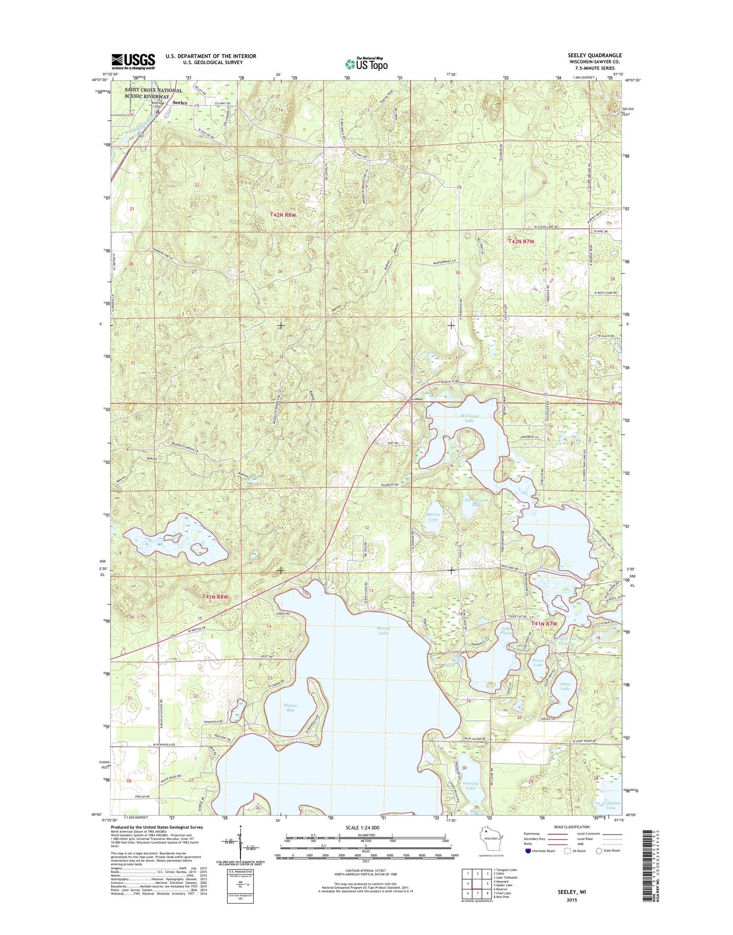
2019 topographic map quadrangle Seeley in the state of Wisconsin. Scale: 1:24000. Based on the newly updated USGS 7.5' US Topo map series, this map is in the following counties: Sawyer. The map contains contour data, water features, and other items you are used to seeing on USGS maps, but also has updated roads and other features. This is the next generation of topographic maps. Printed on high-quality waterproof paper with UV fade-resistant inks.
Quads adjacent to this one:
West: Hayward
Northwest: Totagatic Lake
North: Cable
Northeast: Lake Tahkodah
East: Spider Lake
Southeast: New Post
South: Chief Lake
Southwest: Reserve
Contains the following named places: Burns Lake, Callahan-Mud Lake State Wildlife Management Area, Clear Lake, Clear Lake School, Farnsworth Lake, Hinton Bay, Jackson School, Lake Placid, Lake Placid 2 WP 298 Dam, Lovejoy Lake, McClaine Lake, McClaine School, Mirror Lake, Riverside Cemetery, Round Lake, Round Lake School, Round Lake Seaplane Base, Seeley, Spider Lake Church, Tiger Cat Flowage, Twin Lakes School, Uhrenholdt Memorial State Forest, ZIP Code: 54843