
MyTopo
Spencer North Wisconsin US Topo Map
Couldn't load pickup availability
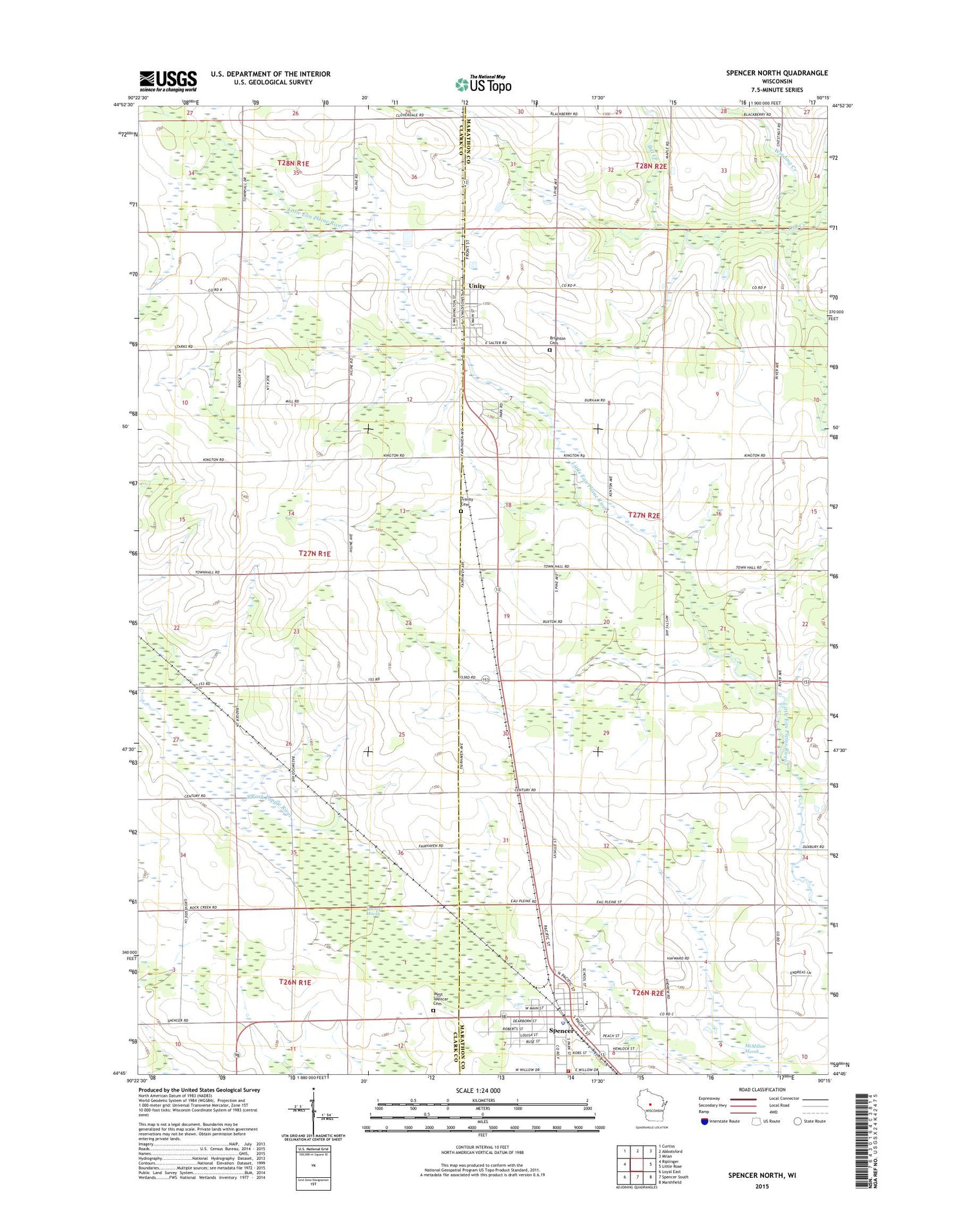
2018 topographic map quadrangle Spencer North in the state of Wisconsin. Scale: 1:24000. Based on the newly updated USGS 7.5' US Topo map series, this map is in the following counties: Clark, Marathon. The map contains contour data, water features, and other items you are used to seeing on USGS maps, but also has updated roads and other features. This is the next generation of topographic maps. Printed on high-quality waterproof paper with UV fade-resistant inks.
Quads adjacent to this one:
West: Riplinger
Northwest: Curtiss
North: Abbotsford
Northeast: Milan
East: Little Rose
Southeast: Marshfield
South: Spencer South
Southwest: Loyal East
Contains the following named places: Brighton Municipal Cemetery, Brighton School, Christ the King Catholic Church, Groveside School, Maplewood School, Marathon County Public Library Spencer Branch, Romeo School, Saint Johns Lutheran Church, Spencer, Spencer Elementary School, Spencer Fire Department, Spencer High School, Spencer Marsh, Spencer Police Department, Spencer Post Office, Town of Brighton, Trinity Cemetery, Unity, Unity Elementary School, Unity Park, Unity Post Office, Village of Spencer, Village of Unity, West Spencer Cemetery, Willow Brook School, Winding Creek, WOSX-FM (Spencer), ZIP Codes: 54479, 54488


