MyTopo
Trempealeau Wisconsin US Topo Map
Couldn't load pickup availability
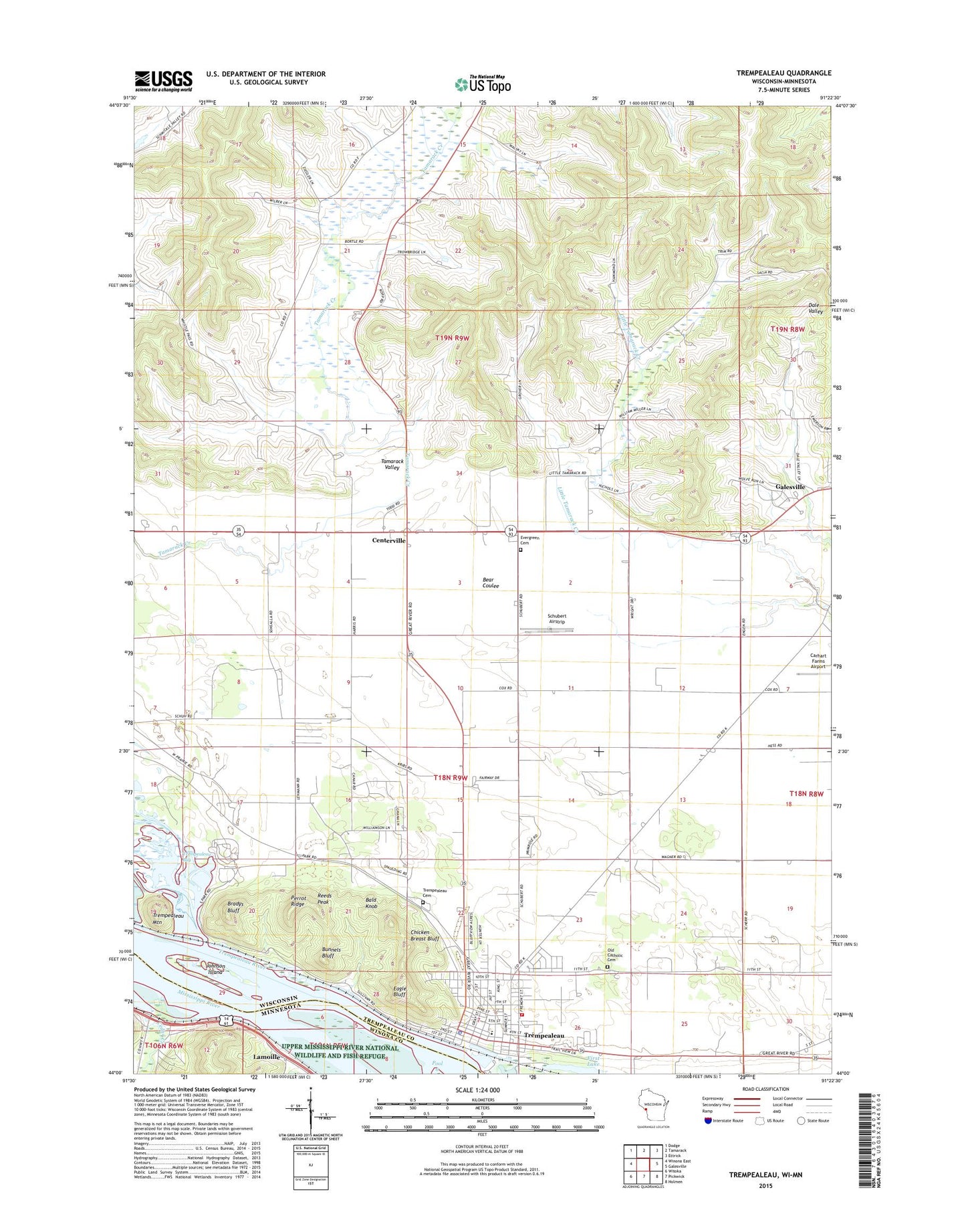
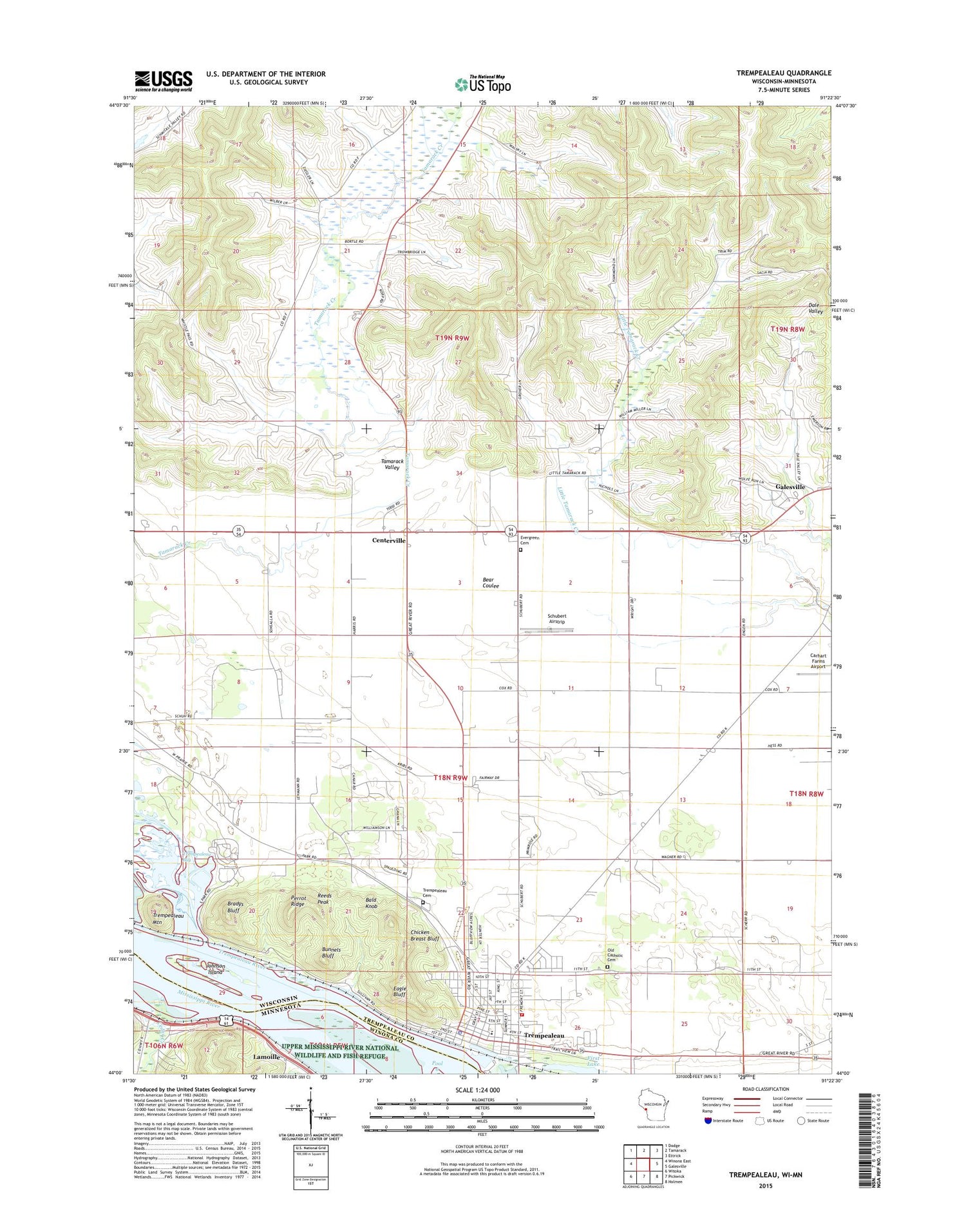
2018 topographic map quadrangle Trempealeau in the states of Wisconsin, Minnesota. Scale: 1:24000. Based on the newly updated USGS 7.5' US Topo map series, this map is in the following counties: Trempealeau, Winona. The map contains contour data, water features, and other items you are used to seeing on USGS maps, but also has updated roads and other features. This is the next generation of topographic maps. Printed on high-quality waterproof paper with UV fade-resistant inks.
Quads adjacent to this one:
West: Winona East
Northwest: Dodge
North: Tamarack
Northeast: Ettrick
East: Galesville
Southeast: Holmen
South: Pickwick
Southwest: Witoka
Contains the following named places: Bald Knob, Bartle School, Bradys Bluff, Brady's Bluff Prairie State Natural Area, Bunnels Bluff, Cedar Creek, Cedar Valley Golf Course, Centerville, Centerville Methodist Church, Centerville School, Chicken Breast Bluff, Eagle Bluff, Evergreen Cemetery, First Lake, Gale - Ettrick - Trempealeau Middle School, Great River Trail Prairies State Natural Area, Hare School, Johnson Island, Lamoille, Lamoille Post Office, Maple Grove School, Morningside Orchard, Old Catholic Cemetery, Perrot Ridge, Perrot State Park, Pool 6, Red School, Reeds Peak, Rhodes School, Schubert Airstrip, South Prairie School, Tamarack Valley, Town of Trempealeau, Towner School, Trempealeau, Trempealeau Bay, Trempealeau Cemetery, Trempealeau Elementary School, Trempealeau Fire Department, Trempealeau Mountain, Trempealeau Mountain State Natural Area, Trempealeau Police Department, Trempealeau Post Office, Trempealeau Prairie, Trempealeau River, Village of Trempealeau, Wagner School, Wrights Corners, ZIP Code: 54661