MyTopo
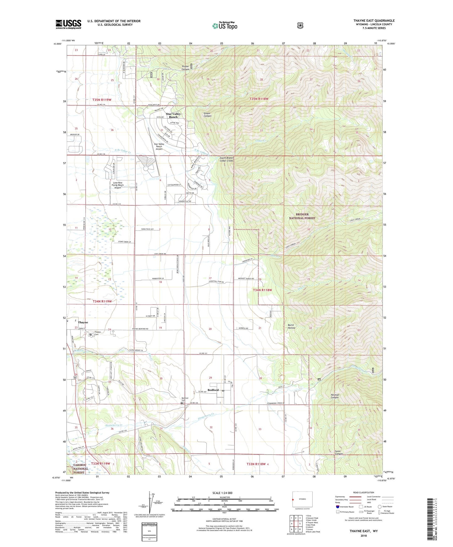
Thayne East Wyoming US Topo Map
Couldn't load pickup availability
Also explore the Thayne East Forest Service Topo of this same quad for updated USFS data
2021 topographic map quadrangle Thayne East in the state of Wyoming. Scale: 1:24000. Based on the newly updated USGS 7.5' US Topo map series, this map is in the following counties: Lincoln. The map contains contour data, water features, and other items you are used to seeing on USGS maps, but also has updated roads and other features. This is the next generation of topographic maps. Printed on high-quality waterproof paper with UV fade-resistant inks.
Quads adjacent to this one:
West: Thayne West
Northwest: Etna
North: Stewart Peak
Northeast: Deer Creek
East: Man Peak
Southeast: Rock Lake Peak
South: Grover
Southwest: Auburn
This map covers the same area as the classic USGS quad with code o42110h8.
Contains the following named places: Aspen Creek, Bedford, Bedford Canal, Bedford Cemetery, Bedford Census Designated Place, Bedford Post Office, Burnt Hollow, Cedar Creek, Dry Creek, Green Canyon, Hardman Ditch, Herman Canyon, Holdaway Elementary School, Lone Pine Flying Ranch Airport, Lost Creek, Prater Canyon, Star Valley Ranch, Star Valley Ranch Airport, Suter Canyon, Thayne Cemetery, Town of Star Valley Ranch, Town of Thayne, ZIP Code: 83127