MyTopo
Thayne West Wyoming US Topo Map
Couldn't load pickup availability
Also explore the Thayne West Forest Service Topo of this same quad for updated USFS data
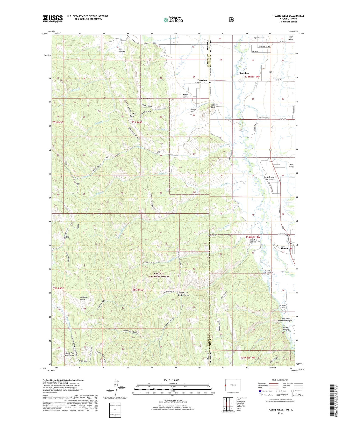
2021 topographic map quadrangle Thayne West in the states of Idaho, Wyoming. Scale: 1:24000. Based on the newly updated USGS 7.5' US Topo map series, this map is in the following counties: Lincoln, Caribou. The map contains contour data, water features, and other items you are used to seeing on USGS maps, but also has updated roads and other features. This is the next generation of topographic maps. Printed on high-quality waterproof paper with UV fade-resistant inks.
Quads adjacent to this one:
West: Stump Peak
Northwest: Tincup Mountain
North: Etna
Northeast: Stewart Peak
East: Thayne East
Southeast: Grover
South: Auburn
Southwest: Diamond Flat
This map covers the same area as the classic USGS quad with code o42111h1.
Contains the following named places: Allred Canyon, Beard Canyon, Dale Creek, Deer Creek, East Side Canal, Flat Creek, Freedom, Freedom Cemetery, Freedom Census Designated Place, Freedom Post Office, Freedom School, Haderlie Creek, Haderlie Knoll, Hemmert Canyon, Holdaway School, Limekiln Creek, Log Canyon, Mill Creek, Miller Creek, North Branch Cedar Creek, Old Man Ridge, Schiess Creek, Smith Canyon, South Branch Cedar Creek, South Fork Hemmert Canyon, South Fork Miller Creek, South Fork Smith Canyon, Strawberry Creek, Swab Creek, Thayne, Thayne Ambulance, Thayne and Rural Volunteer Fire Department, Thayne Post Office, The Slough, Weber Canyon, ZIP Code: 83120