MyTopo
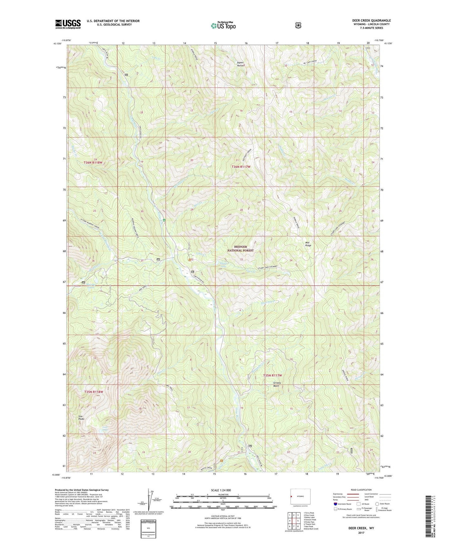
Deer Creek Wyoming US Topo Map
Couldn't load pickup availability
Also explore the Deer Creek Forest Service Topo of this same quad for updated USFS data
2023 topographic map quadrangle Deer Creek in the state of Wyoming. Scale: 1:24000. Based on the newly updated USGS 7.5' US Topo map series, this map is in the following counties: Lincoln. The map contains contour data, water features, and other items you are used to seeing on USGS maps, but also has updated roads and other features. This is the next generation of topographic maps. Printed on high-quality waterproof paper with UV fade-resistant inks.
Quads adjacent to this one:
West: Stewart Peak
Northwest: Ferry Peak
North: Pine Creek
Northeast: Bailey Lake
East: Pickle Pass
Southeast: Blind Bull Creek
South: Man Peak
Southwest: Thayne East
This map covers the same area as the classic USGS quad with code o43110a7.
Contains the following named places: Dead Dog Creek, Deer Creek, Deer Creek Guard Station, Fawn Creek, Grizzly Basin, Hot Foot Creek, Lake Creek, Lost Creek, Lost Lake, Lynx Creek, Lynx Creek Campground, Murphy Creek, Murphy Creek Campground, Murphy Lakes, North Fork Murphy Creek, Porcupine Creek, South Doe Creek, Star Peaks, Stewart Trail, Stump Lake, Weiner Creek, White Creek