MyTopo
Lingle Wyoming US Topo Map
Couldn't load pickup availability
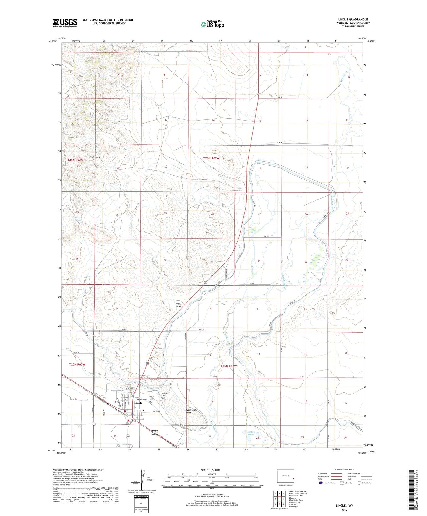
2021 topographic map quadrangle Lingle in the state of Wyoming. Scale: 1:24000. Based on the newly updated USGS 7.5' US Topo map series, this map is in the following counties: Goshen. The map contains contour data, water features, and other items you are used to seeing on USGS maps, but also has updated roads and other features. This is the next generation of topographic maps. Printed on high-quality waterproof paper with UV fade-resistant inks.
Quads adjacent to this one:
West: Barnes
Northwest: Red Cloud Creek West
North: Red Cloud Creek East
Northeast: Spoon Butte SW
East: Tea Kettle Rock
Southeast: Torrington
South: Cottier
Southwest: Habig Spring
This map covers the same area as the classic USGS quad with code o42104b3.
Contains the following named places: Bowen Spring, Goshen County Fire District 12 - Lingle Volunteer Fire Department Station 2, Hanna Lakes, Hillcrest Cemetery, Jones Pit, Lingle, Lingle - Fort Laramie Elementary School, Lingle - Fort Laramie Schools, Lingle Cemetery, Lingle Police Department, Lingle Post Office, Lingle Volunteer Fire Department Station 1, Lucerne Ditch, P-F Hill, Rattlesnake Point, Town of Lingle, Western Farms Pit, Willy Draw