MyTopo
Beaver Creek Hills Wyoming US Topo Map
Couldn't load pickup availability
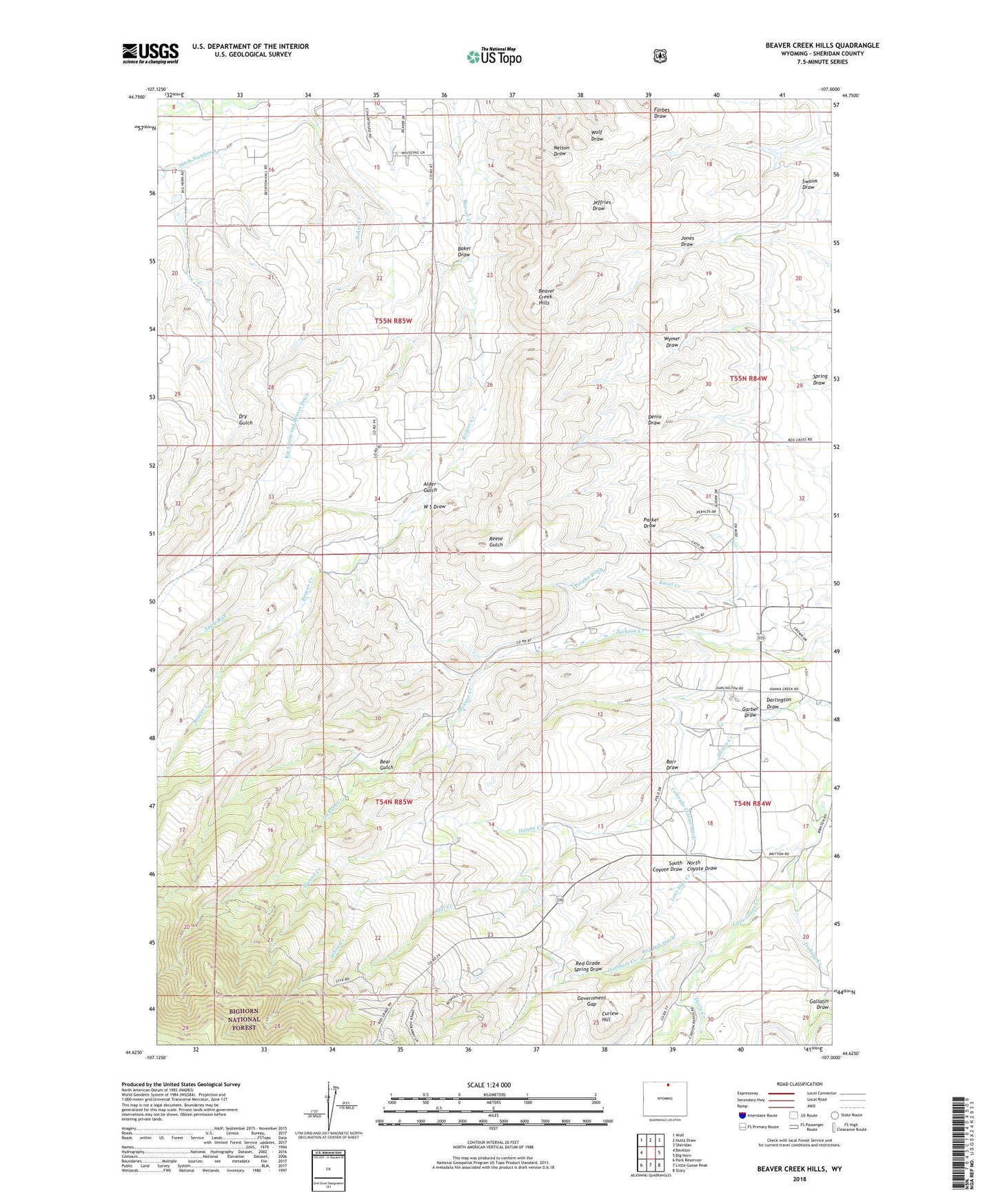
2021 topographic map quadrangle Beaver Creek Hills in the state of Wyoming. Scale: 1:24000. Based on the newly updated USGS 7.5' US Topo map series, this map is in the following counties: Sheridan. The map contains contour data, water features, and other items you are used to seeing on USGS maps, but also has updated roads and other features. This is the next generation of topographic maps. Printed on high-quality waterproof paper with UV fade-resistant inks.
Quads adjacent to this one:
West: Beckton
Northwest: Wolf
North: Hultz Draw
Northeast: Sheridan
East: Big Horn
Southeast: Story
South: Little Goose Peak
Southwest: Park Reservoir
Contains the following named places: Alder Gulch, Apple Run, Baker Draw, Barr Draw, Bear Gulch, Beaver Creek Hills, Big Goose and Beaver Ditch, Bracket Number 3 Dam, Bracket Number 3 Reservoir, Colorado Colony Ditch, Curlew Hill, Darlington Draw, Davis Creek, Ditch Number 9, East Fork Davis Creek, Gallatin Draw, Garber Draw, Government Gap, Hill Creek, Hurlburt Creek, Jerry Johns Reservoir Number 1, Jerry Johns Reservoir Number 1 Dam, Last Chance Ditch, Lone Star Creek, North Coyote Draw, Peralta Ditch, Red Grade Spring Draw, Sheridan South Division, South Coyote Draw, Trabing Creek, W S Draw, West Fork Davis Creek, White Creek