MyTopo
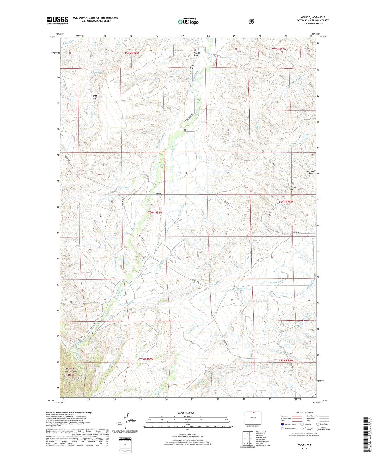
Wolf Wyoming US Topo Map
Couldn't load pickup availability
Also explore the Wolf Forest Service Topo of this same quad for updated USFS data
2021 topographic map quadrangle Wolf in the state of Wyoming. Scale: 1:24000. Based on the newly updated USGS 7.5' US Topo map series, this map is in the following counties: Sheridan. The map contains contour data, water features, and other items you are used to seeing on USGS maps, but also has updated roads and other features. This is the next generation of topographic maps. Printed on high-quality waterproof paper with UV fade-resistant inks.
Quads adjacent to this one:
West: Dayton South
Northwest: Dayton North
North: Ranchester
Northeast: Monarch
East: Hultz Draw
Southeast: Beaver Creek Hills
South: Beckton
Southwest: Walker Mountain
This map covers the same area as the classic USGS quad with code o44107g2.
Contains the following named places: Alliance Ditch, Claussen Creek, Decker Ditch, Dye-Shields Ditch, East Wolf Creek, Garrard Ditch, Grinnell Ditch, Hanff Reservoir, J and H Ranch Number 1 Dam, J and H Ranch Number 1 Reservoir, Lowe Draw, Old Reliable Ditch, P K Ditch, P K Ranch, Parallel Draw, Red Canyon Creek, Roberts Dam, Roberts Reservoir, West Wolf Ditch, Windy Canyon Creek, Wolf, Wolf Creek School, ZIP Code: 82844