MyTopo
Guffy Peak Wyoming US Topo Map
Couldn't load pickup availability
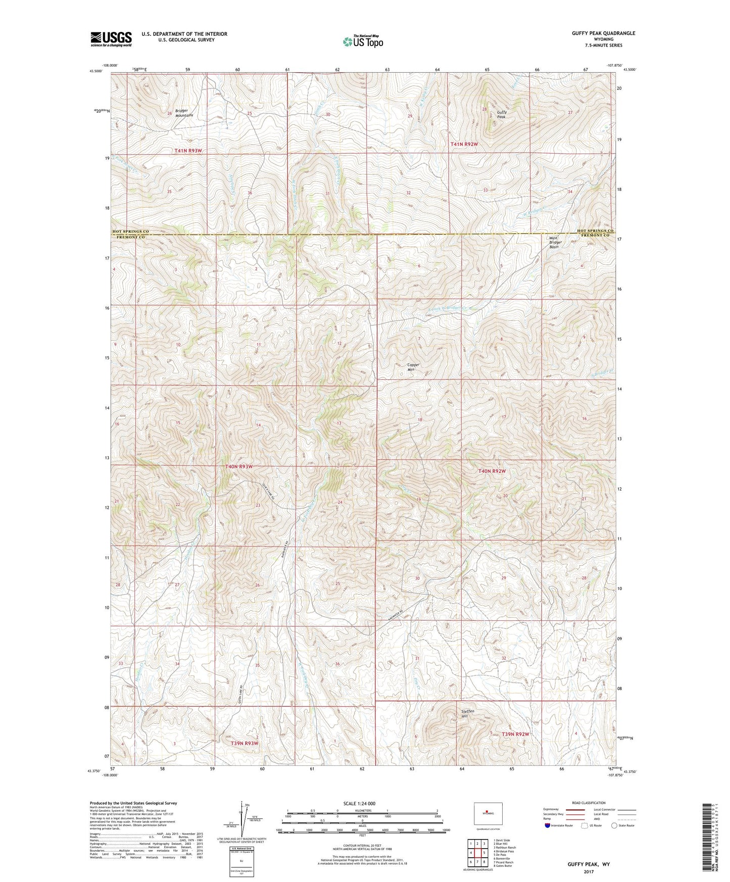
2021 topographic map quadrangle Guffy Peak in the state of Wyoming. Scale: 1:24000. Based on the newly updated USGS 7.5' US Topo map series, this map is in the following counties: Fremont, Hot Springs. The map contains contour data, water features, and other items you are used to seeing on USGS maps, but also has updated roads and other features. This is the next generation of topographic maps. Printed on high-quality waterproof paper with UV fade-resistant inks.
Quads adjacent to this one:
West: Birdseye Pass
Northwest: Devil Slide
North: Blue Hill
Northeast: Rathbun Ranch
East: De Pass
Southeast: Gates Butte
South: Picard Ranch
Southwest: Bonneville
This map covers the same area as the classic USGS quad with code o43107d8.
Contains the following named places: Airline Number Two Mine, Bonanza Mine, Bridger Mountains, Comet Tungsten Mine, Copper Glance Group Mine, Copper Mountain, Copper Mountain Number One Mine, Copper Mountain Number Two Mine, Dawn Claim, Discovery Number One Mine, East Fork Ditch Creek, East Fork West Bridger Creek, Fuller Ranch, Guffy Peak, Guffy Ranch, Hale Number One Mine, Hoodoo Creek Claims, Jones Ranch, McGraw Copper Mine, Meeks Ranch, Mint Number Two Mine, Parker Ranch, Quien Sabe Mine, Quien Sabe Ranch, Sanford Ranch, Shortcut Number One Mine, Stardust Tungsten Mine, Steffen Hill, West Bridger Basin, West Fork, West Fork Ditch Creek, Westfall Ranch, Whippet Number Eight Prospect, Williams-Luman Mine