MyTopo
Blue Hill Wyoming US Topo Map
Couldn't load pickup availability
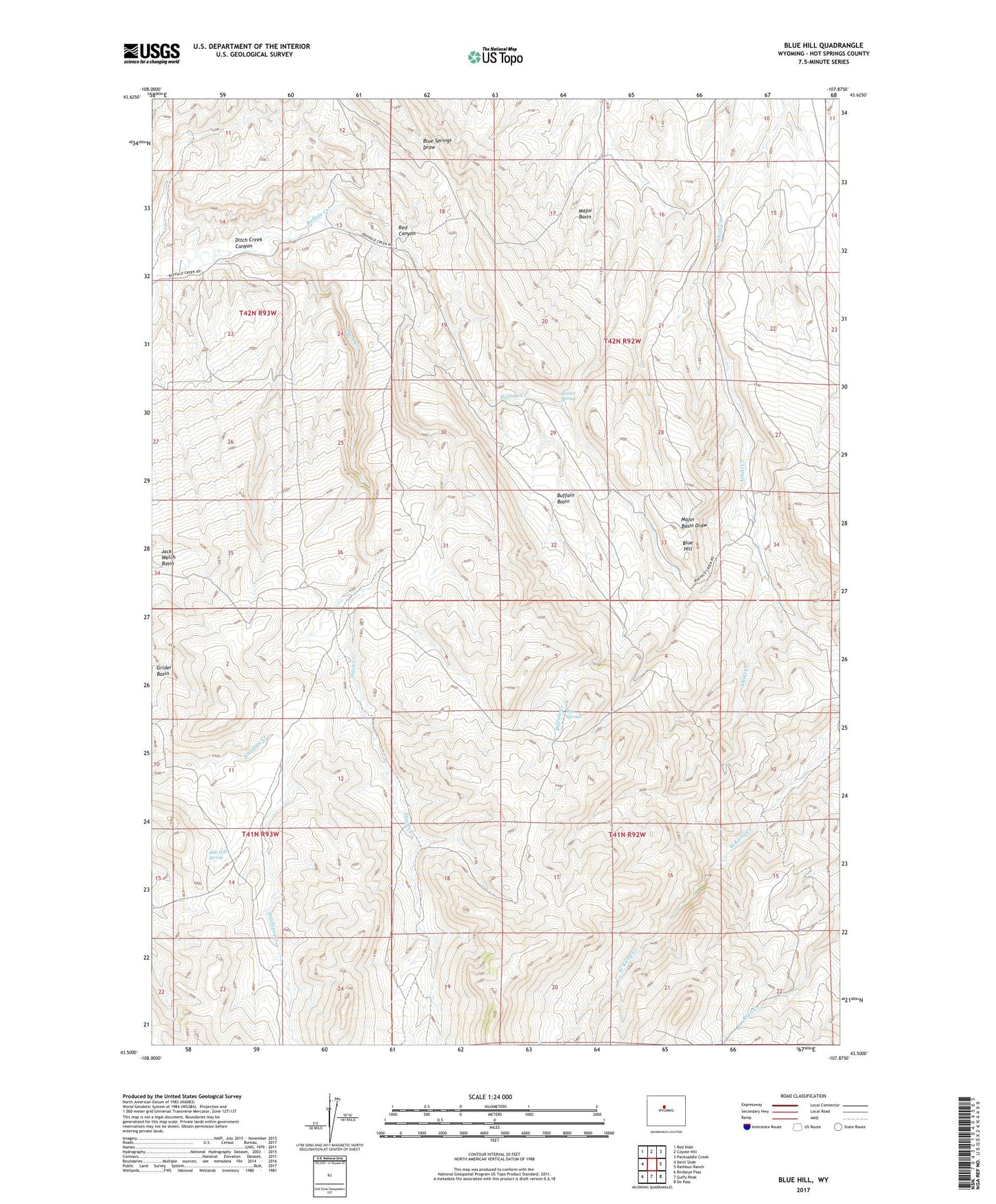
2021 topographic map quadrangle Blue Hill in the state of Wyoming. Scale: 1:24000. Based on the newly updated USGS 7.5' US Topo map series, this map is in the following counties: Hot Springs. The map contains contour data, water features, and other items you are used to seeing on USGS maps, but also has updated roads and other features. This is the next generation of topographic maps. Printed on high-quality waterproof paper with UV fade-resistant inks.
Quads adjacent to this one:
West: Devil Slide
Northwest: Red Hole
North: Coyote Hill
Northeast: Packsaddle Creek
East: Rathbun Ranch
Southeast: De Pass
South: Guffy Peak
Southwest: Birdseye Pass
This map covers the same area as the classic USGS quad with code o43107e8.
Contains the following named places: Antelope Creek Summer Camp, Blue Hill, Buffalo Basin, Ditch Creek, Ditch Creek Canyon, Dye Springs, Fuller Summer Camp, Jack Welch Basin, Johnson Ranch, Major Basin, Red Canyon, Side Hill Spring, Thermopolis East Division, Winter Spring