MyTopo
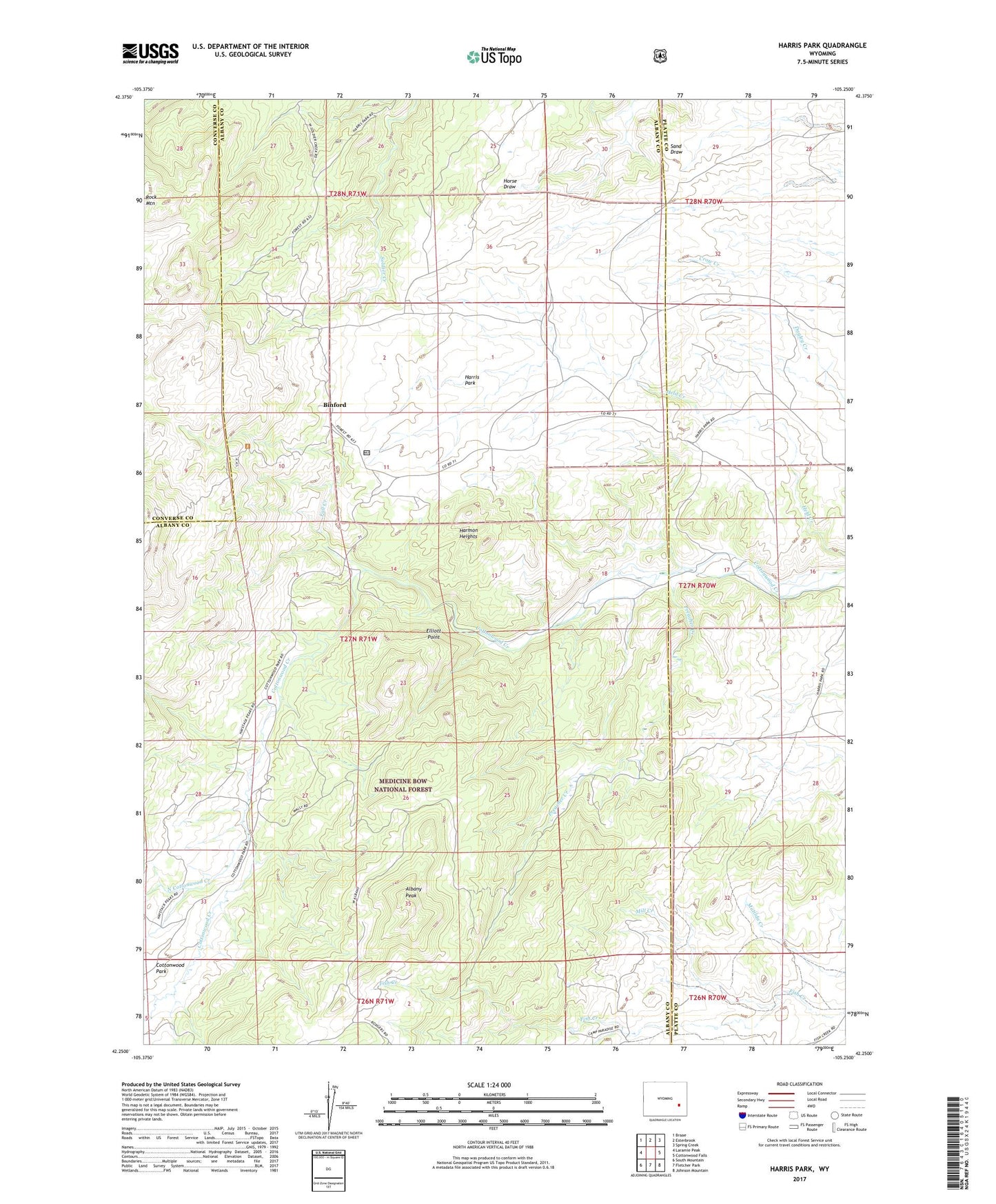
Harris Park Wyoming US Topo Map
Couldn't load pickup availability
Also explore the Harris Park Forest Service Topo of this same quad for updated USFS data
2021 topographic map quadrangle Harris Park in the state of Wyoming. Scale: 1:24000. Based on the newly updated USGS 7.5' US Topo map series, this map is in the following counties: Albany, Platte, Converse. The map contains contour data, water features, and other items you are used to seeing on USGS maps, but also has updated roads and other features. This is the next generation of topographic maps. Printed on high-quality waterproof paper with UV fade-resistant inks.
Quads adjacent to this one:
West: Laramie Peak
Northwest: Braae
North: Esterbrook
Northeast: Spring Creek
East: Cottonwood Falls
Southeast: Johnson Mountain
South: Fletcher Park
Southwest: South Mountain
This map covers the same area as the classic USGS quad with code o42105c3.
Contains the following named places: Albany Peak, Ballard Ranch, Binford, Bromley School, Donaldson Ranch, Elliott Point, Fall Creek, Hagemeisters Twin Pine Ranch Airport, Hanks School, Harmon Heights, Harris Park, Laramie Peak Fire Zone Fire Department, Laramie Peak Scout Camp, Lewis Ranch, Mill Creek, North Cottonwood Creek, Point of Rocks, Preacher Creek, Sutherland Ranch, White Ranch