MyTopo
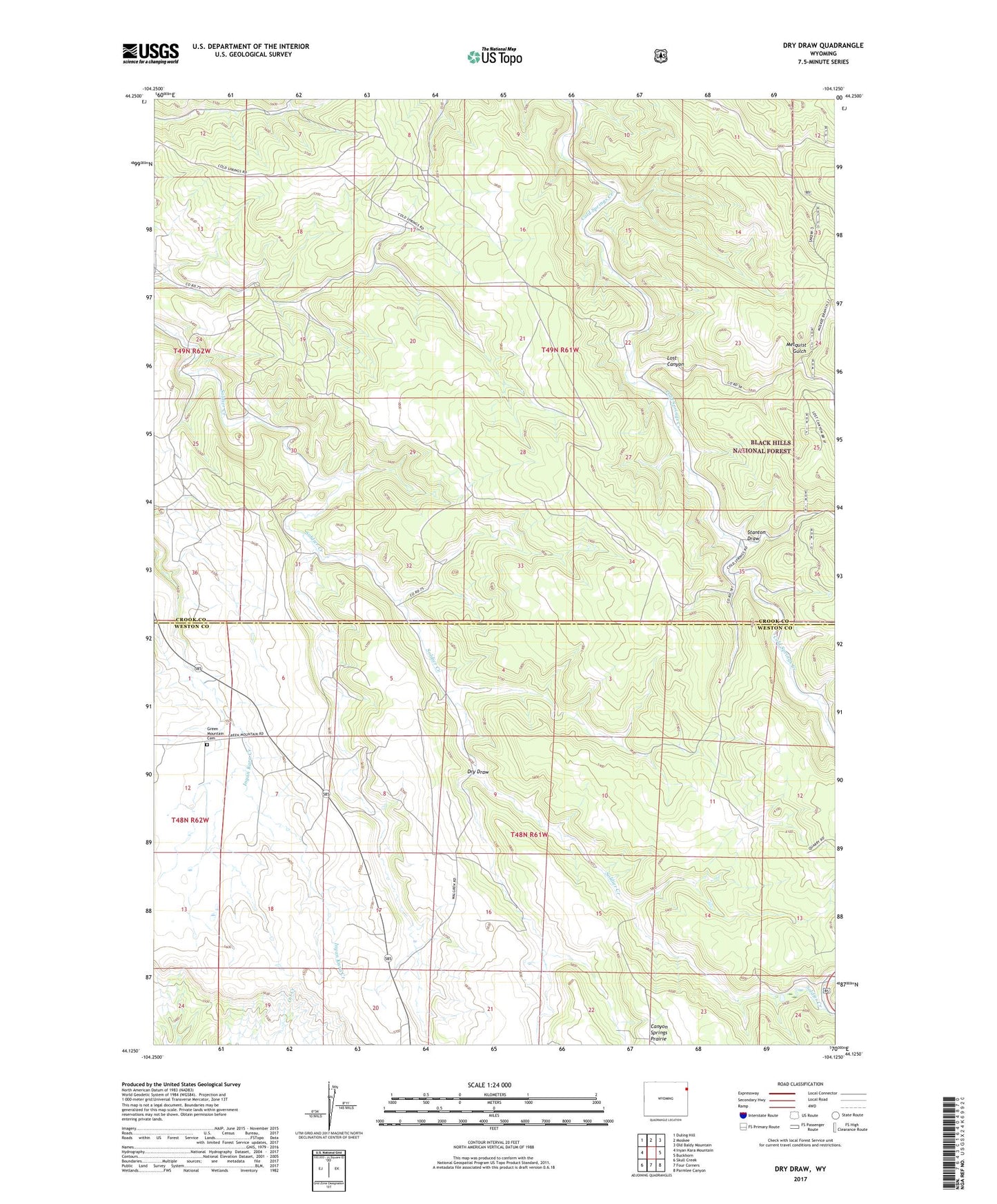
Dry Draw Wyoming US Topo Map
Couldn't load pickup availability
Also explore the Dry Draw Forest Service Topo of this same quad for updated USFS data
2021 topographic map quadrangle Dry Draw in the state of Wyoming. Scale: 1:24000. Based on the newly updated USGS 7.5' US Topo map series, this map is in the following counties: Crook, Weston. The map contains contour data, water features, and other items you are used to seeing on USGS maps, but also has updated roads and other features. This is the next generation of topographic maps. Printed on high-quality waterproof paper with UV fade-resistant inks.
Quads adjacent to this one:
West: Inyan Kara Mountain
Northwest: Duling Hill
North: Moskee
Northeast: Old Baldy Mountain
East: Buckhorn
Southeast: Parmlee Canyon
South: Four Corners
Southwest: Skull Creek
This map covers the same area as the classic USGS quad with code o44104b2.
Contains the following named places: Dry Draw, Green Mountain Cemetery, Homestake Lookout, Horton, Lost Canyon, Melquist Gulch, Rawhauser Sand Pit Mine, Stanton Draw