MyTopo
Campbell Ridge Wyoming US Topo Map
Couldn't load pickup availability
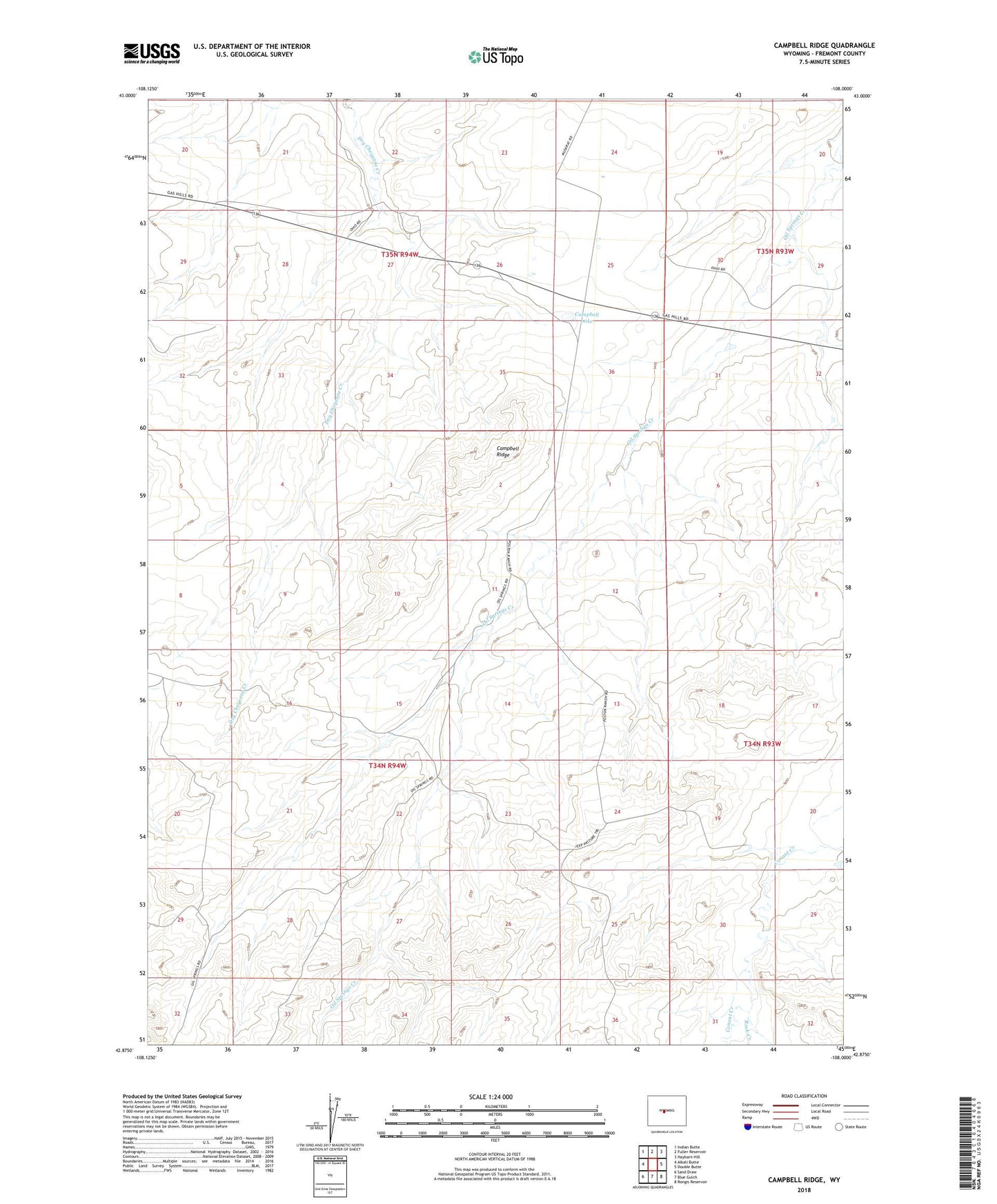
2021 topographic map quadrangle Campbell Ridge in the state of Wyoming. Scale: 1:24000. Based on the newly updated USGS 7.5' US Topo map series, this map is in the following counties: Fremont. The map contains contour data, water features, and other items you are used to seeing on USGS maps, but also has updated roads and other features. This is the next generation of topographic maps. Printed on high-quality waterproof paper with UV fade-resistant inks.
Quads adjacent to this one:
West: Alkali Butte
Northwest: Indian Butte
North: Fuller Reservoir
Northeast: Haybarn Hill
East: Double Butte
Southeast: Rongis Reservoir
South: Blue Gulch
Southwest: Sand Draw
This map covers the same area as the classic USGS quad with code o42108h1.
Contains the following named places: Campbell Lake, Campbell Ridge, Croft Ranch, Rock Creek