MyTopo
Sand Draw Wyoming US Topo Map
Couldn't load pickup availability
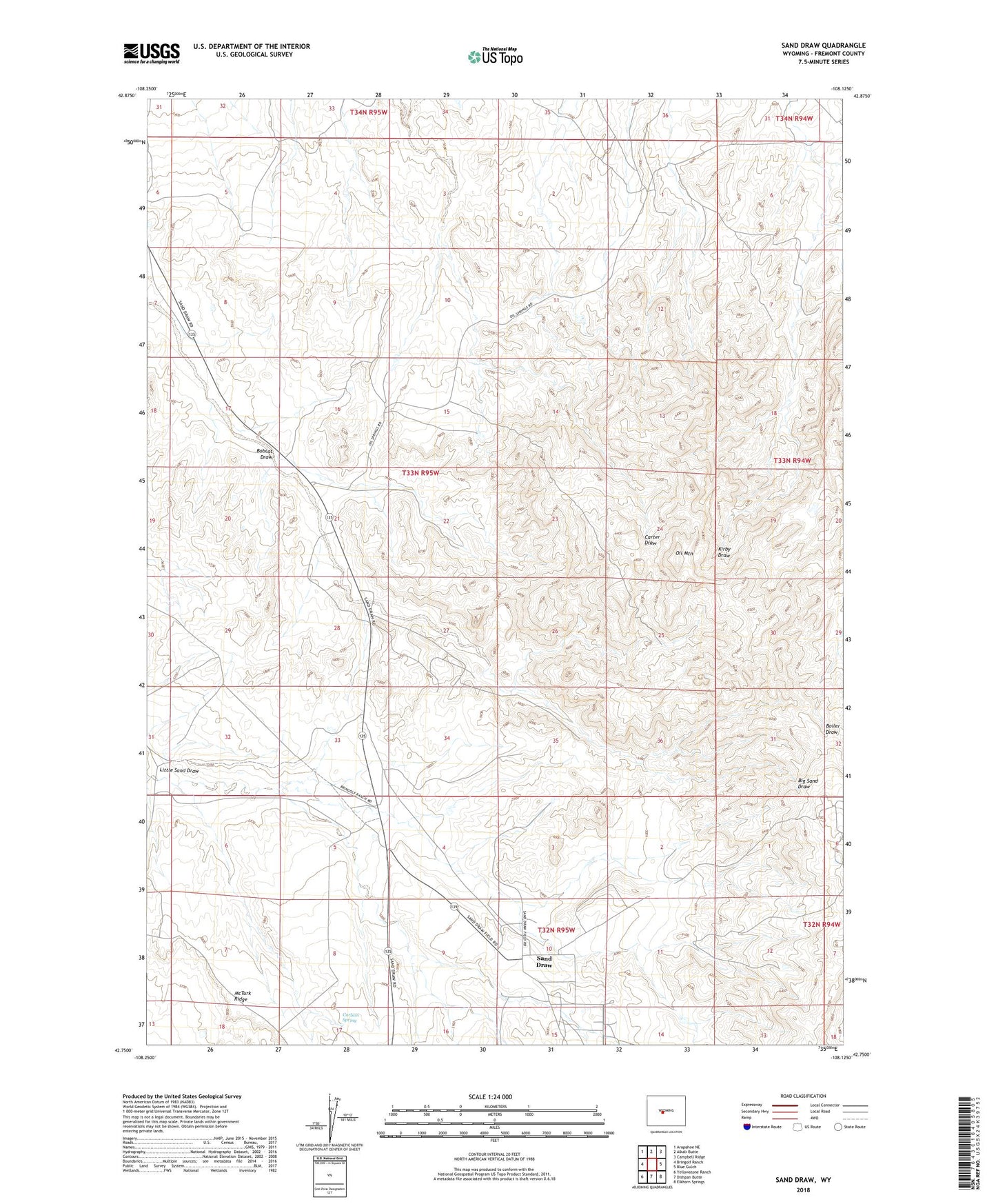
2021 topographic map quadrangle Sand Draw in the state of Wyoming. Scale: 1:24000. Based on the newly updated USGS 7.5' US Topo map series, this map is in the following counties: Fremont. The map contains contour data, water features, and other items you are used to seeing on USGS maps, but also has updated roads and other features. This is the next generation of topographic maps. Printed on high-quality waterproof paper with UV fade-resistant inks.
Quads adjacent to this one:
West: Bringolf Ranch
Northwest: Arapahoe NE
North: Alkali Butte
Northeast: Campbell Ridge
East: Blue Gulch
Southeast: Elkhorn Springs
South: Dishpan Butte
Southwest: Yellowstone Ranch
This map covers the same area as the classic USGS quad with code o42108g2.
Contains the following named places: Alkali Butte Unit, Big Sand Draw Oil and Gas Field, Blue Star Number Twenty Mine, Bobcat Draw, Carlson Spring, Downey Mine, E-Twenty Claim, Jent Number Six Mine, Jonebell Number Ten Mine, Linda Number Two Mine, McTurk Ridge, North Sand Draw Unit, Oil Mountain, Sand Draw, Sand Draw Coal Mine