MyTopo
Cokeville Wyoming US Topo Map
Couldn't load pickup availability
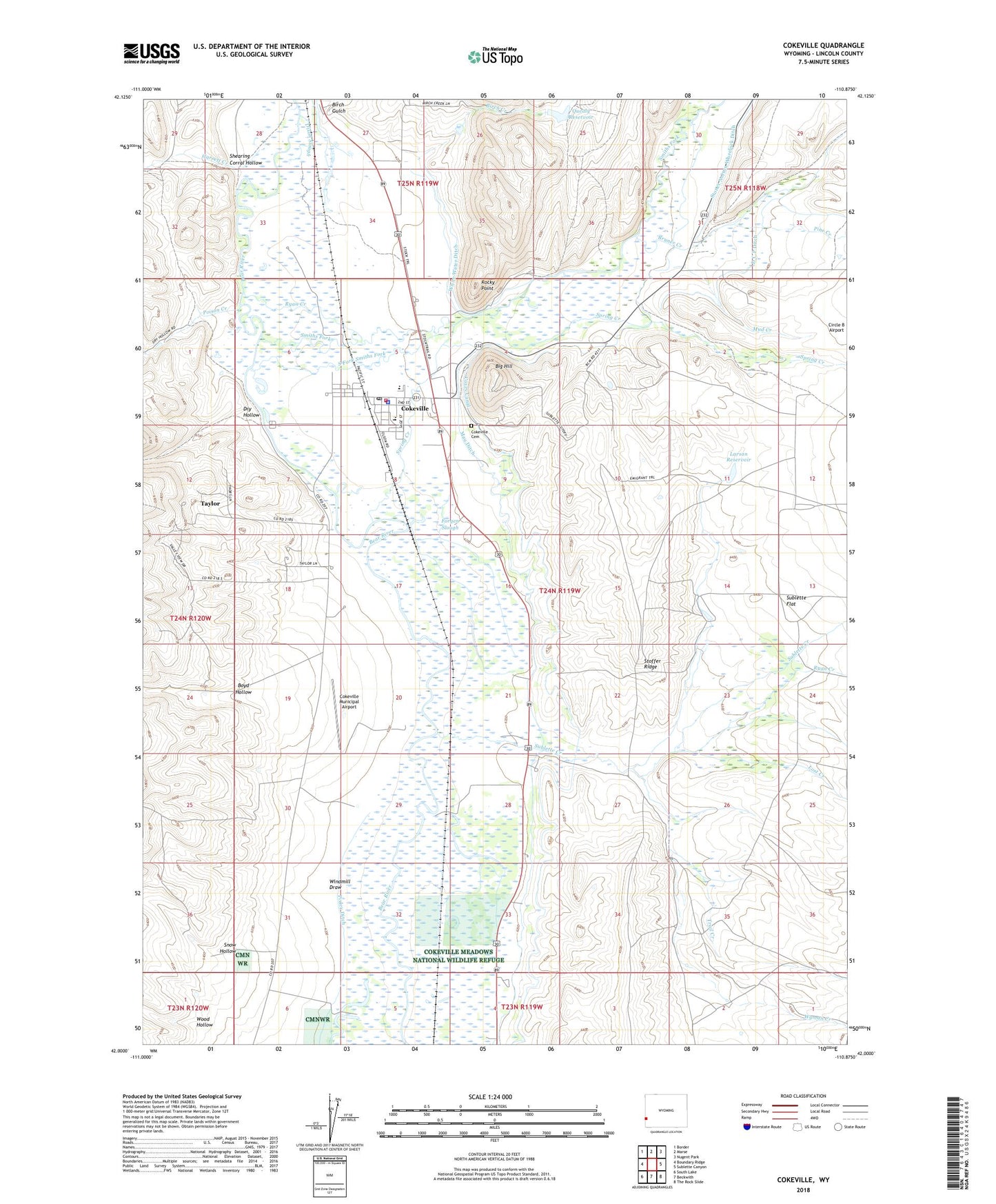
2021 topographic map quadrangle Cokeville in the state of Wyoming. Scale: 1:24000. Based on the newly updated USGS 7.5' US Topo map series, this map is in the following counties: Lincoln. The map contains contour data, water features, and other items you are used to seeing on USGS maps, but also has updated roads and other features. This is the next generation of topographic maps. Printed on high-quality waterproof paper with UV fade-resistant inks.
Quads adjacent to this one:
West: Boundary Ridge
Northwest: Border
North: Marse
Northeast: Nugent Park
East: Sublette Canyon
Southeast: The Rock Slide
South: Beckwith
Southwest: South Lake
Contains the following named places: Big Hill, Birch Creek, Birch Gulch, Boyd Hollow, Bruner Creek, Cokeville, Cokeville Cemetery, Cokeville Fire Department, Cokeville High School, Cokeville Junior High School, Cokeville Mine, Cokeville Municipal Airport, Cokeville Police Department, Cokeville Post Office, Cokeville School, D C P Ditch, Dixon Slough, Dry Hollow, Forgen Slough, Garrett Creek, Larson Reservoir, Lost Creek, Mau Ditch, Mud Creek, Pine Creek, Pixley, Poison Creek, Q P Dam, Quealy Reservoir, Rocky Point, Ryan Creek, Shearing Corral Hollow, Smiths Fork, Snow Hollow, South Fork Smiths Fork, Spring Creek, Stauffer Chemical Company Rocky Point Mine, Stoffer Ridge, Stoner Nelson Wheelock Ditch, Sublette Creek, Sublette Flat, Tanner Hunt Garrett, Taylor Census Designated Place, Town of Cokeville, Trail Creek, Tunp Range Number One Mine, White Water Ditch, Windmill Draw, Wood Hollow, Wyman Creek