MyTopo
Cony Mountain Wyoming US Topo Map
Couldn't load pickup availability
Also explore the Cony Mountain Forest Service Topo of this same quad for updated USFS data
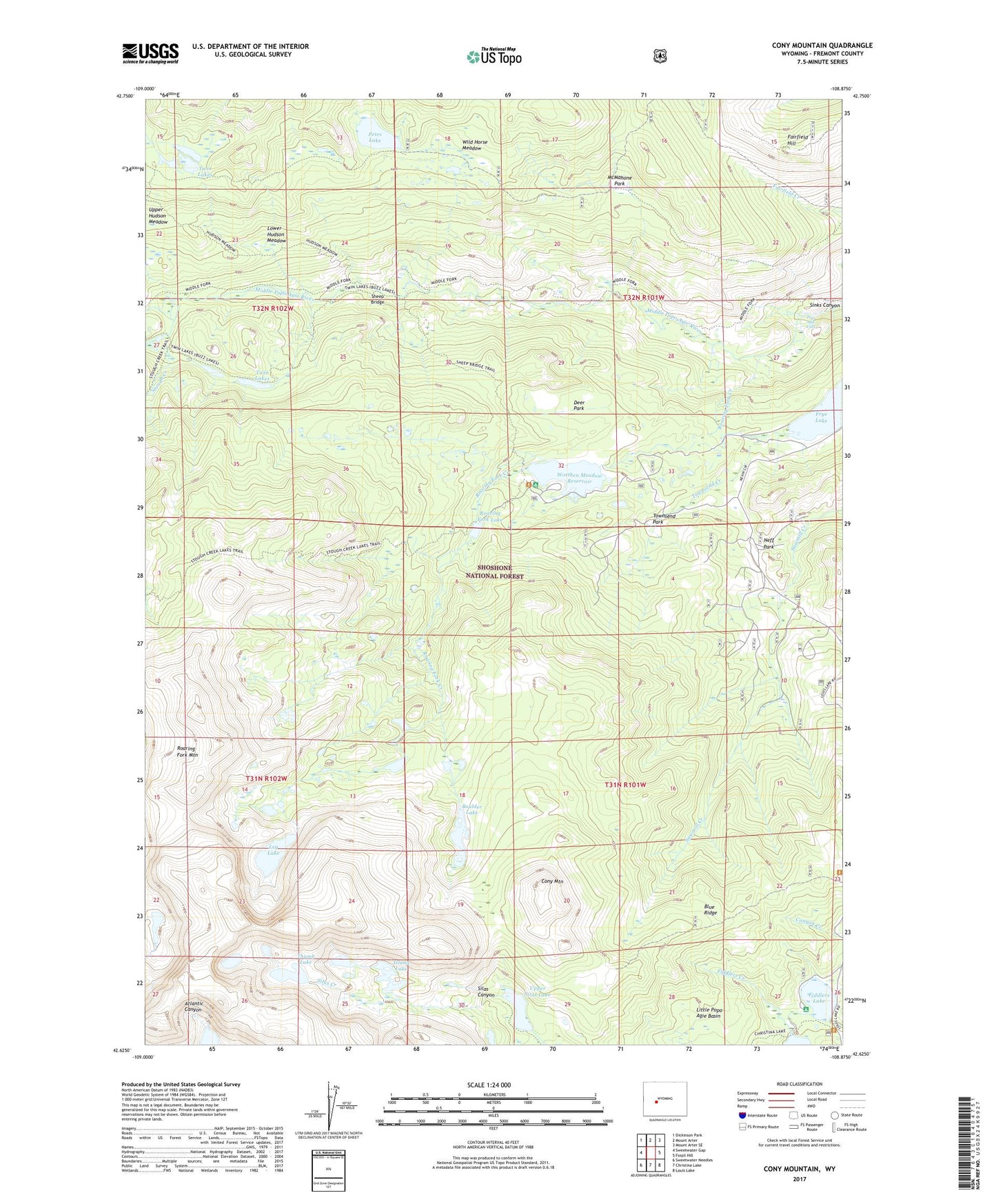
2023 topographic map quadrangle Cony Mountain in the state of Wyoming. Scale: 1:24000. Based on the newly updated USGS 7.5' US Topo map series, this map is in the following counties: Fremont. The map contains contour data, water features, and other items you are used to seeing on USGS maps, but also has updated roads and other features. This is the next generation of topographic maps. Printed on high-quality waterproof paper with UV fade-resistant inks.
Quads adjacent to this one:
West: Sweetwater Gap
Northwest: Dickinson Park
North: Mount Arter
Northeast: Mount Arter SE
East: Fossil Hill
Southeast: Louis Lake
South: Christina Lake
Southwest: Sweetwater Needles
This map covers the same area as the classic USGS quad with code o42108f8.
Contains the following named places: Blue Ridge, Boulder Lake, Cold Spring Trail, Cony Mountain, Deer Park, Enterprise Supply Ditch, Fiddlers Lake, Fiddlers Lake Campground, Fremont County Youth Camp, Frye Lake, Island Lake, Leg Lake, Lower Hudson Meadow, McMahone Park, Middle Fork Trail, Neff Park, Petes Lake, Petes Lake Trail, Popo Agie Falls, Roaring Fork Creek, Roaring Fork Lake, Sheep Bridge, Silas Canyon, Stough Creek, Thumb Lake, Townsend Park, Twin Lakes, Upper Silas Lake, Wild Horse Meadow, Worten Meadow Dam, Worthen Meadow Reservoir