MyTopo
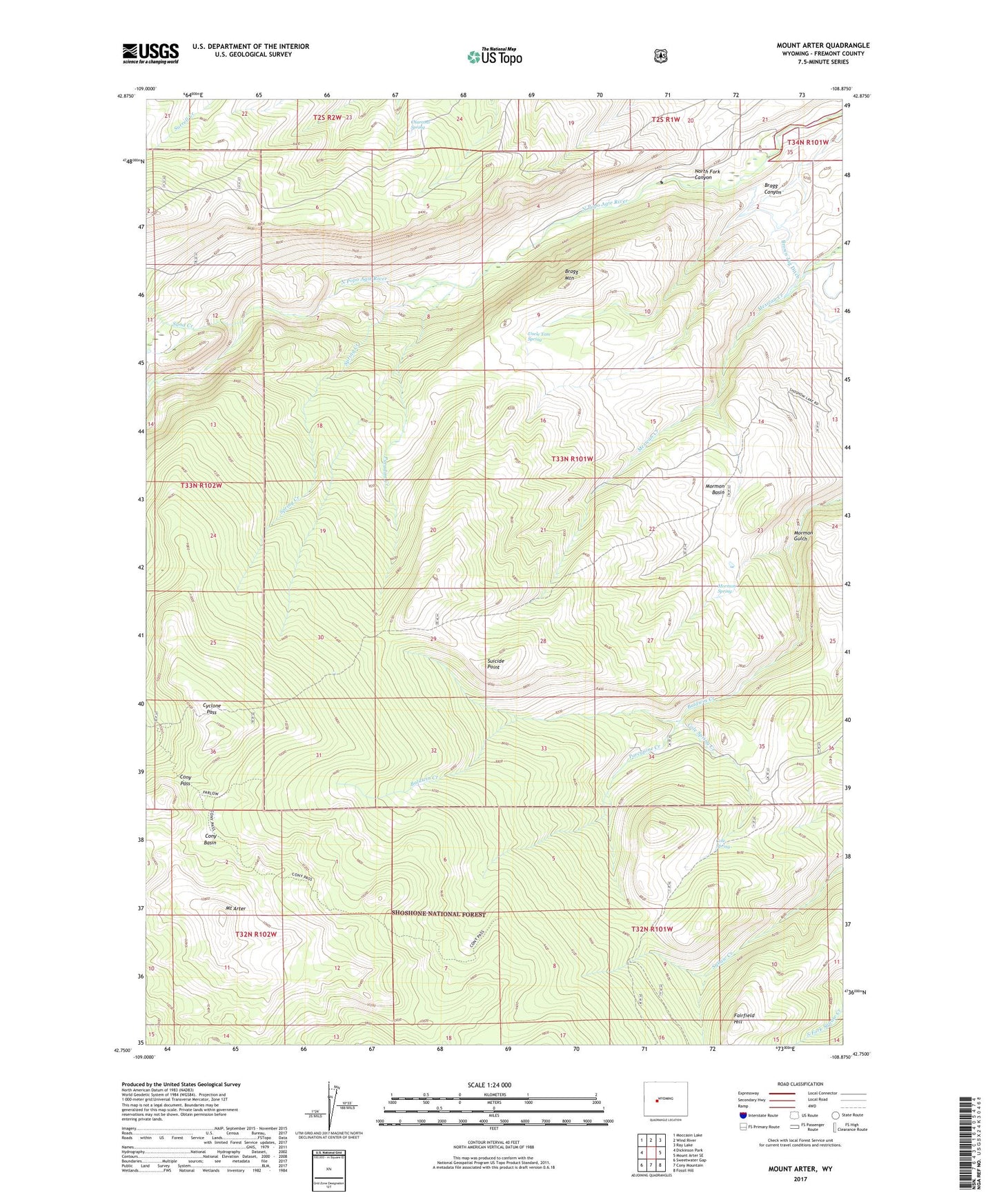
Mount Arter Wyoming US Topo Map
Couldn't load pickup availability
Also explore the Mount Arter Forest Service Topo of this same quad for updated USFS data
2023 topographic map quadrangle Mount Arter in the state of Wyoming. Scale: 1:24000. Based on the newly updated USGS 7.5' US Topo map series, this map is in the following counties: Fremont. The map contains contour data, water features, and other items you are used to seeing on USGS maps, but also has updated roads and other features. This is the next generation of topographic maps. Printed on high-quality waterproof paper with UV fade-resistant inks.
Quads adjacent to this one:
West: Dickinson Park
Northwest: Moccasin Lake
North: Wind River
Northeast: Ray Lake
East: Mount Arter SE
Southeast: Fossil Hill
South: Cony Mountain
Southwest: Sweetwater Gap
This map covers the same area as the classic USGS quad with code o42108g8.
Contains the following named places: Bragg Canyon, Bragg Mountain, Brown Jug Ditch, Charcoal Spring, Cole Spring, Cole Spring Creek, Cony Basin, Cony Pass, Cyclone Pass, Fairfield Hill, Farlow Homestead, Farlow Trail, Hart Ranch, Mexican Creek Mine, Mormon Basin, Mormon Gulch, Mormon Spring, Mount Arter, North Fork Canyon, Paradise Creek, Pine Bar Ranch, Porcupine Creek, Sand Creek, Spring Creek, Squaw Creek Trail, Suicide Point, Uncle Tom Spring